Download
Preview
Add to list
More
13.9 km
~1 day 0 hrs
1342 m
Out and Back
“"Embark on the challenging Rock Mountain Trail for breathtaking views, rich history, and diverse wildlife."”
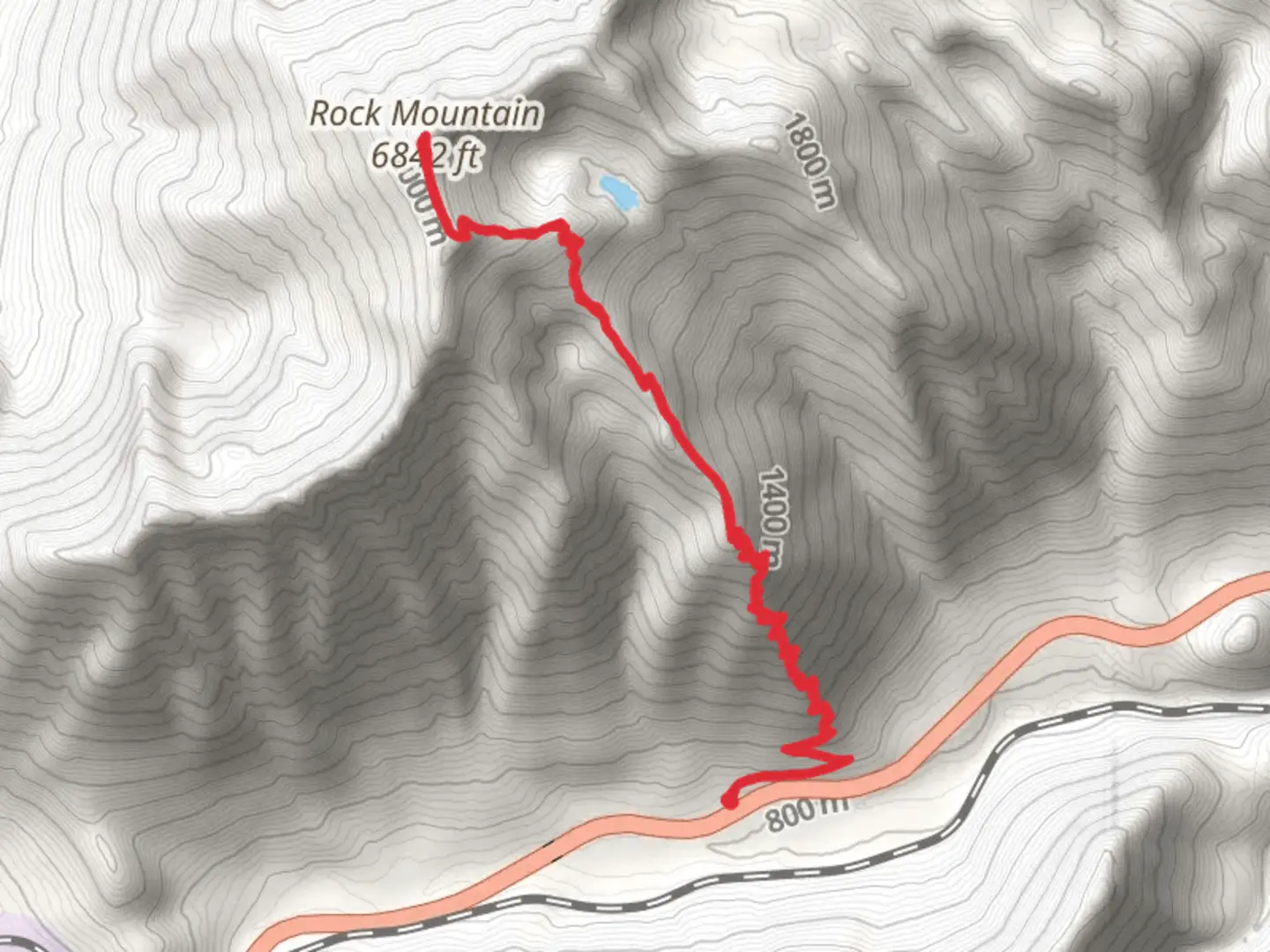
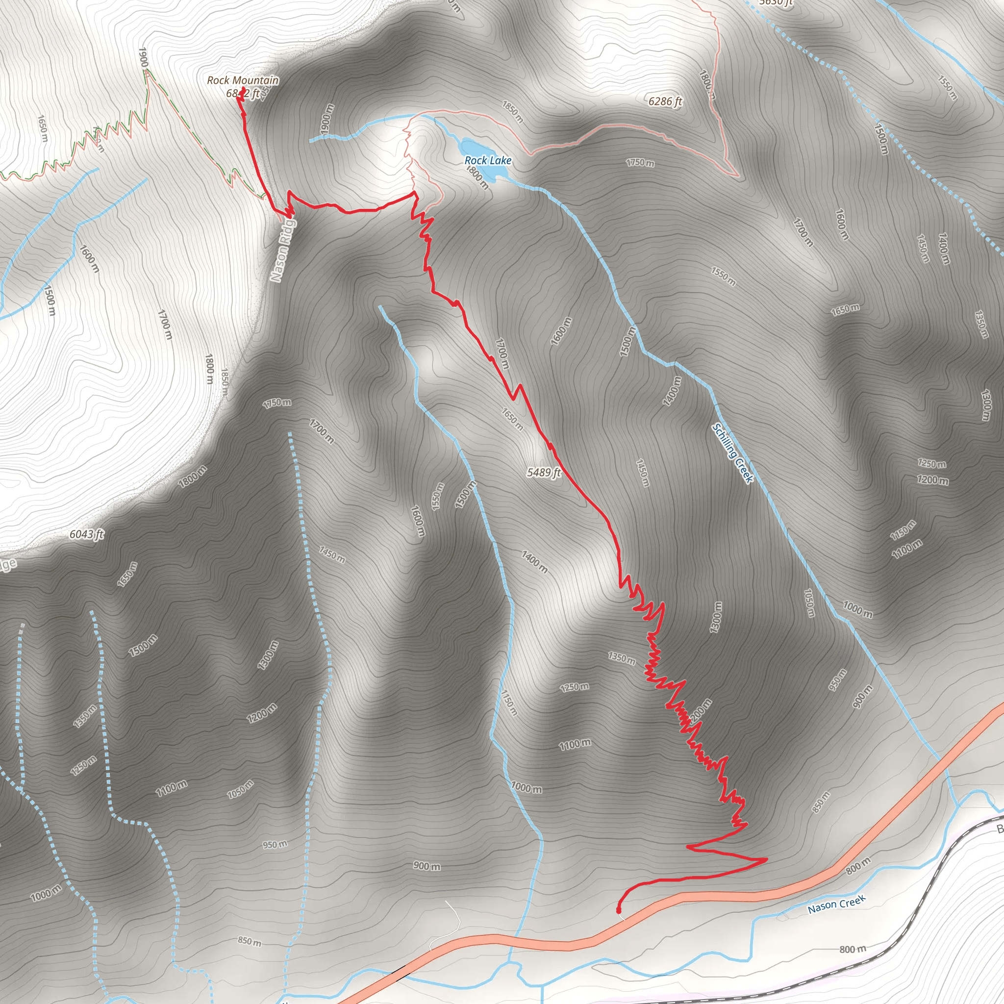
Starting your adventure near Chelan County, Washington, the Rock Mountain Trail offers a challenging yet rewarding experience. This out-and-back trail spans approximately 14 kilometers (around 8.7 miles) and features an elevation gain of about 1300 meters (4265 feet). The trailhead is conveniently located near the Stevens Pass area, which is accessible by car or public transport.
Getting There If you're driving, head towards Stevens Pass on US Highway 2. The trailhead is located near the Smith Brook Road turnoff, which is a well-known landmark in the area. For those relying on public transport, you can take a bus to the Stevens Pass Ski Area and then arrange for a local shuttle or taxi to the trailhead.
Trail Overview The Rock Mountain Trail is rated as medium difficulty, making it suitable for hikers with some experience. The trail begins with a steady ascent through dense forest, where you'll encounter a variety of flora, including Douglas firs and western hemlocks. As you climb, the forest opens up, offering glimpses of the surrounding peaks and valleys.
Key Landmarks and Sections - **First Kilometer (0-1 km / 0-0.6 miles):** The initial section is a moderate climb through lush forest. Keep an eye out for local wildlife such as deer and various bird species. - **Second to Fourth Kilometer (1-4 km / 0.6-2.5 miles):** The trail becomes steeper, and you'll start to see more rocky terrain. This section offers stunning views of Nason Ridge and the Wenatchee River Valley. - **Midpoint (5-7 km / 3.1-4.3 miles):** Around the halfway mark, you'll reach a series of switchbacks that lead to a ridge. This is a great spot to take a break and enjoy panoramic views of the Cascades.
Historical Significance The Rock Mountain area has a rich history, with roots tracing back to the indigenous peoples who originally inhabited the region. The trail itself was used by early settlers and loggers, and remnants of old logging roads can still be seen in some sections.
Final Ascent - **Seventh to Ninth Kilometer (7-9 km / 4.3-5.6 miles):** The trail becomes more rugged as you approach the summit. The final push involves navigating through rocky outcrops and loose gravel, so be sure to have sturdy footwear. - **Summit (9-10 km / 5.6-6.2 miles):** Upon reaching the summit, you'll be rewarded with breathtaking 360-degree views of the surrounding peaks, including Mount Stuart and Glacier Peak. This is a perfect spot for a well-deserved rest and some photography.
Descent The return journey follows the same path, so be prepared for a steep descent. Trekking poles can be particularly useful for maintaining balance and reducing strain on your knees.
Navigation and Safety Given the trail's elevation gain and rugged terrain, it's essential to be well-prepared. Use HiiKER for accurate trail maps and real-time updates. Always carry sufficient water, snacks, and layers of clothing to adapt to changing weather conditions.
Wildlife and Flora The Rock Mountain Trail is home to diverse wildlife, including black bears, mountain goats, and various bird species. The flora ranges from dense forest at lower elevations to alpine meadows near the summit, where you can find wildflowers in bloom during the summer months.
Final Tips Start early to avoid the midday heat and ensure you have enough daylight for the return trip. Check weather conditions before you go, as the trail can be treacherous in wet or snowy conditions. Always let someone know your hiking plans and estimated return time.
Embark on this trail with respect for nature and the historical significance of the area, and you'll find the Rock Mountain Trail to be a truly enriching experience.
What to expect?
Activity types
Comments and Reviews
User comments, reviews and discussions about the Rock Mountain Trail, Washington.
4.54
average rating out of 5
13 rating(s)
