Download
Preview
Add to list
More
221.2 km
~12 days
5062 m
Multi-Day
“Embark on Glyndŵr's Way to traverse historic and scenic mid-Wales, a rewarding trek for the reasonably fit.”
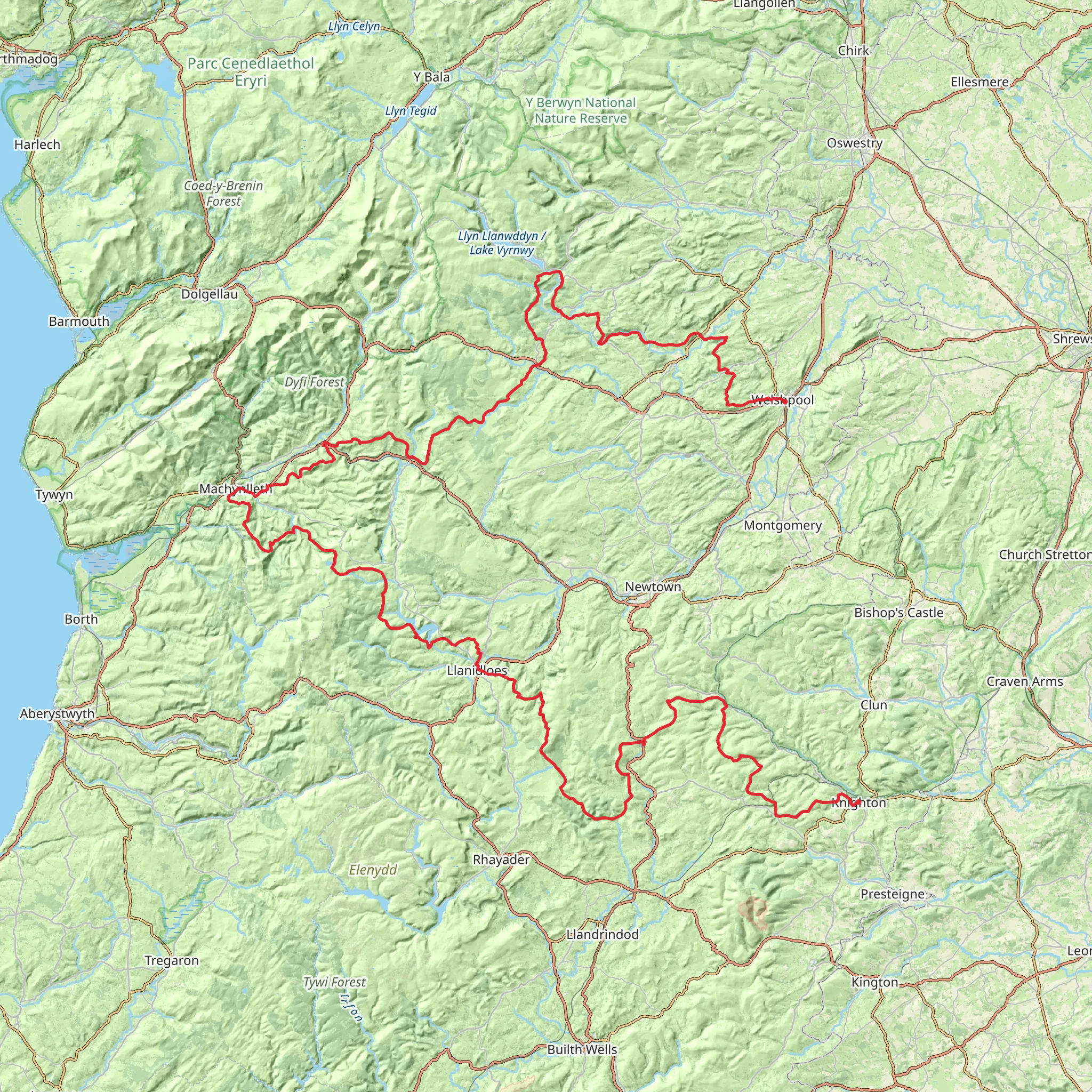
Glyndŵr's Way, a National Trail named after the 15th-century Welsh prince Owain Glyndŵr, meanders through the rolling hills and pastoral countryside of mid-Wales. Spanning approximately 221 kilometers (137 miles) with an elevation gain of around 5000 meters (16,404 feet), this trail offers a medium difficulty level, making it accessible to hikers with a reasonable level of fitness.
Starting the Journey The trailhead is located near the town of Knighton in Powys, Wales, which is accessible by public transport. Trains and buses serve Knighton, allowing hikers to arrive from various parts of the UK. For those driving, parking is available in the town, from where you can embark on your journey.
Navigating the Trail As you set out, the path takes you through a variety of landscapes, including open moorland, forests, farmland, and small Welsh villages. The trail is well-marked with the distinctive Glyndŵr's Way symbol, but carrying a reliable navigation tool like HiiKER is advisable to ensure you stay on track and can plan your stops accordingly.
Historical Significance The trail is steeped in history, tracing the legacy of Owain Glyndŵr, who led a rebellion against English rule in the early 1400s. Along the route, you'll encounter historical landmarks that echo the past, such as the ancient town of Machynlleth, which Glyndŵr established as his parliamentary seat.
Wildlife and Natural Beauty The diverse habitats along Glyndŵr's Way are home to an array of wildlife. Keep an eye out for birds of prey, such as red kites and buzzards, soaring above the hills. The trail also passes through the tranquil waters of Lake Vyrnwy, a reservoir with a Gothic revival straining tower that's a haven for waterfowl.
Challenging Sections and Scenic Highlights One of the more challenging sections includes the climb to Foel Fadian, which stands at 510 meters (1,673 feet). From this vantage point, you'll be rewarded with panoramic views of the Cambrian Mountains and the verdant Dyfi Valley.
Accommodations and Resupply Points Throughout the journey, there are opportunities to rest and resupply in welcoming towns and villages. Wild camping is not officially permitted, so planning your accommodation in advance is essential. Options range from cozy B&Bs to more rustic camping sites.
End of the Trail The trail concludes in the historic town of Welshpool, near Powys Castle, a National Trust property with beautiful gardens. Welshpool can be reached by public transport, with train and bus services connecting hikers back to major cities and towns.
Preparation Tips Before embarking on Glyndŵr's Way, ensure you have appropriate gear for variable weather conditions, as the Welsh climate can be unpredictable. Waterproof clothing, sturdy hiking boots, and a good map or GPS device are essential. It's also wise to carry a first-aid kit and sufficient food and water, although there are places to resupply along the route.
By preparing adequately and respecting the natural environment, hikers can fully enjoy the rich history, stunning landscapes, and welcoming communities that Glyndŵr's Way has to offer.
What to expect?
Activity types
Comments and Reviews
User comments, reviews and discussions about the Glyndŵr's Way, Wales.
4.38
average rating out of 5
32 rating(s)

