Download
Preview
Add to list
More
201.2 km
~12 days
5843 m
Multi-Day
“Embark on the scenic Monmouthshire Way, a 201 km historical Welsh odyssey through diverse landscapes and rich heritage.”
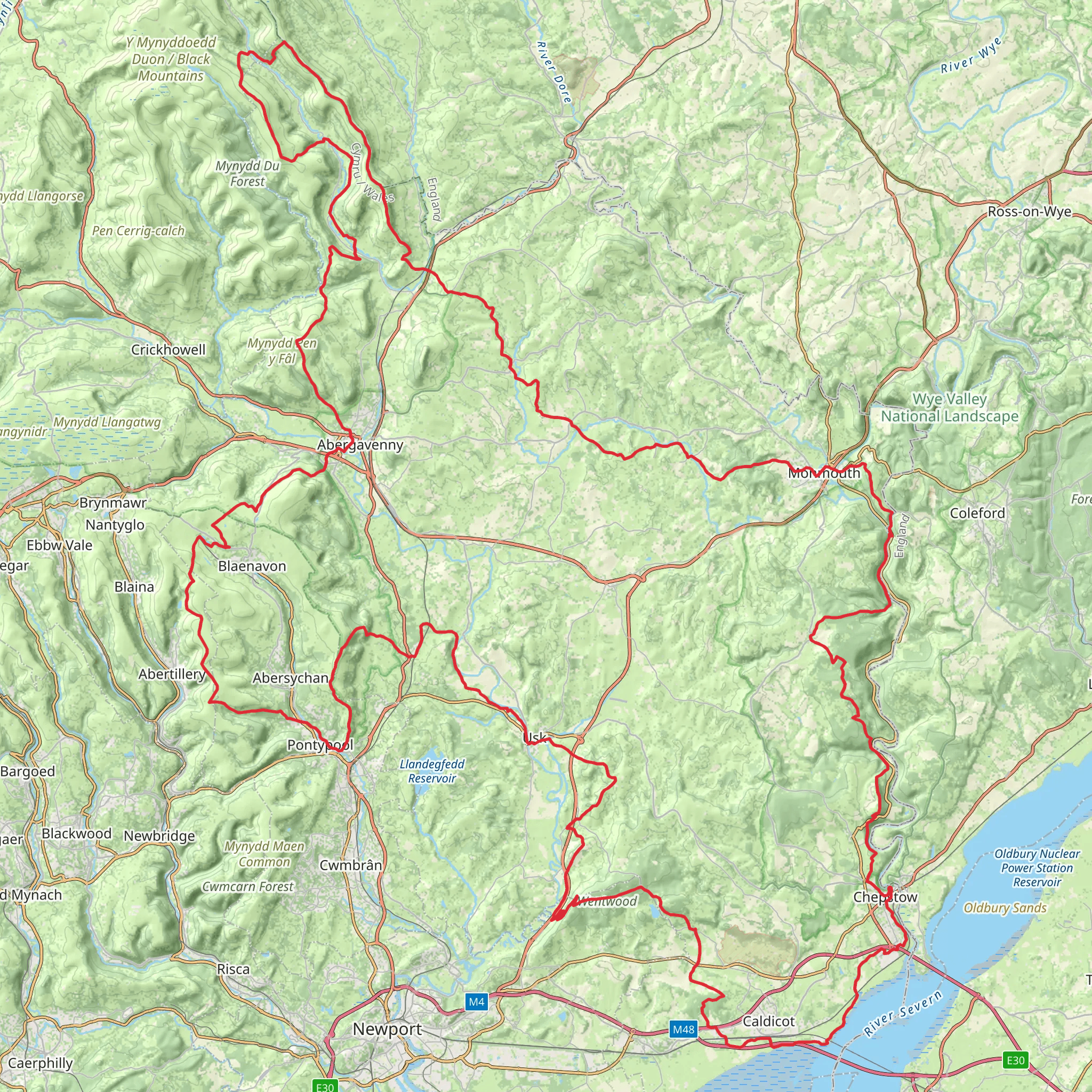
The Monmouthshire Way is a captivating loop trail that spans approximately 201 km (125 miles) with an elevation gain of around 5800 meters (19,000 feet), offering hikers a medium difficulty rating. This trail encircles the historic county of Monmouthshire in Wales, providing a rich tapestry of landscapes, from rolling hills and river valleys to ancient woodlands and rural countryside.
Getting to the Trail Head
The trail head is conveniently located near the town of Monmouth, which is accessible by public transport or car. For those arriving by car, Monmouth is situated off the A40, and there are several car parks where you can leave your vehicle before embarking on your hike. If you're using public transport, buses serve the area, and the nearest train stations are in Abergavenny and Chepstow, from which you can catch a bus or taxi to Monmouth.
Navigating the Trail
As you set out on the Monmouthshire Way, it's advisable to use a reliable navigation tool like HiiKER to keep track of your progress and ensure you're following the correct path. The trail is marked, but having a digital map can be invaluable, especially in areas where the trail may be less defined.
Landmarks and Historical Significance
The trail takes you through a region steeped in history, with numerous castles, abbeys, and fortresses dotting the landscape. Notable historical landmarks include the ruins of Tintern Abbey, a 12th-century monastery that offers a glimpse into the area's monastic past, and the imposing Skenfrith Castle, a Norman fortress that stands as a testament to the turbulent history of the Welsh-English border.
Natural Beauty and Wildlife
As you traverse the Monmouthshire Way, you'll be treated to a variety of natural wonders. The trail meanders through the Wye Valley, an Area of Outstanding Natural Beauty, where the River Wye carves its way through limestone gorges, offering stunning vistas. Keep an eye out for wildlife such as peregrine falcons, otters, and a diverse array of butterflies and wildflowers, particularly in the spring and summer months.
Terrain and Elevation
The trail's terrain is varied, with some sections taking you along riverbanks and others climbing to higher elevations that provide panoramic views of the surrounding countryside. The elevation gain is significant, with some steep ascents and descents, so a good level of fitness is recommended. The highest point on the trail is The Kymin, a hill overlooking Monmouth, which offers a rewarding view for those who make the climb.
Preparation and Planning
Before embarking on the Monmouthshire Way, ensure you have appropriate gear, including sturdy hiking boots, weather-appropriate clothing, and sufficient water and food. Given the trail's length, planning overnight stops is essential. There are various accommodation options along the route, from campsites to B&Bs, allowing you to experience the local hospitality.
Seasonal Considerations
The trail can be hiked year-round, but the best conditions are typically from spring to autumn when the weather is milder, and the days are longer. Winter hiking is possible, but be prepared for shorter days and potentially challenging weather conditions.
By taking the time to prepare and plan, hikers can fully immerse themselves in the beauty and history of the Monmouthshire Way, creating a memorable outdoor adventure in the heart of Wales.
What to expect?
Activity types
Comments and Reviews
User comments, reviews and discussions about the Monmouthshire Way, Wales.
4.66
average rating out of 5
50 rating(s)

