Download
Preview
Add to list
More
193.1 km
~11 days
5271 m
Multi-Day
“Embark on the Clwydian Way to discover Wales' historical gems and breathtaking nature across varied terrain.”
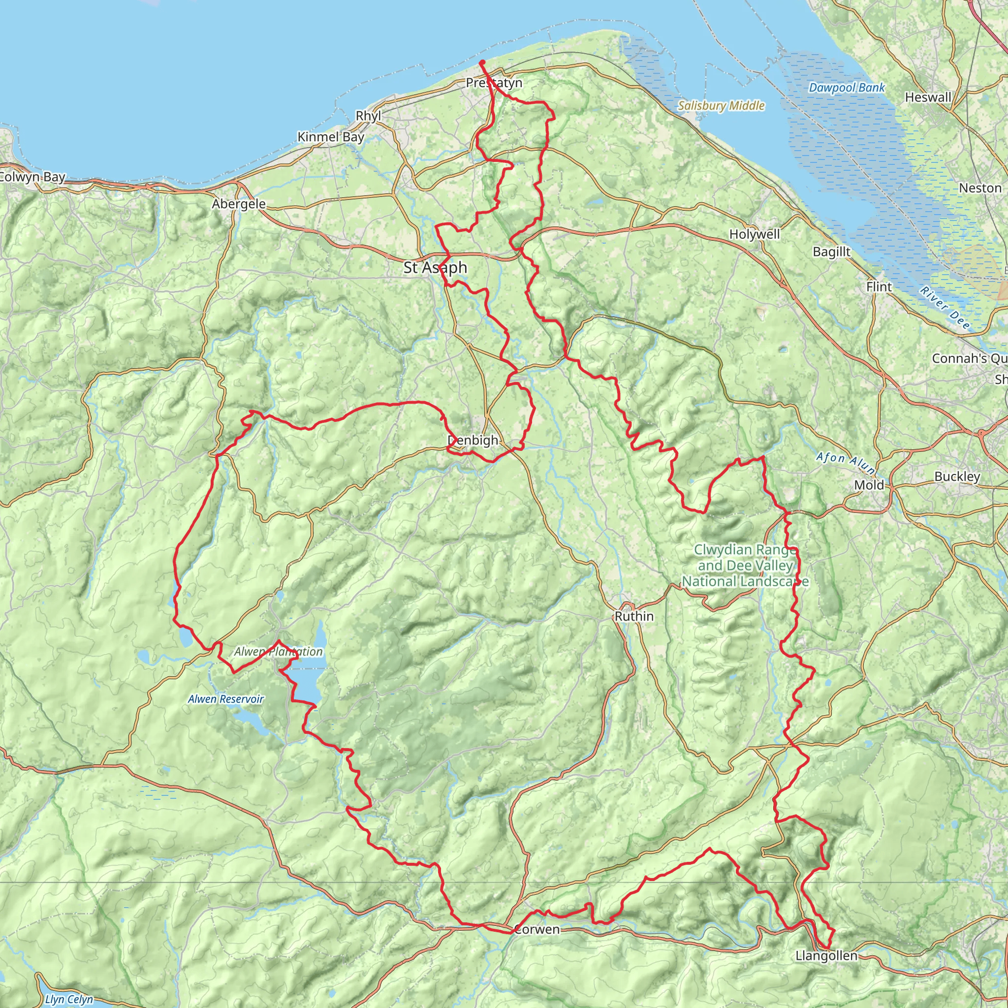
Spanning approximately 193 kilometers (about 120 miles) with an elevation gain of around 5200 meters (approximately 17,060 feet), the Clwydian Way is a captivating loop trail situated near Denbighshire, Wales. This medium-difficulty hike offers a rich tapestry of Welsh countryside, historical sites, and diverse wildlife, making it a rewarding experience for those who embark on its path.
Getting to the Trailhead
The trailhead for the Clwydian Way is accessible from the town of Prestatyn, which is well-connected by public transport. Visitors can take a train to Prestatyn railway station and then opt for a local bus or taxi to reach the starting point near Denbighshire. For those driving, parking is available in the area, and the trailhead can be found just a short distance from the town center.
Route Overview
The Clwydian Way takes hikers through a variety of landscapes, including rolling hills, lush valleys, and quaint villages. The trail is well-marked, but carrying a reliable navigation tool like HiiKER is advisable to stay on track and monitor progress.
Historical Significance and Landmarks
As hikers traverse the Clwydian Way, they will encounter numerous historical landmarks. One of the most significant is the Iron Age hillforts that dot the Clwydian Range, offering a glimpse into ancient Welsh history. The trail also passes through the medieval market town of Ruthin, where hikers can explore the well-preserved Ruthin Castle and the old gaol.
Natural Beauty and Wildlife
The Clwydian Range, an Area of Outstanding Natural Beauty, is a highlight of the trail, providing stunning panoramic views of the surrounding countryside. The trail also winds through the Dee Valley, where the River Dee meanders gracefully, and hikers may spot a variety of birds, including buzzards and peregrine falcons.
Terrain and Elevation
The Clwydian Way's terrain is varied, with some sections featuring steep ascents and descents. The highest point is Moel Famau, which stands at 554 meters (1,818 feet) and offers breathtaking views from the summit. Hikers should be prepared for the physical demands of the trail, especially in areas with significant elevation changes.
Accommodations and Resupply Points
Along the Clwydian Way, there are several towns and villages where hikers can find accommodations ranging from campsites to B&Bs. Resupply points for food and water are also available in these settlements, allowing hikers to replenish their provisions.
Safety and Preparation
Before setting out, hikers should ensure they have appropriate gear for the trail, including sturdy footwear, weather-appropriate clothing, and sufficient food and water. It's also wise to check the weather forecast and plan for any contingencies that may arise during the hike.
By preparing adequately and respecting the trail's natural and historical significance, hikers can fully enjoy the immersive experience that the Clwydian Way offers.
What to expect?
Activity types
Comments and Reviews
User comments, reviews and discussions about the Clwydian Way, Wales.
4.62
average rating out of 5
52 rating(s)

