Download
Preview
Add to list
More
47.2 km
~3 days
420 m
Multi-Day
“Hike from Conwy to Caernarfon on the Wales Coast Path, a journey through history and stunning seascapes.”
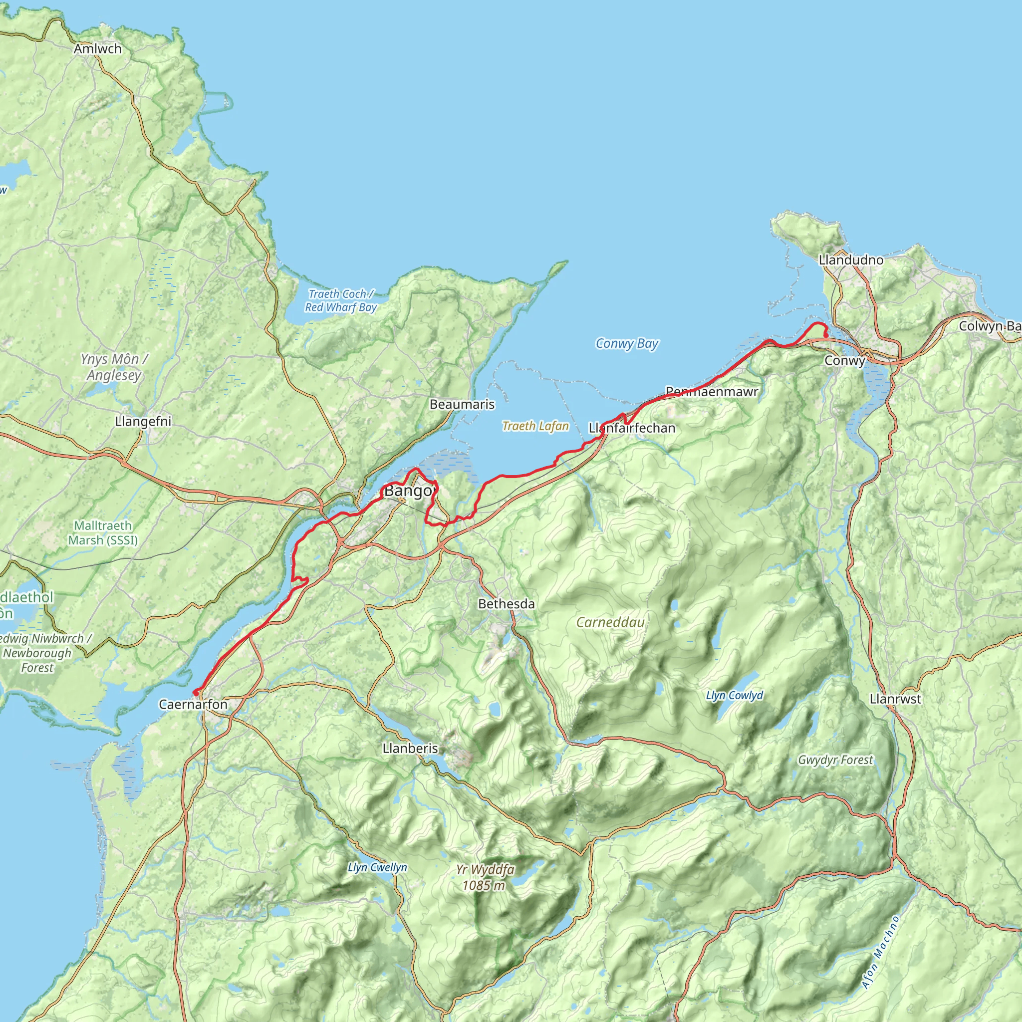
Embarking on the Wales Coast Path from Conwy to Caernarfon, hikers will traverse approximately 47 kilometers (about 29 miles) of diverse landscapes, with an elevation gain of around 400 meters (roughly 1,300 feet). This point-to-point trail is rated as medium difficulty, offering a blend of coastal views, historical sites, and charming Welsh towns.
Getting to the Trailhead
The trailhead is located near the historic town of Conwy, which is easily accessible by public transport or car. For those arriving by train, Conwy railway station is a convenient starting point, just a short walk from the trailhead. If driving, there are several car parks in Conwy where you can leave your vehicle before beginning your hike. Utilizing HiiKER for navigation, you can pinpoint the exact starting location and plan your route accordingly.
Conwy to Penmaenmawr (0-10 km / 0-6.2 miles)
From the medieval Conwy Castle, the path meanders along the estuary, offering views of the rugged Great Orme headland. As you leave Conwy behind, the trail climbs slightly, providing panoramic vistas of the Irish Sea. The path then descends into the town of Penmaenmawr, known for its ancient stone circles and quarrying history.
Penmaenmawr to Llanfairfechan (10-16 km / 6.2-10 miles)
Continuing westward, the path skirts around the base of the Sychnant Pass, leading to the seaside town of Llanfairfechan. This section is relatively flat and offers a chance to observe a variety of seabirds along the coast.
Llanfairfechan to Bangor (16-32 km / 10-20 miles)
As you progress towards Bangor, the trail becomes more undulating, with a few steep sections. The Menai Strait comes into view, separating the mainland from the Isle of Anglesey. The city of Bangor serves as a midpoint where hikers can restock supplies or even take a detour to visit the impressive Penrhyn Castle.
Bangor to Caernarfon (32-47 km / 20-29 miles)
The final stretch to Caernarfon is characterized by a mix of coastal and countryside walking. The trail crosses the iconic Menai Suspension Bridge, a feat of engineering from the 19th century. Approaching Caernarfon, the imposing Caernarfon Castle, a UNESCO World Heritage Site, dominates the skyline, marking the end of the journey.
Wildlife and Nature
Throughout the hike, the rich biodiversity of the Welsh coastline is on full display. Keep an eye out for marine wildlife, including seals and dolphins, and a variety of bird species such as puffins and guillemots. The trail also passes through several nature reserves, offering opportunities to appreciate the local flora and fauna.
Historical Significance
The region is steeped in history, with ancient monuments and castles dotting the landscape. Conwy Castle and Caernarfon Castle are part of the "Castles and Town Walls of King Edward in Gwynedd" World Heritage Site, reflecting the military architecture of the 13th and 14th centuries.
Preparation and Planning
Before setting out, ensure you have appropriate gear for variable weather conditions, as the Welsh coast can be unpredictable. Waterproof clothing, sturdy hiking boots, and a map or GPS device are essential. HiiKER can be used to track your progress and navigate the trail. It's advisable to check the tide times for certain coastal sections and to be aware of any temporary path diversions or closures.
With its combination of natural beauty, wildlife, and historical landmarks, the Wales Coast Path from Conwy to Caernarfon offers an enriching hiking experience through the heart of North Wales.
What to expect?
Activity types
Comments and Reviews
User comments, reviews and discussions about the Wales Coast Path - Conwy to Caernarfon, Wales.
4.52
average rating out of 5
44 rating(s)

