Download
Preview
Add to list
More
95.9 km
~6 days
3326 m
Multi-Day
“Embark on the Ceredigion Coast Path for a scenic Welsh adventure through history, wildlife, and dramatic coastal beauty.”
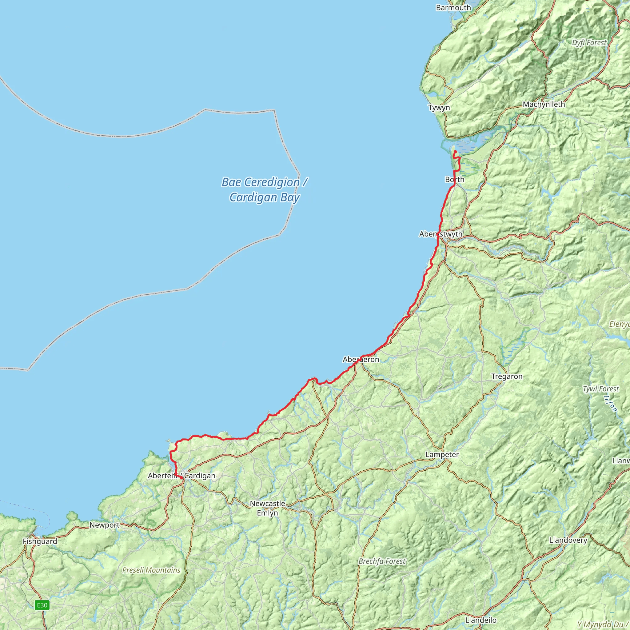
Spanning approximately 60 miles (96 kilometers) along the picturesque Welsh coastline, the Ceredigion Coast Path offers hikers a medium-difficulty trek with an elevation gain of around 10,830 feet (3300 meters). This point-to-point trail is a feast for the eyes, showcasing the rugged beauty of the Ceredigion coast with its sweeping views of Cardigan Bay.
Getting to the Trailhead
The trailhead is located near the town of Cardigan, which is accessible by car or public transport. If driving, you can reach Cardigan via the A487 road, which runs along the west coast of Wales. For those preferring public transport, buses serve the area and can drop you off in the town center, from where the trailhead is a short walk away.
Navigating the Path
The Ceredigion Coast Path is well-marked, but it's always wise to carry a reliable navigation tool like HiiKER to ensure you stay on track. The path winds its way through a variety of landscapes, including sandy beaches, rocky headlands, and rolling countryside.
Landmarks and Scenery
As you embark on your journey, you'll be greeted by the dramatic cliffs at Mwnt, an iconic spot known for its Holy Cross Church and opportunities to spot dolphins and seals in the waters below. Approximately 15 miles (24 kilometers) into the hike, you'll reach the bustling seaside town of New Quay, where the poet Dylan Thomas once lived. Here, you can take a break and enjoy the local seafood before continuing on your trek.
Wildlife and Nature
The path traverses several nature reserves, such as the Ynys Lochtyn Peninsula, where the diverse birdlife includes razorbills and guillemots. Keep an eye out for the rare chough, with its distinctive red beak and legs, which can often be seen along the coastal cliffs.
Historical Significance
The region is steeped in history, with numerous castles and ancient settlements dotting the landscape. The remains of Aberystwyth Castle, a 13th-century fortress, are a testament to the area's medieval past. The path also passes through the town of Aberaeron, known for its Georgian architecture and colorful harbor.
Preparation and Planning
Before setting out, ensure you have adequate supplies, as some stretches of the path are remote with few facilities. The weather can be changeable, so pack waterproof gear and layers to accommodate shifts in temperature. It's advisable to plan your hike between April and October when the weather is milder and the days are longer.
Accommodation and Amenities
There are various accommodation options along the route, from campsites to bed and breakfasts, allowing you to break the hike into manageable sections. The towns of Aberystwyth and Aberaeron offer a wider range of amenities, including shops, restaurants, and hotels.
Remember, the Ceredigion Coast Path is a journey to be savored, not rushed. Take your time to enjoy the stunning vistas, the rich wildlife, and the warm Welsh hospitality you'll encounter along the way.
What to expect?
Activity types
Comments and Reviews
User comments, reviews and discussions about the Ceredigion Coast Path, Wales.
4.58
average rating out of 5
50 rating(s)

