Download
Preview
Add to list
More
3.7 km
~47 min
33 m
Loop
“Explore the scenic and historic Sugarland Run Stream Valley Trail, a 4 km loop suitable for medium-difficulty hikes.”
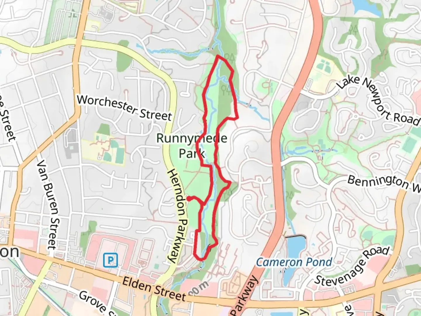
Starting near Fairfax County, Virginia, the Sugarland Run Stream Valley Trail and Redbud Path Loop is a delightful 4 km (2.5 miles) loop with virtually no elevation gain, making it accessible for a wide range of hikers. This trail is estimated to be of medium difficulty, offering a pleasant mix of natural beauty and historical significance.### Getting There To reach the trailhead, you can drive or use public transportation. If driving, set your GPS to the nearest known address: 11150 Sunset Hills Rd, Reston, VA 20190. There is ample parking available near this location. For those using public transport, the closest metro station is the Wiehle-Reston East Station on the Silver Line. From there, you can take a local bus or a short taxi ride to the trailhead.### Trail Navigation For navigation, it’s highly recommended to use the HiiKER app, which provides detailed maps and real-time updates. This will ensure you stay on track and can easily find points of interest along the way.### Trail Highlights The trail begins with a gentle walk along the Sugarland Run Stream, a serene waterway that offers a peaceful start to your hike. Approximately 1 km (0.6 miles) into the trail, you’ll encounter a charming wooden bridge that crosses the stream. This is a great spot for a quick rest and some photos.### Flora and Fauna As you continue, the trail meanders through a lush forest filled with native trees such as redbuds, oaks, and maples. In the spring, the redbuds bloom with vibrant pink flowers, creating a picturesque canopy. Keep an eye out for local wildlife, including deer, squirrels, and a variety of bird species like cardinals and blue jays.### Historical Significance Around the 2 km (1.2 miles) mark, you’ll come across a historical marker indicating the site of a former Native American settlement. This area was once inhabited by the Algonquian-speaking tribes, and you can still find remnants of their presence in the form of pottery shards and arrowheads if you look closely.### Redbud Path Loop The Redbud Path Loop section of the trail offers a slightly more challenging terrain with a few gentle inclines and declines. This part of the trail is particularly beautiful in the fall when the leaves change color, providing a stunning backdrop for your hike. The loop reconnects with the main trail after about 1.5 km (0.9 miles), leading you back towards the starting point.### Final Stretch As you near the end of the trail, you’ll pass through a meadow that is often filled with wildflowers in the warmer months. This open area is perfect for a picnic or simply to enjoy the surrounding nature before completing your hike.### Practical Tips - Wear sturdy hiking shoes, as some parts of the trail can be muddy, especially after rain. - Bring water and snacks, as there are no facilities along the trail. - Check the weather forecast before heading out, and dress appropriately for the conditions. - Use the HiiKER app for navigation and to stay updated on any trail conditions or closures.This trail offers a wonderful mix of natural beauty, wildlife, and historical intrigue, making it a rewarding experience for any hiker.

What to expect?
Activity types
Comments and Reviews
User comments, reviews and discussions about the Sugarland Run Stream Valley Trail and Redbud Path Loop, Virginia.
4.44
average rating out of 5
18 rating(s)