Download
Preview
Add to list
More
8.7 km
~2 hrs 25 min
403 m
Out and Back
“Embark on the Timber Ridge Trail for scenic views, diverse wildlife, and rich historical significance.”
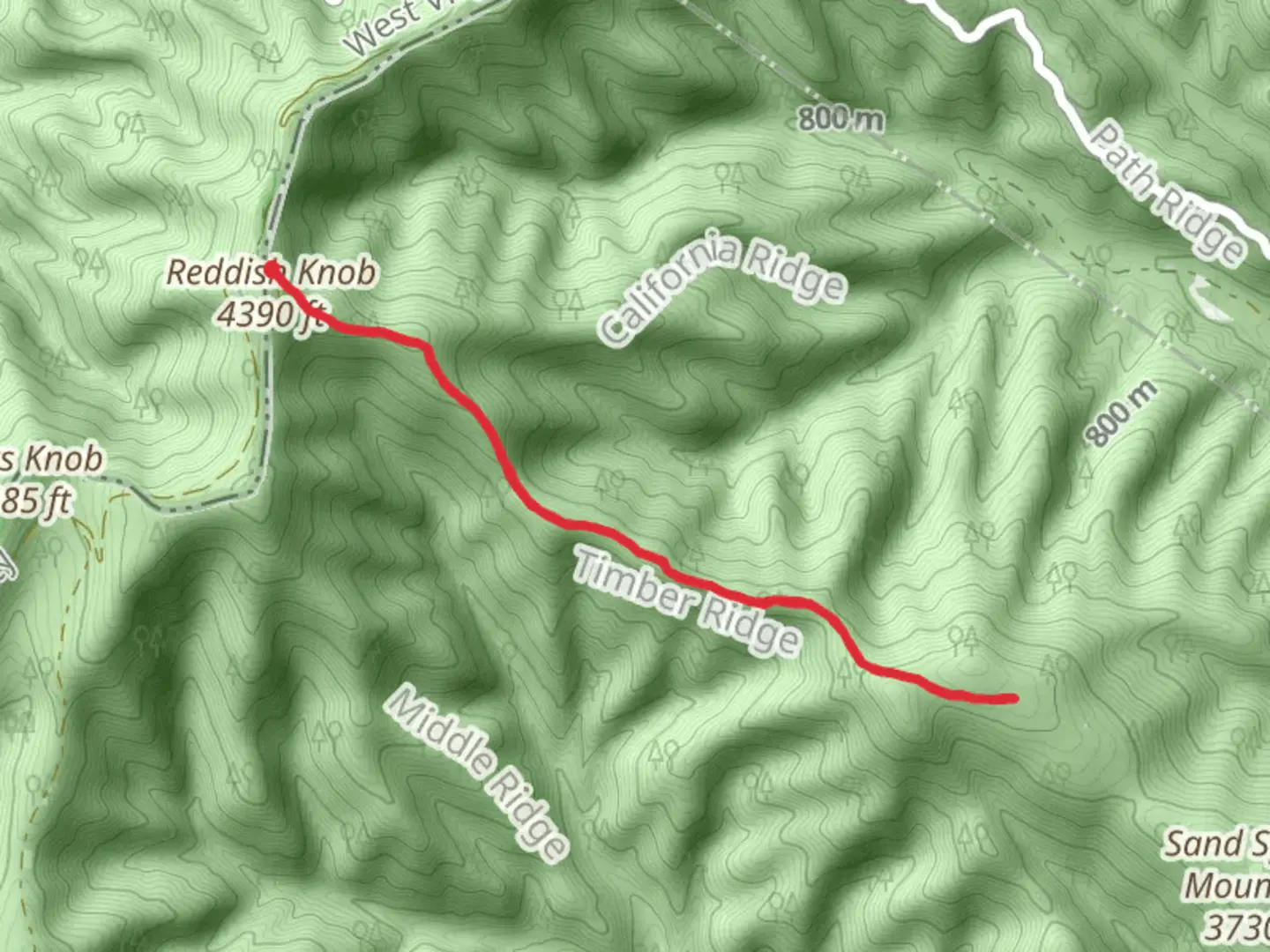
Starting near Augusta County, Virginia, the Timber Ridge Trail Out and Back is a captivating 9 km (approximately 5.6 miles) journey with an elevation gain of around 400 meters (about 1,312 feet). This medium-difficulty trail offers a blend of natural beauty, historical significance, and a moderate challenge suitable for most hikers.
Getting There
To reach the trailhead, you can drive or use public transportation. If driving, head towards the George Washington National Forest, where the trailhead is located. The nearest significant landmark is the Braley Pond, which is a popular spot for fishing and picnicking. For those using public transport, the closest major city is Staunton, Virginia. From Staunton, you can take a local bus or taxi to the trailhead area.
Trail Overview
The trail begins with a gentle ascent through a dense forest of oak, hickory, and maple trees. This initial section is relatively easy, allowing you to warm up before the more challenging parts of the hike. Approximately 1.5 km (0.9 miles) in, you'll encounter a small creek that you can cross via a wooden footbridge. This is a great spot to take a short break and enjoy the serene surroundings.
Significant Landmarks and Nature
As you continue, the trail becomes steeper, gaining elevation more rapidly. Around the 3 km (1.9 miles) mark, you'll reach a rocky outcrop that offers stunning views of the Shenandoah Valley. This is one of the most picturesque spots on the trail, perfect for photography and a well-deserved rest.
The trail then winds through a series of switchbacks, making the ascent more manageable. At approximately 4.5 km (2.8 miles), you'll reach the highest point of the trail. Here, the elevation gain totals around 400 meters (1,312 feet). The summit provides panoramic views of the surrounding forest and distant mountains, making the climb well worth the effort.
Wildlife and Flora
The Timber Ridge Trail is home to a variety of wildlife, including white-tailed deer, black bears, and numerous bird species such as the Eastern Bluebird and Red-tailed Hawk. Keep an eye out for these creatures, but remember to maintain a safe distance, especially from larger animals like bears.
The flora along the trail is equally diverse. In the spring and summer, you'll find an array of wildflowers, including Virginia Bluebells and Trilliums. The fall season transforms the forest into a vibrant tapestry of reds, oranges, and yellows, offering a different kind of beauty.
Historical Significance
The region around Augusta County has a rich history dating back to the early settlers and Native American tribes. The Timber Ridge area was once a hunting ground for the Monacan tribe. During the Civil War, the Shenandoah Valley was a strategic location, and remnants of old encampments can still be found in the area.
Navigation and Safety
For navigation, it's highly recommended to use the HiiKER app, which provides detailed maps and real-time updates. The trail is well-marked, but having a reliable navigation tool ensures you stay on track.
Be sure to carry enough water, snacks, and a first-aid kit. The weather can change rapidly, so dressing in layers and bringing rain gear is advisable. Always inform someone of your hiking plans and expected return time.
The Timber Ridge Trail Out and Back offers a rewarding experience with its mix of natural beauty, wildlife, and historical significance. Whether you're a seasoned hiker or a beginner looking for a moderate challenge, this trail has something for everyone.

What to expect?
Activity types
Comments and Reviews
User comments, reviews and discussions about the Timber Ridge Trail Out and Back, Virginia.
4.75
average rating out of 5
8 rating(s)