Download
Preview
Add to list
More
40.7 km
~3 days
2042 m
Multi-Day
“The Monroe Skyline Trail offers an arduous yet stunning trek through Vermont's historic and scenic Green Mountains.”
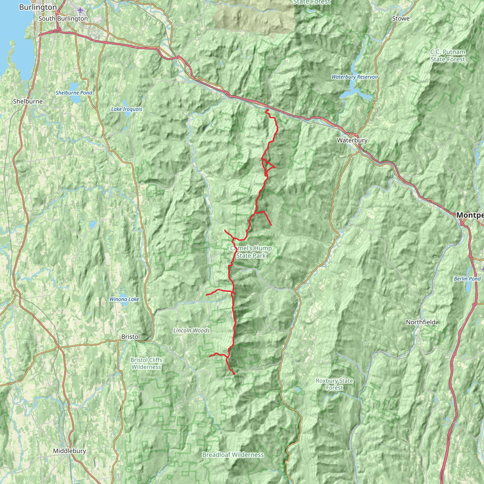
The Monroe Skyline Trail, spanning approximately 41 kilometers (25.5 miles) with an elevation gain of around 2000 meters (6562 feet), is a challenging point-to-point hike located near Addison County, Vermont. This trail is not for the faint of heart, as it is estimated to be difficult due to its length and significant elevation changes.
Getting to the Trailhead
To reach the trailhead, hikers can drive to the vicinity of Addison County, where parking is available near the start of the trail. For those relying on public transportation, options may be limited, so it's advisable to check local transit resources for the latest schedules and routes that can get you as close as possible to the trailhead.
Navigating the Trail
Hikers should prepare to use navigation tools like HiiKER to stay on track, as the Monroe Skyline Trail traverses a variety of terrains and can be challenging to navigate without a reliable GPS tool. The trail is well-marked in most sections, but weather conditions and seasonal changes can sometimes obscure the path.
Landmarks and Scenery
As you embark on the Monroe Skyline Trail, you'll be greeted with breathtaking views of the Green Mountains, which are part of the Appalachian Range. The trail includes a traverse of the main ridge of the Green Mountains, including the Camel's Hump and Mount Abraham, both of which are over 1200 meters (4000 feet) in elevation. Camel's Hump, recognizable by its distinct shape, is one of the trail's most iconic landmarks and offers panoramic views from its summit.
Flora and Fauna
Throughout the hike, you'll encounter a diverse array of flora, including hardwood forests that blaze with color during the fall. Wildlife is abundant, with chances to spot white-tailed deer, moose, and various bird species. Black bears also inhabit the area, so hikers should be bear-aware and practice proper food storage and disposal.
Historical Significance
The region is steeped in history, with the Green Mountains playing a pivotal role during the Revolutionary War. The trail itself may not have historical markers, but the land it crosses has been witness to early American history and the development of Vermont as a state.
Preparation and Planning
Given the trail's difficulty, hikers should be in good physical condition and have experience with long-distance, high-elevation hiking. It's essential to pack sufficient water, food, and clothing for changing weather conditions. Hikers should also plan for a multi-day trek or arrange for pick-up at the end of the trail if they intend to complete it in one go.
Safety and Etiquette
Always let someone know your hiking plan and expected return time. Carry a first aid kit, and be prepared for limited cell phone reception in remote areas. Follow Leave No Trace principles to minimize your impact on the environment, and be respectful of other hikers and wildlife you may encounter on your journey.
By preparing adequately and respecting the trail and its surroundings, hikers can enjoy a rewarding experience on the Monroe Skyline Trail, taking in the natural beauty and rugged terrain that Vermont's Green Mountains have to offer.
What to expect?
Activity types
Comments and Reviews
User comments, reviews and discussions about the Monroe Skyline Trail, Vermont.
4.52
average rating out of 5
299 rating(s)

