Download
Preview
Add to list
More
34.9 km
~2 day
1840 m
Out and Back
“Embark on the challenging Ben Lomond via Skyline North Trail for breathtaking views and rich historical intrigue.”
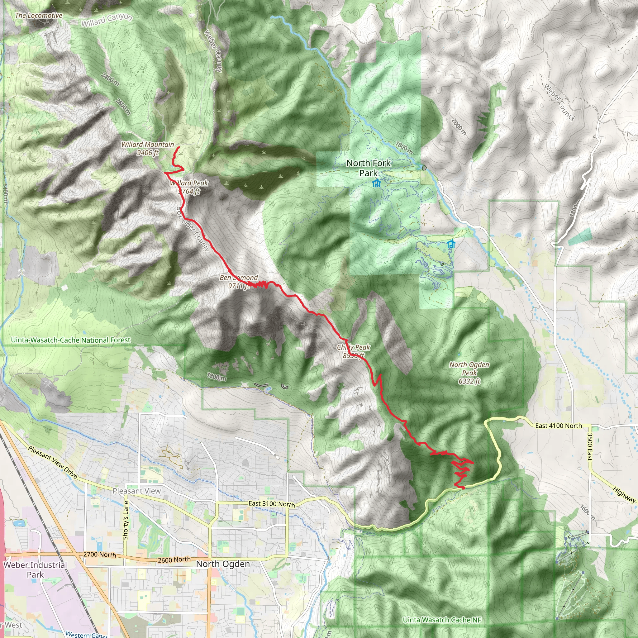
Starting your adventure near Weber County, Utah, the Ben Lomond via Skyline North Trail offers a challenging yet rewarding experience. This out-and-back trail spans approximately 35 kilometers (around 22 miles) with an elevation gain of about 1800 meters (5905 feet). The trailhead is conveniently located near North Ogden Divide, making it accessible for those traveling by car or public transport.
Getting There If you're driving, head towards North Ogden Divide, which is easily accessible from Ogden, Utah. For those using public transport, you can take a bus to Ogden and then a taxi or rideshare service to the trailhead. The nearest significant landmark to the trailhead is the North Ogden Divide Trailhead Parking Lot.
Trail Overview The trail begins with a steady ascent through a mix of scrub oak and pine forests. Early on, you'll encounter switchbacks that help manage the elevation gain. As you climb, the views of the Ogden Valley and the Great Salt Lake become increasingly spectacular.
Key Landmarks and Sections - **First 5 km (3.1 miles)**: The initial section is moderately steep, gaining about 300 meters (984 feet) in elevation. You'll pass through dense forest, which provides ample shade and a chance to spot local wildlife such as mule deer and various bird species. - **5 km to 10 km (3.1 to 6.2 miles)**: This section levels out slightly, offering a mix of open meadows and forested areas. Wildflowers are abundant in the spring and summer months. Keep an eye out for the occasional mountain biker, as this trail is popular for multi-use.
- 10 km to 15 km (6.2 to 9.3 miles): The trail becomes steeper again as you approach the ridgeline. Here, you'll gain another 500 meters (1640 feet) in elevation. The views become more panoramic, offering sights of the Wasatch Range and the distant Uinta Mountains.
- 15 km to Summit (9.3 miles to summit): The final push to the summit of Ben Lomond is the most challenging, with rocky terrain and a steep incline. The summit sits at an elevation of 2960 meters (9711 feet). From the top, you'll have 360-degree views that are truly breathtaking, making the effort well worth it.
Historical Significance Ben Lomond is steeped in local lore and history. It is said to have inspired the Paramount Pictures logo, although this is a subject of debate. The mountain has long been a landmark for Native American tribes and early settlers in the region.
Wildlife and Flora The trail is home to a variety of wildlife, including mule deer, elk, and occasionally black bears. Bird watchers will enjoy spotting species like the golden eagle and peregrine falcon. The flora varies with elevation, from scrub oak and sagebrush at lower levels to alpine wildflowers and pine forests higher up.
Navigation and Safety Given the trail's length and elevation gain, it's crucial to be well-prepared. Use HiiKER for detailed maps and real-time navigation. The trail is well-marked, but weather conditions can change rapidly, especially near the summit. Always carry sufficient water, snacks, and layers of clothing to adapt to changing temperatures.
Return Journey The return journey follows the same path, offering a different perspective on the landscape as you descend. The descent can be tough on the knees, so trekking poles are recommended.
This trail offers a comprehensive hiking experience, combining physical challenge with stunning natural beauty and historical intrigue. Whether you're a seasoned hiker or looking to push your limits, the Ben Lomond via Skyline North Trail is a must-visit.
What to expect?
Activity types
Comments and Reviews
User comments, reviews and discussions about the Ben Lomond via Skyline North Trail, Utah.
4.29
average rating out of 5
14 rating(s)
