Download
Preview
Add to list
More
5.7 km
~1 hrs 27 min
192 m
Out and Back
“The Cooks Mesa Trail offers a scenic, moderately challenging 6 km hike through Utah's diverse landscapes and history.”
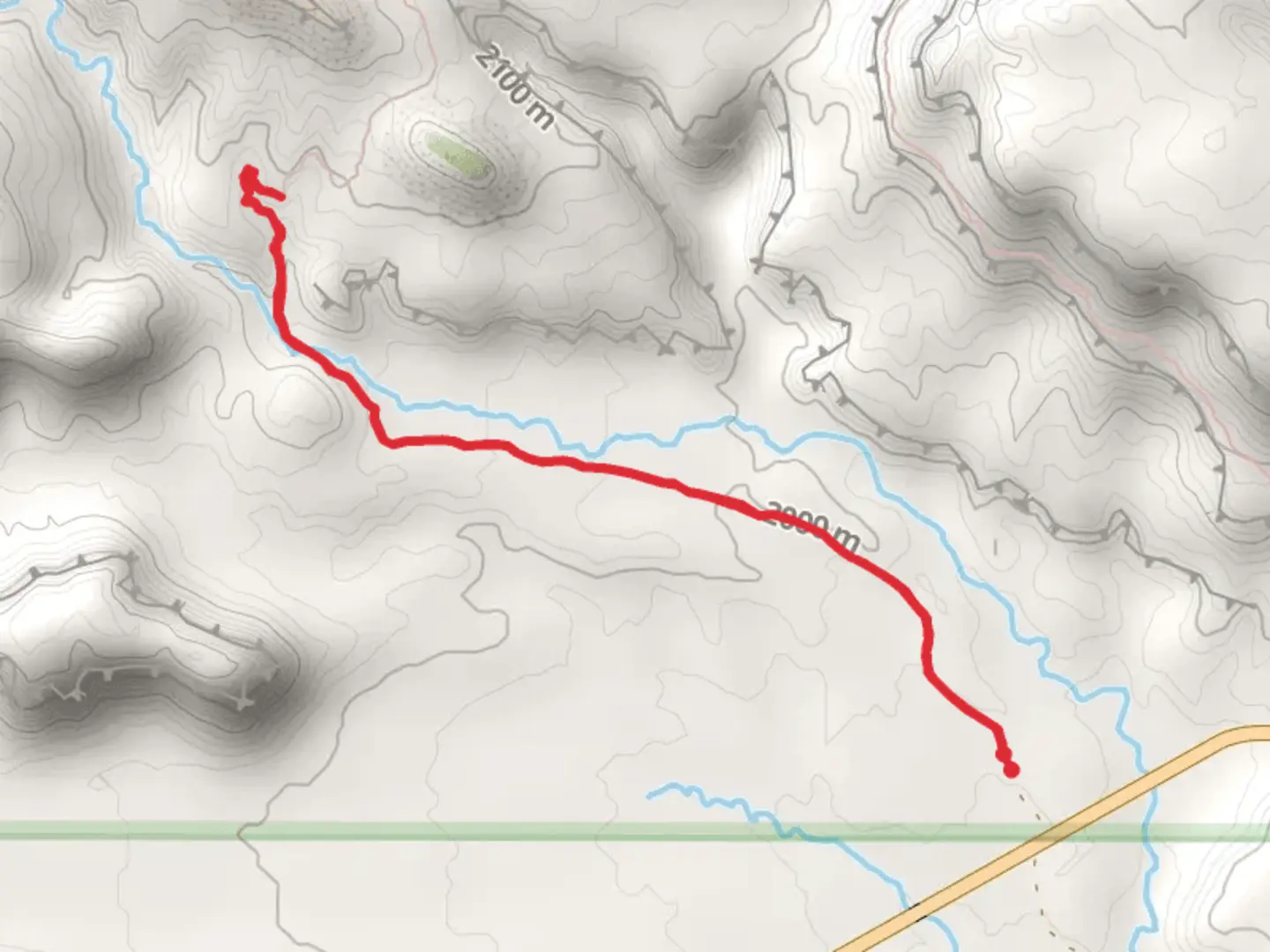
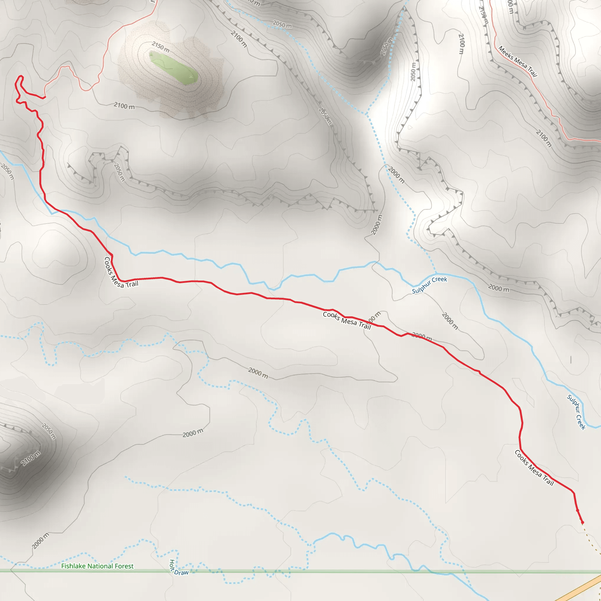
Starting near Wayne County, Utah, the Cooks Mesa Trail Out and Back is a moderately challenging hike that spans approximately 6 kilometers (around 3.7 miles) with an elevation gain of about 100 meters (328 feet). This trail offers a unique blend of natural beauty, historical significance, and a moderate workout, making it a rewarding experience for hikers of various skill levels.
Getting There To reach the trailhead, you can drive or use public transportation. If driving, head towards Wayne County, Utah, and look for the nearest significant landmark, which is the town of Hanksville. From Hanksville, follow local roads to the trailhead. For those using public transport, buses run from larger cities like Salt Lake City to Hanksville, from where you can take a local taxi or rideshare to the trailhead.
Trail Overview The trail begins with a gentle ascent, allowing you to ease into the hike. The initial section is relatively flat, making it a good warm-up. As you progress, the trail starts to climb gradually, offering panoramic views of the surrounding landscape. The terrain is a mix of sandy paths and rocky sections, so sturdy hiking boots are recommended.
Significant Landmarks and Nature Around the 1.5-kilometer (0.9-mile) mark, you'll encounter a striking rock formation known as "The Sentinel." This natural landmark is a popular spot for photos and a good place to take a short break. Continuing on, the trail winds through a series of small canyons and mesas, each offering unique geological features and stunning vistas.
Wildlife and Flora The area is home to a variety of wildlife, including mule deer, jackrabbits, and various bird species like the golden eagle and red-tailed hawk. Keep an eye out for these creatures, especially in the early morning or late afternoon when they are most active. The flora is typical of the high desert, with sagebrush, juniper, and pinyon pine dotting the landscape.
Historical Significance The region around Cooks Mesa has a rich history, dating back to Native American tribes who once inhabited the area. Petroglyphs and ancient artifacts have been found in nearby canyons, adding a layer of historical intrigue to your hike. The trail itself was used by early settlers and explorers, making it a path steeped in history.
Navigation and Safety Given the moderate difficulty of the trail, it's advisable to use a reliable navigation tool like HiiKER to keep track of your progress and ensure you stay on the correct path. The trail is well-marked, but having a digital map can provide extra peace of mind. Always carry sufficient water, especially during the hotter months, and be prepared for sudden weather changes common in desert environments.
Final Stretch As you approach the 3-kilometer (1.85-mile) point, the trail reaches its highest elevation, offering a breathtaking view of the surrounding mesas and valleys. This is the perfect spot to take a moment and soak in the natural beauty before beginning your descent back to the trailhead.
The return journey follows the same path, allowing you to revisit the landmarks and perhaps notice details you missed on the way up. The descent is generally easier, but take care on the rocky sections to avoid slips and falls.
By the time you complete the Cooks Mesa Trail Out and Back, you'll have experienced a diverse range of landscapes, historical sites, and possibly some local wildlife, making it a memorable hike in the heart of Utah's rugged terrain.
What to expect?
Activity types
Comments and Reviews
User comments, reviews and discussions about the Cooks Mesa Trail Out and Back, Utah.
4.67
average rating out of 5
18 rating(s)
