Download
Preview
Add to list
More
10.2 km
~2 hrs 42 min
400 m
Out and Back
“The Cooks Mesa Trail in Wayne County, Utah offers a 10-kilometer hike with stunning views and historical petroglyphs.”
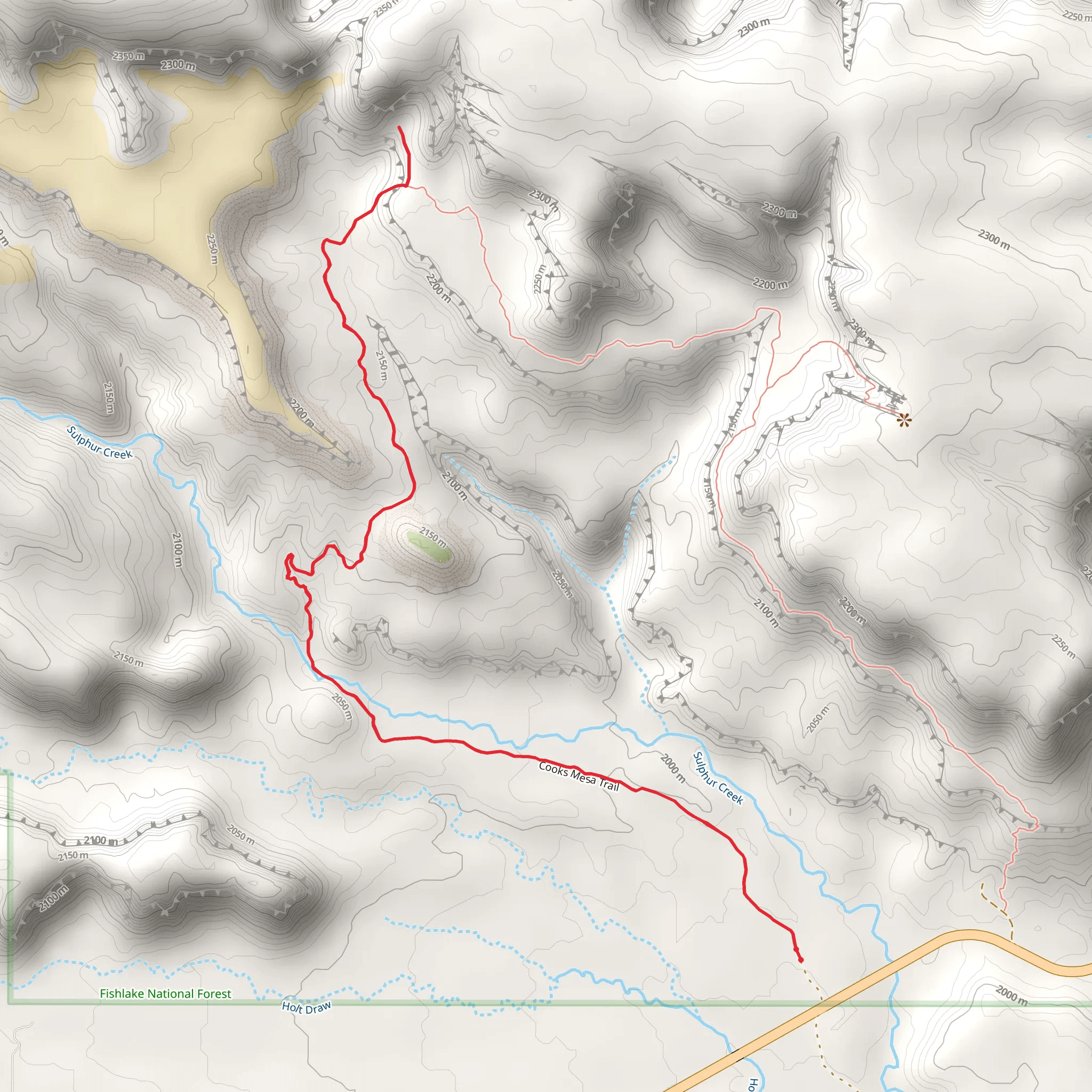
Starting near Wayne County, Utah, the Cooks Mesa Trail offers a captivating out-and-back hiking experience. Spanning approximately 10 kilometers (6.2 miles) with an elevation gain of around 400 meters (1,312 feet), this trail is rated as medium difficulty, making it suitable for moderately experienced hikers.
Getting There To reach the trailhead, you can drive or use public transport. If driving, head towards Wayne County, Utah, and look for the nearest significant landmark, Capitol Reef National Park. The trailhead is located near this area. For those using public transport, the nearest bus stop is in Torrey, Utah, from where you can take a taxi or rideshare to the trailhead.
Trail Overview The trail begins with a gentle ascent through a landscape characterized by red rock formations and sparse vegetation. As you progress, the trail becomes steeper, offering panoramic views of the surrounding mesas and canyons. The first significant landmark you'll encounter is a series of ancient petroglyphs etched into the rock faces, approximately 2 kilometers (1.2 miles) from the start. These petroglyphs provide a glimpse into the region's rich Native American history.
Flora and Fauna The trail is home to a variety of plant and animal species. Keep an eye out for juniper and pinyon pine trees, as well as desert wildflowers that bloom in the spring. Wildlife sightings may include mule deer, jackrabbits, and various bird species such as hawks and eagles.
Mid-Trail Highlights Around the 5-kilometer (3.1-mile) mark, you'll reach the mesa's summit, offering breathtaking views of the surrounding landscape. This is an excellent spot for a rest and some photography. The elevation gain to this point is about 300 meters (984 feet), making it a rewarding challenge for hikers.
Historical Significance The area around Cooks Mesa has a rich history, with evidence of ancient Native American settlements. The petroglyphs you encounter early in the hike are believed to be created by the Fremont culture, which inhabited the region over a thousand years ago. These historical markers add a layer of intrigue and significance to your hike.
Navigation and Safety Given the trail's moderate difficulty, it's advisable to use a reliable navigation tool like HiiKER to stay on track. The trail is well-marked, but having a digital map can be invaluable, especially if you decide to explore any of the side paths.
Final Stretch The return journey follows the same path, allowing you to enjoy the views from a different perspective. The descent is generally easier, but be cautious of loose rocks and uneven terrain. The total elevation gain for the entire hike is around 400 meters (1,312 feet), making it a good workout without being overly strenuous.
By the time you return to the trailhead, you will have experienced a diverse range of landscapes, historical sites, and possibly some local wildlife, making the Cooks Mesa Trail a memorable adventure.
What to expect?
Activity types
Comments and Reviews
User comments, reviews and discussions about the Cooks Mesa Trail, Utah.
4.43
average rating out of 5
14 rating(s)
