Download
Preview
Add to list
More
11.4 km
~3 hrs 17 min
600 m
Out and Back
“Discover the Subway Bottom-Up Approach: a 11 km trail with stunning geology, historical intrigue, and diverse wildlife.”
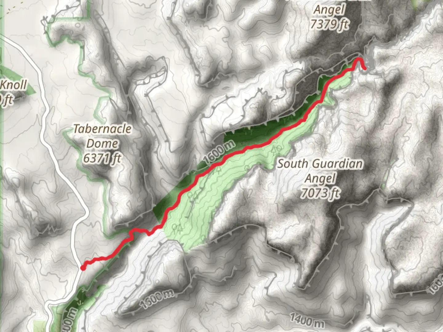
Starting near Washington County, Utah, the Subway Bottom-Up Approach is a captivating out-and-back trail that spans approximately 11 kilometers (around 6.8 miles) with an elevation gain of about 600 meters (approximately 1,970 feet). This trail is rated as medium difficulty and offers a unique blend of natural beauty, geological formations, and historical significance.### Getting There To reach the trailhead, you can drive to the Left Fork Trailhead, located off Kolob Terrace Road. If you're using public transport, the nearest major city is St. George, Utah. From St. George, you can take a shuttle or taxi service to the trailhead, which is roughly a 45-minute drive.### Trail Overview The trail begins with a descent into the Left Fork of North Creek. The initial section is relatively straightforward, but be prepared for some scrambling over rocks and navigating through dense vegetation. The first 1.5 kilometers (about 1 mile) will see a gradual descent of around 150 meters (approximately 500 feet).### Key Landmarks and Features - Arch Angel Falls: About 3 kilometers (1.9 miles) into the hike, you'll encounter Arch Angel Falls. This cascading waterfall is a perfect spot for a short break and some photography. - The Crack: Roughly 4 kilometers (2.5 miles) from the trailhead, you'll come across "The Crack," a narrow section of the canyon that requires careful navigation. This part of the trail is particularly challenging and may involve some wading through water. - The Subway: The highlight of the trail, The Subway, is located around 5.5 kilometers (3.4 miles) from the start. This iconic section features tubular rock formations that resemble a subway tunnel. The unique geological formations here are a result of years of water erosion.### Wildlife and Flora The trail is home to a variety of wildlife, including mule deer, foxes, and a range of bird species. Keep an eye out for the vibrant wildflowers that bloom in the spring and early summer. The area is also rich in plant life, including cottonwood trees and various shrubs.### Historical Significance The region has a rich history, with evidence of Native American habitation dating back thousands of years. Petroglyphs and ancient artifacts have been found in the area, adding a layer of historical intrigue to your hike.### Navigation and Safety Given the challenging nature of the trail, it's advisable to use a reliable navigation tool like HiiKER to keep track of your progress and ensure you stay on the correct path. The trail can be slippery, especially near water features, so sturdy hiking boots with good grip are essential. Additionally, be prepared for sudden weather changes and carry sufficient water and snacks.### Return Journey The return journey follows the same path back to the trailhead. The ascent can be strenuous, especially the final climb out of the canyon, so pace yourself and take breaks as needed.

What to expect?
Activity types
Comments and Reviews
User comments, reviews and discussions about the The Subway Bottom-Up Approach, Utah.
4.33
average rating out of 5
12 rating(s)