Download
Preview
Add to list
More
3.6 km
~51 min
81 m
Loop
“Explore a scenic, accessible loop trail with rich history, striking landmarks, and diverse desert flora and fauna.”
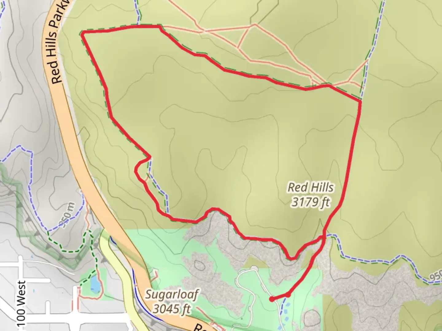
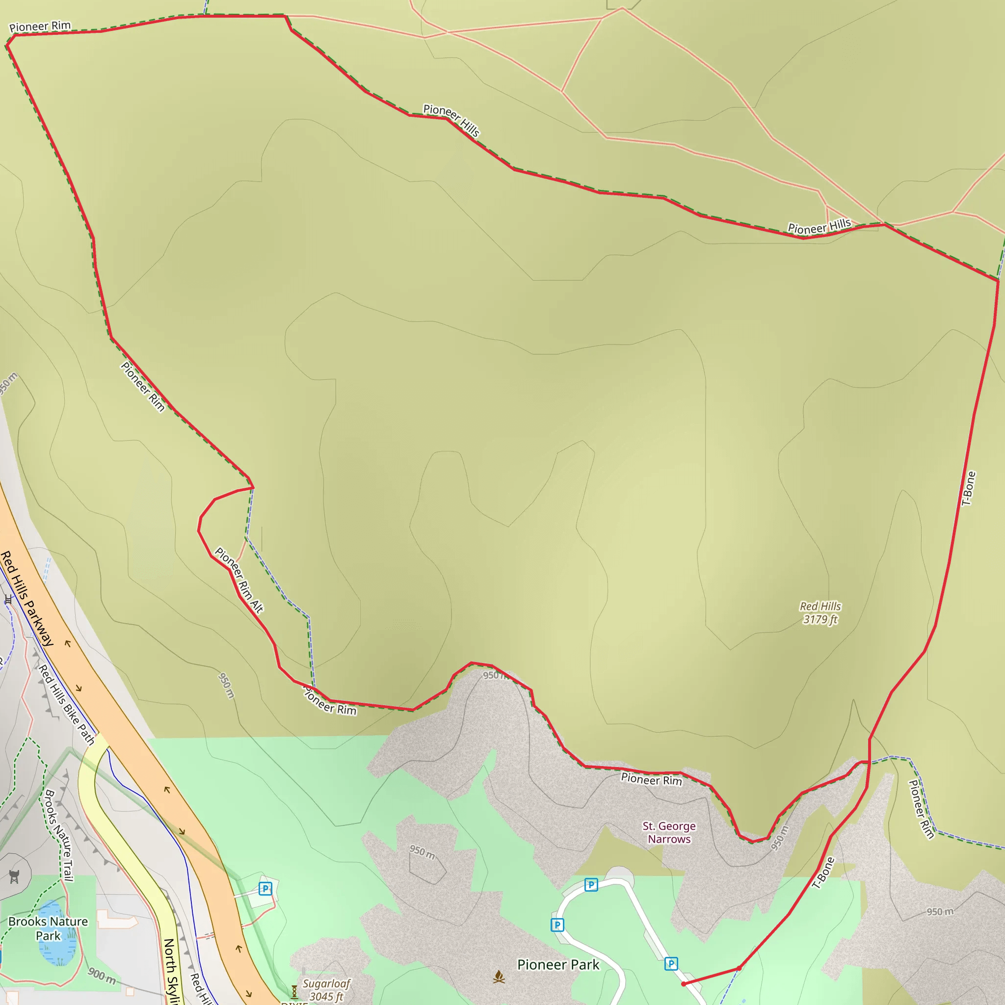
Starting near Washington County, Utah, this 4 km (approximately 2.5 miles) loop trail offers a moderate hiking experience with no significant elevation gain, making it accessible for most hikers. The trailhead is conveniently located near the intersection of Washington Dam Road and South Washington Fields Road, providing easy access whether you're arriving by car or public transport. If you're driving, there's ample parking available at the trailhead. For those using public transport, the nearest bus stop is at the Washington Fields Road and Washington Dam Road intersection, just a short walk from the trailhead.
Trail Navigation and Terrain
The T-Bone Trail, Pioneer Rim Trail, and Pioneer Hills Trail loop is well-marked and maintained, but it's always a good idea to have a reliable navigation tool like HiiKER to ensure you stay on track. The terrain is predominantly flat, with a mix of sandy paths and rocky sections. Given the lack of significant elevation gain, the trail is suitable for hikers of varying skill levels, including families with children.
Landmarks and Points of Interest
As you embark on this loop, you'll encounter several notable landmarks and natural features. Approximately 1 km (0.6 miles) into the hike, you'll come across a striking rock formation known locally as "The Sentinel." This towering structure offers a great photo opportunity and a chance to take a short break.
Continuing along the trail, around the 2 km (1.2 miles) mark, you'll reach Pioneer Rim, a scenic overlook that provides panoramic views of the surrounding desert landscape. This is an excellent spot to pause and take in the beauty of the area, especially during sunrise or sunset when the colors of the sky and land are particularly vibrant.
Flora and Fauna
The trail is rich in native flora and fauna. Keep an eye out for desert wildflowers, especially in the spring when the trail is adorned with blooms of various colors. Common plant species include sagebrush, yucca, and prickly pear cactus. Wildlife sightings are also frequent; you might spot lizards, jackrabbits, and a variety of bird species such as hawks and quails.
Historical Significance
The region around Washington County has a rich history, with evidence of Native American habitation dating back thousands of years. Along the trail, you may notice petroglyphs etched into the rocks, remnants of the area's ancient inhabitants. These petroglyphs offer a fascinating glimpse into the past and are a reminder of the cultural significance of the land.
Preparation and Safety
Given the desert environment, it's crucial to come prepared. Bring plenty of water, especially during the hotter months, and wear sun protection, including a hat and sunscreen. The trail is exposed with little shade, so plan your hike during the cooler parts of the day if possible. Comfortable hiking shoes with good traction are recommended due to the sandy and rocky terrain.
Getting There
To reach the trailhead, head towards Washington County, Utah. If you're driving, take the I-15 and exit at Washington Parkway, then follow Washington Dam Road until you reach the intersection with South Washington Fields Road. For those using public transport, the nearest bus stop is at the Washington Fields Road and Washington Dam Road intersection, a short walk from the trailhead.
This loop trail offers a blend of natural beauty, historical intrigue, and moderate physical challenge, making it a rewarding experience for hikers of all levels.
What to expect?
Activity types
Comments and Reviews
User comments, reviews and discussions about the T-Bone Trail, Pioneer Rim Trail and Pioneer Hills Trail, Utah.
4.65
average rating out of 5
17 rating(s)
