Download
Preview
Add to list
More
22.6 km
~1 day 0 hrs
460 m
Out and Back
“Explore Southern Utah's stunning desert landscape and historical richness on the medium-difficulty, 23 km JEM Trail.”
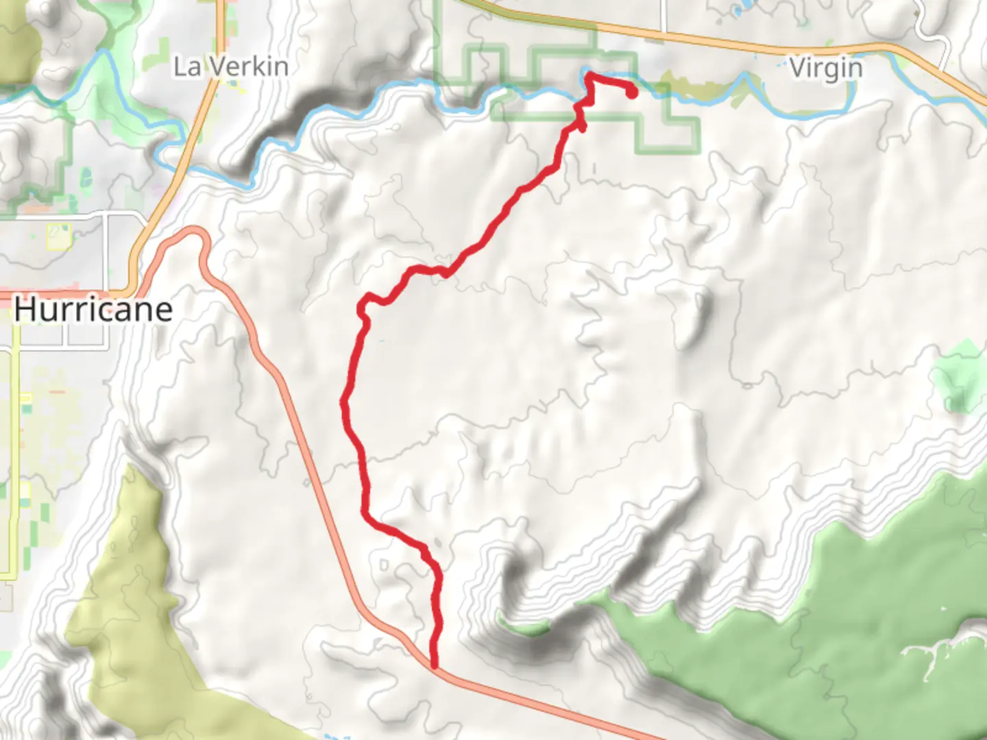
Starting near Washington County, Utah, the JEM Trail is an out-and-back trail that spans approximately 23 kilometers (around 14.3 miles) with an elevation gain of about 400 meters (approximately 1,312 feet). This trail is rated as medium difficulty, making it suitable for hikers with some experience.
Getting There To reach the trailhead, you can drive or use public transport. If driving, head towards Hurricane, Utah, and follow signs to the JEM Trailhead, located near Sheep Bridge Road. For those using public transport, the nearest significant landmark is Hurricane, Utah, where you can catch a local taxi or rideshare service to the trailhead.
Trail Navigation For navigation, it's highly recommended to use HiiKER, which provides detailed maps and real-time updates. The trail is well-marked, but having a reliable navigation tool will enhance your hiking experience.
Trail Description The JEM Trail offers a mix of singletrack and doubletrack paths, winding through the stunning desert landscape of Southern Utah. The trail is known for its smooth, flowing sections interspersed with technical rocky areas, making it a favorite among mountain bikers as well.
Key Landmarks and Sections - **First 5 Kilometers (3.1 Miles):** The initial section of the trail is relatively flat, offering a gentle introduction with minimal elevation gain. You'll traverse through open desert terrain, characterized by sagebrush and juniper trees. Keep an eye out for the occasional jackrabbit or lizard darting across the path. - **5 to 10 Kilometers (3.1 to 6.2 Miles):** As you progress, the trail begins to ascend gradually. This section offers panoramic views of the Virgin River and the surrounding mesas. The elevation gain here is around 150 meters (492 feet), providing a moderate challenge. Look out for the vibrant red rock formations that are iconic to this region.
- 10 to 15 Kilometers (6.2 to 9.3 Miles): This middle section is the most challenging, with steeper climbs and rocky terrain. The elevation gain in this segment is approximately 200 meters (656 feet). You'll pass through narrow canyons and ridgelines, offering breathtaking views of the desert landscape. This is also a good spot to take a break and hydrate.
- 15 to 23 Kilometers (9.3 to 14.3 Miles): The final stretch of the trail is a mix of descents and flat sections, making for a more relaxed finish. The trail loops back towards the starting point, offering a different perspective of the landscape you traversed earlier. The total elevation gain in this section is around 50 meters (164 feet).
Nature and Wildlife The JEM Trail is home to a variety of desert flora and fauna. You might encounter mule deer, coyotes, and a variety of bird species, including hawks and eagles. The flora includes yucca, prickly pear cactus, and various wildflowers, especially vibrant in the spring.
Historical Significance The region around the JEM Trail has a rich history, with evidence of Native American habitation dating back thousands of years. Petroglyphs and ancient artifacts have been found in the area, offering a glimpse into the lives of the indigenous peoples who once roamed these lands.
Preparation Tips - **Water:** Carry at least 2-3 liters of water, as the desert environment can be extremely dehydrating. - **Footwear:** Wear sturdy hiking boots with good ankle support to navigate the rocky sections. - **Sun Protection:** Bring sunscreen, a hat, and sunglasses to protect against the intense sun. - **Navigation:** Use HiiKER for accurate trail maps and updates.
By following these guidelines and being well-prepared, you'll have a rewarding experience exploring the JEM Trail's unique desert landscape and historical richness.

What to expect?
Activity types
Comments and Reviews
User comments, reviews and discussions about the JEM Trail, Utah.
4.57
average rating out of 5
23 rating(s)