Download
Preview
Add to list
More
11.7 km
~2 hrs 59 min
396 m
Loop
“Embark on a captivating 12-kilometer loop through Utah's natural beauty and historical landmarks on the Gardner Peak Trail.”
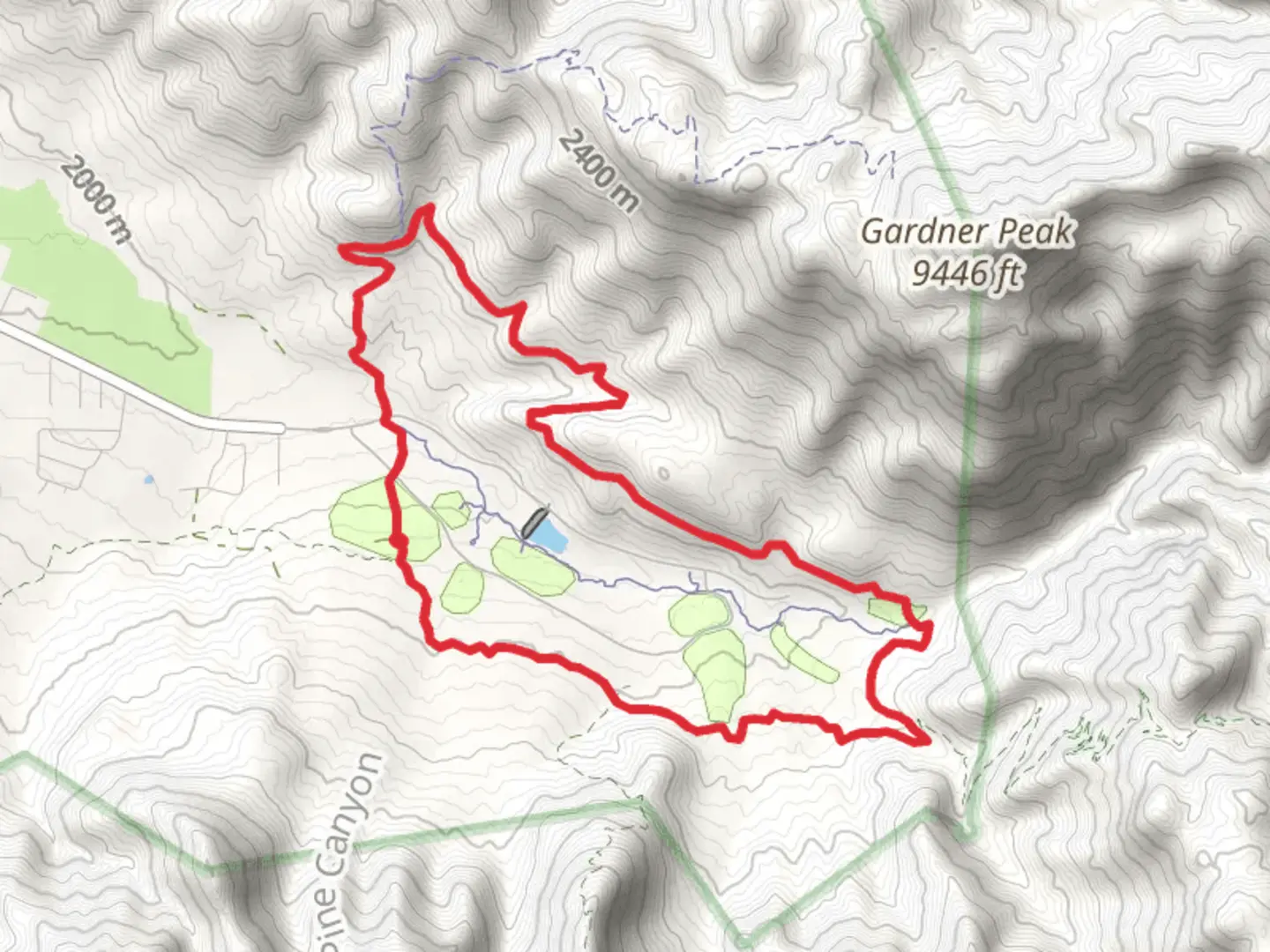
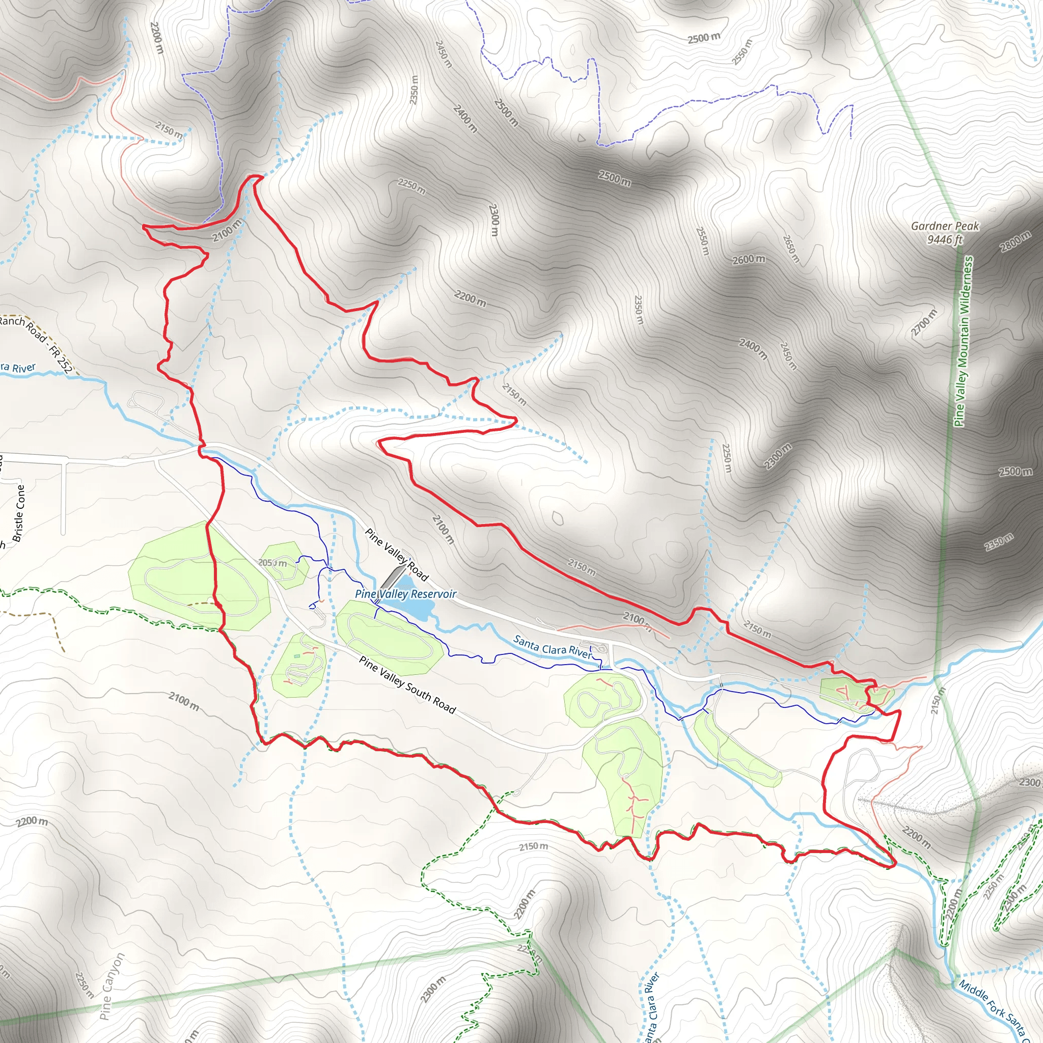
Starting your adventure near Washington County, Utah, the Gardner Peak Trail and Pine Valley Canal Trail offer a captivating loop of approximately 12 kilometers (7.5 miles) with an elevation gain of around 300 meters (984 feet). This medium-difficulty trail is perfect for those looking to immerse themselves in the natural beauty and historical richness of the area.
Getting There To reach the trailhead, you can drive or use public transportation. If you're driving, head towards Pine Valley, Utah. The nearest significant landmark is the Pine Valley Recreation Area. From there, follow the signs to the trailhead parking area. For those using public transport, the closest major city is St. George, Utah. From St. George, you can take a regional bus service to Pine Valley, and then a short taxi ride or a local shuttle will get you to the trailhead.
Trail Overview The loop begins with a gentle ascent through a mixed forest of pines and junipers. As you climb, you'll be treated to panoramic views of the Pine Valley Mountains. The first significant landmark is the Gardner Peak, which stands at an elevation of 2,743 meters (9,000 feet). Although the trail doesn't summit the peak, the views from the trail are breathtaking, offering a glimpse of the rugged terrain and diverse flora.
Flora and Fauna The trail is rich in biodiversity. Keep an eye out for mule deer, wild turkeys, and a variety of bird species. The area is also home to several types of wildflowers, especially in the spring and early summer. The forested sections provide ample shade, making it a pleasant hike even during warmer months.
Historical Significance The Pine Valley Canal, which the trail partially follows, is a historical marvel. Built in the late 19th century, the canal was an ambitious project aimed at irrigating the arid lands of the region. Remnants of the old canal can still be seen along the trail, offering a glimpse into the engineering feats of the past. Informational plaques along the route provide historical context and enrich the hiking experience.
Navigation and Safety The trail is well-marked, but it's always a good idea to have a reliable navigation tool. HiiKER is an excellent app for this purpose, offering detailed maps and real-time GPS tracking. The trail can be rocky in sections, so sturdy hiking boots are recommended. Carry plenty of water, especially during the summer months, as the trail can be quite dry.
Points of Interest - **Gardner Peak Overlook**: Approximately 4 kilometers (2.5 miles) into the hike, this overlook offers stunning views of the surrounding mountains and valleys. - **Pine Valley Canal Remnants**: Around the 7-kilometer (4.3 miles) mark, you'll encounter sections of the old canal, complete with informational plaques. - **Wildflower Meadows**: Near the 9-kilometer (5.6 miles) point, the trail opens up into meadows that are often blanketed with wildflowers in the spring.
Final Stretch The last few kilometers of the trail descend gently back towards the trailhead, offering a relaxing end to your hike. The loop nature of the trail means you'll return to your starting point, making logistics simple.
This trail offers a perfect blend of natural beauty, historical intrigue, and moderate physical challenge, making it a must-visit for any hiking enthusiast.
What to expect?
Activity types
Comments and Reviews
User comments, reviews and discussions about the Gardner Peak Trail and Pine Valley Canal Trail, Utah.
4.5
average rating out of 5
8 rating(s)
