Download
Preview
Add to list
More
24.6 km
~1 day 1 hrs
981 m
Out and Back
“The Gander Walk is a 25 km trail in Utah, blending natural beauty, history, and diverse wildlife.”
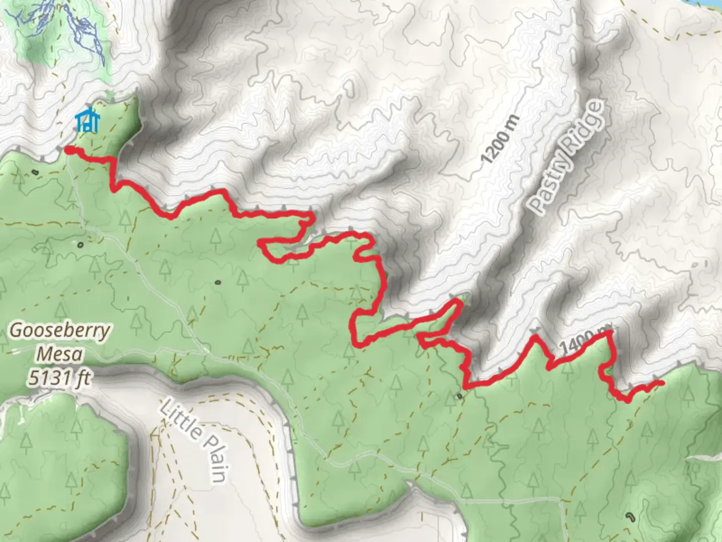
Starting near Washington County, Utah, the Gander Walk is an out-and-back trail that stretches approximately 25 kilometers (15.5 miles) with an elevation gain of around 900 meters (2,950 feet). This medium-difficulty trail offers a blend of natural beauty, historical significance, and diverse wildlife, making it a rewarding experience for hikers.### Getting There To reach the trailhead, you can drive or use public transport. If driving, head towards Washington County, Utah, and look for parking near the Red Cliffs Desert Reserve. For those using public transport, the nearest significant landmark is the St. George Regional Airport. From there, you can take a local bus or taxi to the Red Cliffs Desert Reserve.### Trail Overview The trail begins with a gentle ascent through a landscape dotted with juniper and pinyon pine trees. As you progress, the terrain becomes more rugged, and the elevation gain becomes more noticeable. The first 5 kilometers (3.1 miles) offer a relatively easy hike, with an elevation gain of about 150 meters (492 feet).### Significant Landmarks Around the 8-kilometer (5-mile) mark, you'll encounter the first significant landmark: a series of ancient petroglyphs etched into the red sandstone. These petroglyphs are believed to be created by the Ancestral Puebloans, offering a glimpse into the region's rich history.### Mid-Trail Highlights As you continue, the trail becomes steeper, and the vegetation transitions to a mix of sagebrush and wildflowers, especially vibrant in the spring. At approximately 12 kilometers (7.5 miles), you'll reach a scenic overlook that provides panoramic views of the surrounding valleys and distant mountain ranges. This is an excellent spot for a rest and some photography.### Wildlife and Nature The Gander Walk is home to a variety of wildlife. Keep an eye out for mule deer, desert cottontails, and a variety of bird species, including the majestic golden eagle. The trail also passes through several micro-ecosystems, each with its unique flora and fauna.### Final Stretch The last segment of the trail is the most challenging, with a steep ascent that adds another 300 meters (984 feet) of elevation gain over the final 5 kilometers (3.1 miles). This part of the trail is rocky and requires careful footing. The endpoint offers a secluded spot perfect for a picnic before you begin your return journey.### Navigation Given the trail's varying terrain and potential for getting off-track, it's advisable to use a reliable navigation tool like HiiKER to ensure you stay on course. The app provides detailed maps and real-time GPS tracking, which can be invaluable, especially in the more remote sections of the trail.### Historical Significance The region around the Gander Walk has a rich history, with evidence of human habitation dating back thousands of years. The petroglyphs and other archaeological sites along the trail offer a fascinating glimpse into the lives of the Ancestral Puebloans and other indigenous peoples who once roamed these lands.### Preparation Tips Given the trail's length and elevation gain, it's essential to come prepared. Bring plenty of water, especially during the hotter months, and wear sturdy hiking boots. A trekking pole can also be helpful for the steeper sections. Weather can change rapidly, so pack layers and be prepared for sudden shifts in temperature.The Gander Walk offers a challenging yet rewarding hike through some of Utah's most stunning landscapes, rich in both natural beauty and historical significance.

What to expect?
Activity types
Comments and Reviews
User comments, reviews and discussions about the Gander Walk, Utah.
4.29
average rating out of 5
14 rating(s)