Download
Preview
Add to list
More
2.8 km
~50 min
164 m
Loop
“Embark on the Cinder Cone Trail for volcanic landscapes, historical petroglyphs, and panoramic summit views.”
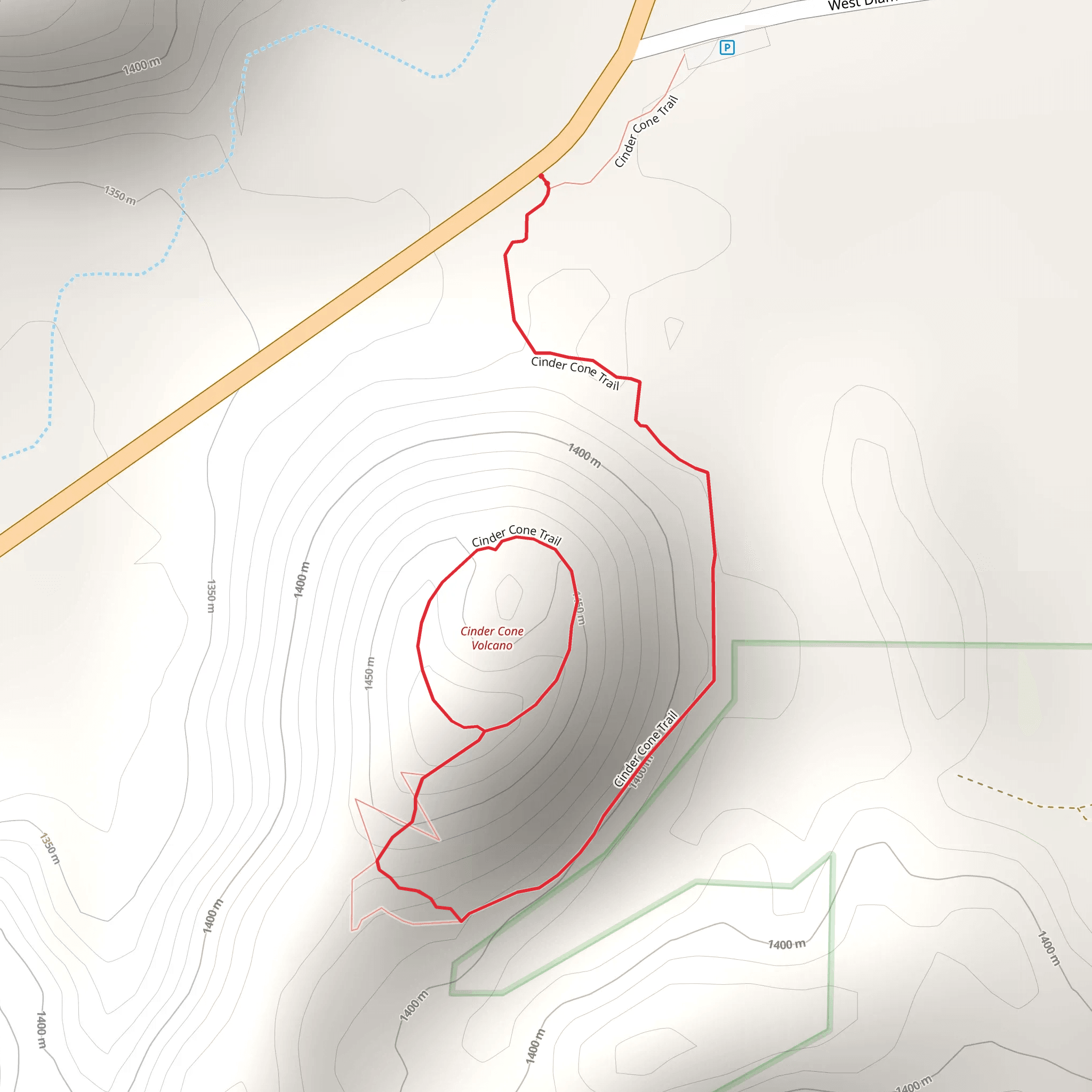
Starting your adventure near Washington County, Utah, the Cinder Cone Trail offers a unique hiking experience. This 3 km (approximately 1.9 miles) loop trail features an elevation gain of around 100 meters (328 feet), making it a moderately challenging hike suitable for those with a bit of hiking experience.
Getting There To reach the trailhead, you can drive or use public transport. If you're driving, head towards Snow Canyon State Park, which is the nearest significant landmark. The trailhead is located just off the Snow Canyon Parkway. For those using public transport, you can take a bus to St. George, Utah, and then a taxi or rideshare service to the park.
Trail Overview The trail begins with a gentle ascent through a landscape dominated by volcanic rock and sparse desert vegetation. As you progress, the path becomes steeper, leading you up the side of the cinder cone. The trail is well-marked, but it's always a good idea to have a navigation tool like HiiKER to ensure you stay on track.
Significant Landmarks About 1 km (0.6 miles) into the hike, you'll encounter the first significant landmark: a lava flow field. This area is a stark reminder of the volcanic activity that shaped the region. The black, jagged rocks create a dramatic contrast against the red and orange hues of the surrounding desert.
Flora and Fauna The trail is home to a variety of desert flora, including sagebrush, yucca, and various cacti. Keep an eye out for wildlife such as lizards, jackrabbits, and occasionally, desert tortoises. Birdwatchers will also enjoy spotting species like the Gambel's quail and the black-throated sparrow.
Historical Significance The cinder cone itself is a remnant of volcanic activity that occurred millions of years ago. The area has been inhabited by Native American tribes for centuries, and you may come across petroglyphs etched into the rocks, offering a glimpse into the region's rich cultural history.
The Summit Reaching the summit of the cinder cone, you'll be rewarded with panoramic views of the surrounding landscape, including Snow Canyon State Park and the distant Pine Valley Mountains. The climb to the top is steep but manageable, and the views make the effort worthwhile.
Descent and Return The descent follows a different path, completing the loop. This section of the trail is less steep but still requires careful footing due to loose rocks. As you make your way back to the trailhead, you'll pass through more lava fields and desert scrub, offering a final opportunity to take in the unique geological features of the area.
Final Tips Given the desert environment, it's crucial to bring plenty of water, wear sun protection, and start your hike early in the day to avoid the midday heat. The trail can be slippery in places, so sturdy hiking boots are recommended. Always check the weather forecast before heading out, as conditions can change rapidly.
By following these guidelines and being prepared, you'll have a safe and enjoyable hike on the Cinder Cone Trail.
What to expect?
Activity types
Comments and Reviews
User comments, reviews and discussions about the Cinder Cone Trail, Utah.
4.56
average rating out of 5
16 rating(s)
