Download
Preview
Add to list
More
Trail length
11.1 km
Time
~4 hrs 15 min
Elevation Gain
1224 m
Hike Type
Loop
“Embark on the 11-km Y Mountain Trail for breathtaking views, rich history, and a rewarding hike.”
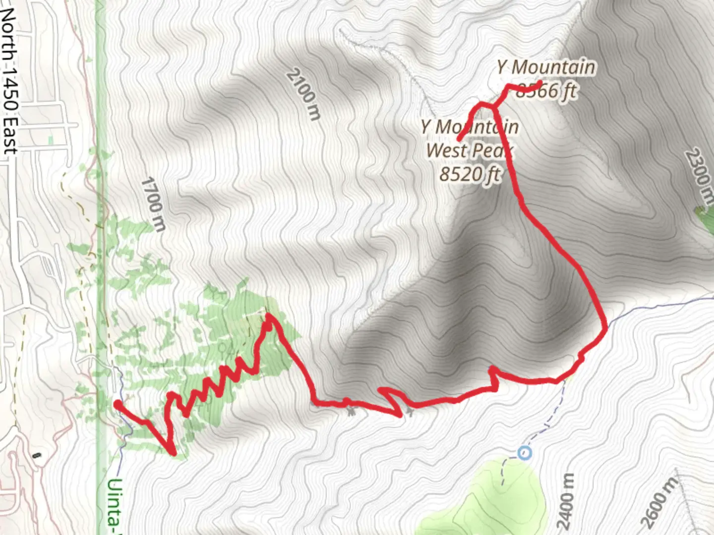
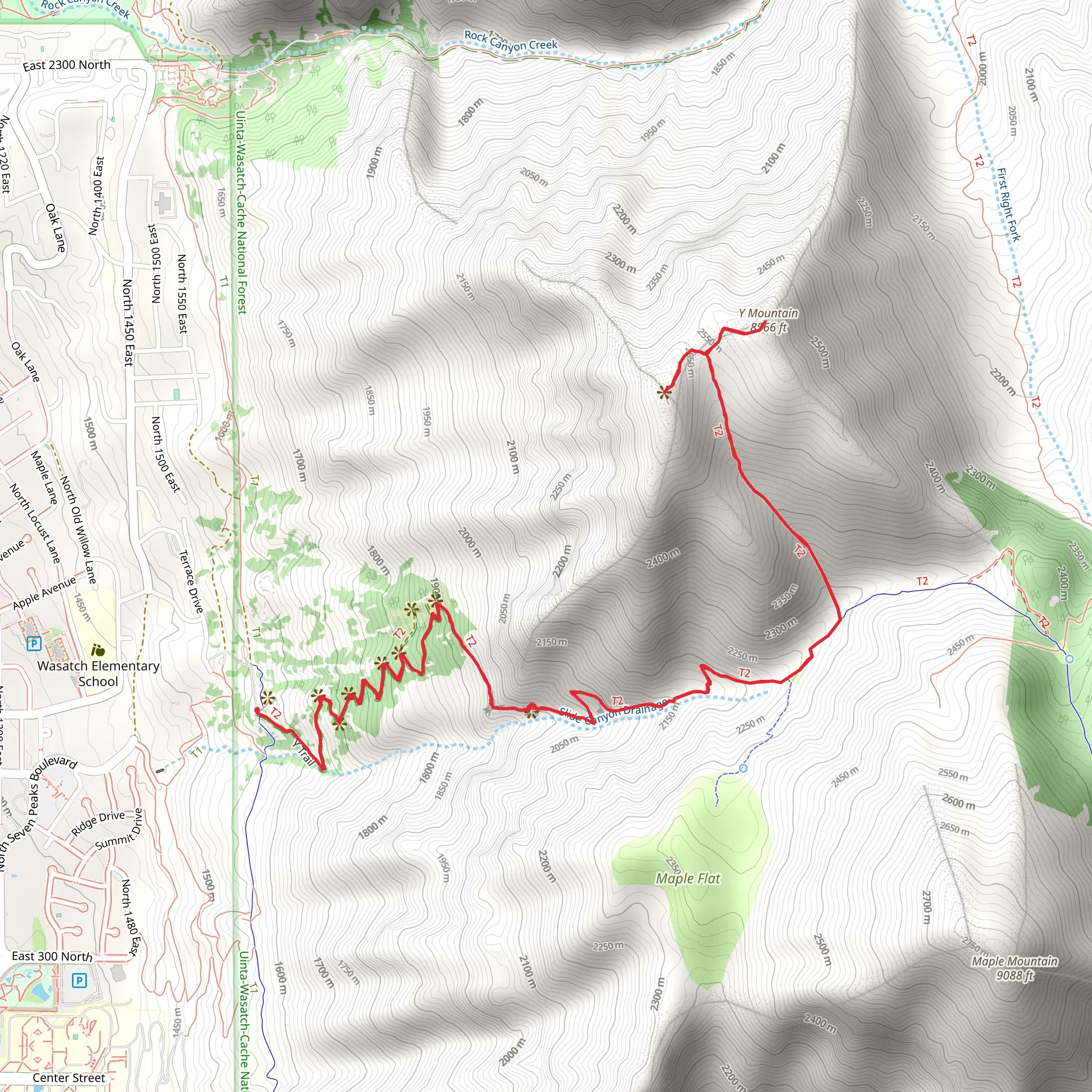
Starting your adventure near Utah County, Utah, the Y Mountain Trail and Y Mountain West Peak loop spans approximately 11 kilometers (around 6.8 miles) with an elevation gain of about 1200 meters (3937 feet). This medium-difficulty trail offers a rewarding experience for hikers looking to explore the natural beauty and historical significance of the region.
Getting There To reach the trailhead, you can drive or use public transportation. If driving, head towards the Y Trailhead Parking Lot located near the base of Y Mountain. For those using public transport, the nearest significant landmark is Brigham Young University (BYU) in Provo, Utah. From BYU, you can take a local bus or a short taxi ride to the trailhead.
Trail Overview The trail begins with a series of switchbacks that lead you up the mountain. The initial section is well-marked and offers stunning views of the Utah Valley and Utah Lake. As you ascend, you'll notice the iconic white "Y" on the mountainside, a landmark that has been a symbol of BYU since 1906. This section of the trail is approximately 2.4 kilometers (1.5 miles) with an elevation gain of about 300 meters (984 feet).
Mid-Trail Landmarks and Nature After reaching the "Y," the trail continues to climb more steeply. You'll pass through a mix of scrub oak and maple trees, providing some shade and a chance to spot local wildlife such as mule deer and various bird species. Around the 5-kilometer (3.1-mile) mark, you'll reach a plateau offering panoramic views of the surrounding peaks and valleys. This is a great spot to take a break and enjoy the scenery.
Y Mountain West Peak Continuing from the plateau, the trail becomes more rugged as you approach Y Mountain West Peak. This section is about 3 kilometers (1.9 miles) with an elevation gain of 600 meters (1968 feet). The terrain here is rocky, so be sure to watch your footing. Upon reaching the summit, you'll be rewarded with breathtaking 360-degree views, including the Wasatch Range and the distant Great Salt Lake.
Historical Significance The "Y" on Y Mountain was initially created by BYU students in 1906 as part of a class rivalry. Over the years, it has become a cherished symbol of the university and a popular hiking destination. The trail itself has been maintained by various local organizations, ensuring its accessibility and preserving its historical significance.
Navigation and Safety For navigation, it's highly recommended to use the HiiKER app, which provides detailed maps and real-time updates. The trail is generally well-marked, but having a reliable navigation tool can enhance your hiking experience and ensure you stay on the right path.
Return Loop The descent follows a loop that takes you back to the trailhead. This section is less steep but still requires careful navigation, especially in wet conditions. The return loop is approximately 3.6 kilometers (2.2 miles) with a gradual descent of about 300 meters (984 feet).
Final Tips Ensure you carry enough water, wear appropriate hiking boots, and check the weather forecast before heading out. The trail can be quite exposed, so sun protection is also essential. Happy hiking!
What to expect?
scenic-views
Activity types
hiking
Comments and Reviews
User comments, reviews and discussions about the Y Mountain Trail and Y Mountain West Peak, Utah.
4.5
average rating out of 5
12 rating(s)
