Download
Preview
Add to list
More
9.9 km
~2 hrs 5 min
70 m
Point-to-Point
“Explore the scenic, historic Mapleton Lateral Canal Trail—ideal for hikers seeking moderate, leisurely adventures.”
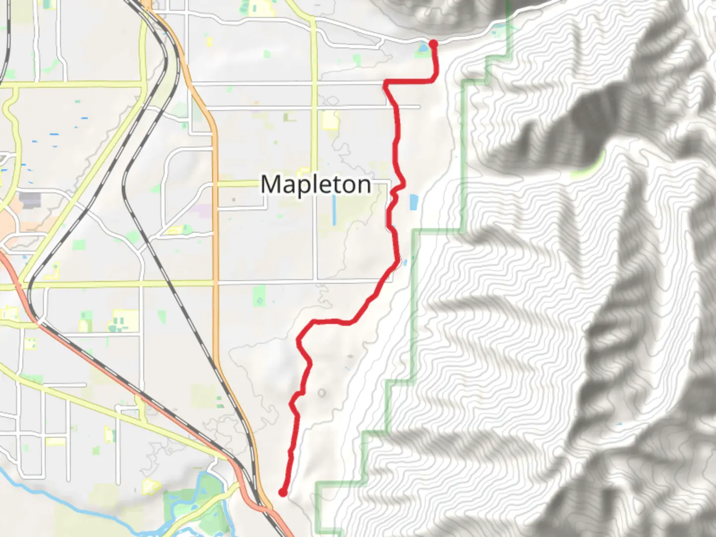
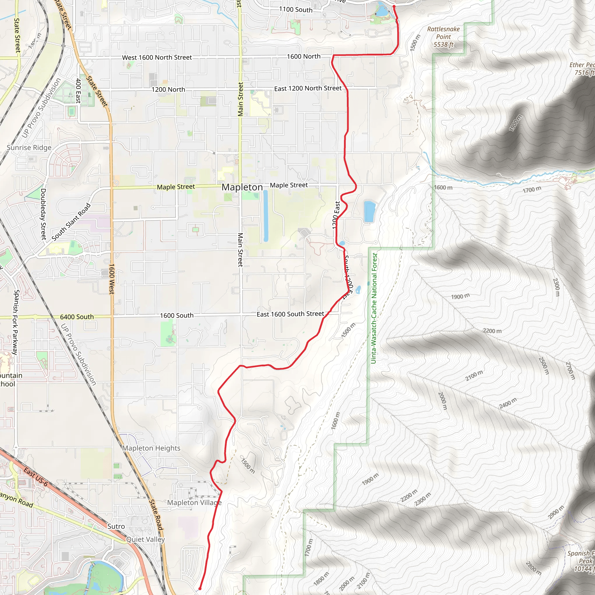
Starting near Utah County, Utah, the Mapleton Lateral Canal Trail is a point-to-point trail that stretches approximately 10 kilometers (6.2 miles) with virtually no elevation gain, making it accessible for a wide range of hikers. The trail is estimated to be of medium difficulty, suitable for those with some hiking experience.
Getting There To reach the trailhead, you can drive or use public transportation. If driving, head towards Mapleton, Utah, and look for parking near the Mapleton City Park. For those using public transport, the nearest bus stop is at Mapleton City Park, serviced by local routes. From there, it's a short walk to the trailhead.
Trail Overview The Mapleton Lateral Canal Trail follows an old irrigation canal, providing a unique blend of natural beauty and historical significance. The trail is relatively flat, making it ideal for a leisurely hike or a family outing.
Key Landmarks and Points of Interest - **Mapleton City Park (Trailhead)**: This is where your journey begins. The park itself is a great place to relax before or after your hike, with picnic areas and restrooms available. - **Historic Canal**: As you walk along the trail, you'll follow the path of an old irrigation canal that played a crucial role in the agricultural development of the region. This canal was part of a larger network that helped early settlers irrigate their crops. - **Scenic Views**: Approximately 2 kilometers (1.2 miles) into the hike, you'll start to see stunning views of the surrounding mountains and valleys. This is a great spot for photography. - **Wildlife**: Keep an eye out for local wildlife, including deer, rabbits, and various bird species. Early morning or late afternoon hikes offer the best chances for wildlife sightings. - **Flora**: The trail is lined with native plants and trees, including cottonwoods and willows. In the spring and summer, wildflowers add a splash of color to the landscape.
Navigation For navigation, it's highly recommended to use the HiiKER app, which provides detailed maps and real-time updates. The trail is well-marked, but having a reliable navigation tool can enhance your hiking experience.
Trail Conditions and Safety - **Trail Surface**: The path is mostly dirt and gravel, so sturdy hiking shoes are recommended. - **Weather**: The trail can get quite hot in the summer, so bring plenty of water and wear sun protection. In the winter, sections of the trail may be icy or muddy. - **Facilities**: There are no restrooms or water sources along the trail, so plan accordingly.
Historical Significance The Mapleton Lateral Canal is a testament to the ingenuity of early settlers in Utah. Constructed in the late 19th century, the canal was part of a larger irrigation system that transformed the arid landscape into fertile farmland. Walking this trail offers a glimpse into the region's agricultural history and the challenges faced by its early inhabitants.
Final Stretch As you approach the end of the trail, you'll find yourself near the outskirts of Springville, Utah. The trail concludes near the Springville Reservoir, another historical site worth exploring if you have the time.
This trail offers a blend of natural beauty, historical significance, and moderate physical challenge, making it a rewarding experience for hikers of all levels.
What to expect?
Activity types
Comments and Reviews
User comments, reviews and discussions about the Mapleton Lateral Canal Trail, Utah.
4.33
average rating out of 5
12 rating(s)
