Download
Preview
Add to list
More
5.9 km
~2 hrs 36 min
862 m
Point-to-Point
“Discover Kyhv Peak Trail: a challenging 6-kilometer hike offering stunning vistas and rich historical significance.”
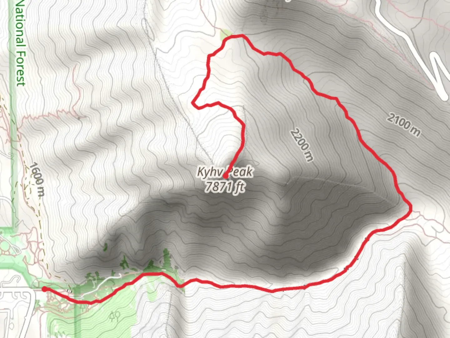
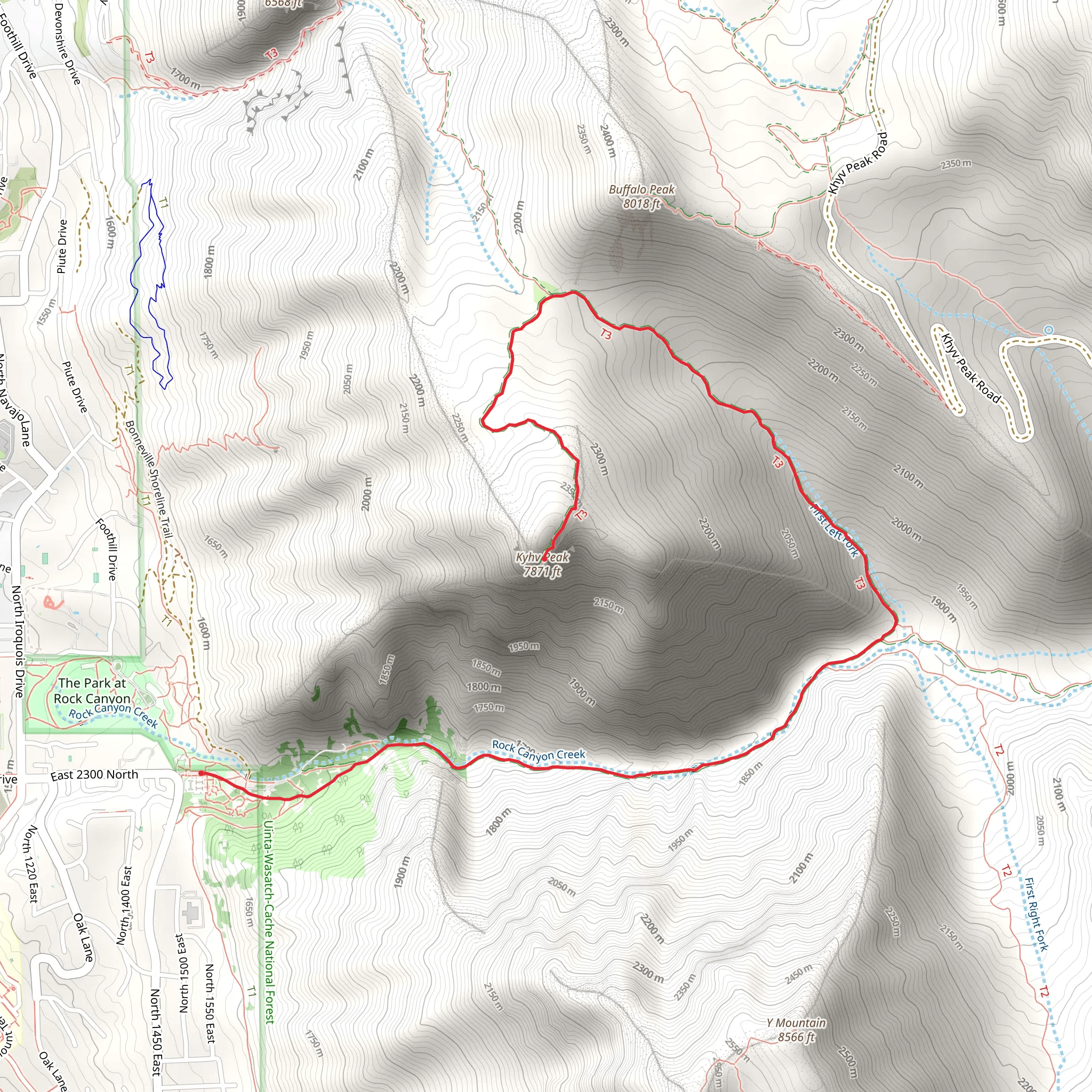
Starting near Utah County, Utah, this point-to-point trail spans approximately 6 kilometers (around 3.7 miles) with an elevation gain of about 800 meters (roughly 2,625 feet). The trailhead is conveniently located near the city of Provo, making it accessible for both locals and visitors.
Getting There To reach the trailhead, you can drive or use public transport. If driving, head towards Provo and follow signs to the Squaw Peak Road. The nearest significant landmark is the Rock Canyon Trailhead, located at 2620 N 1200 E, Provo, UT 84604. From there, follow the Squaw Peak Road until you reach the designated parking area. For those using public transport, take a bus to Provo and then a taxi or rideshare service to the trailhead.
Trail Overview The trail begins with a moderate ascent through a forested area, offering shade and a cool environment, especially in the summer months. Early on, you'll encounter a series of switchbacks that help to manage the steep elevation gain. The first kilometer (0.6 miles) is relatively gentle, gaining about 150 meters (492 feet) in elevation.
Significant Landmarks and Nature As you progress, the trail opens up to reveal stunning vistas of the surrounding Wasatch Range. Around the 2-kilometer (1.2-mile) mark, you'll come across a prominent rock outcropping known locally as "The Lookout." This spot offers panoramic views of Utah Valley and is a popular place for a short rest and photo opportunity.
Continuing onward, the trail becomes steeper and more rugged. At approximately 3 kilometers (1.9 miles) in, you'll reach a meadow filled with wildflowers during the spring and summer months. This area is also a good spot to observe local wildlife, including mule deer and various bird species.
Historical Significance The region around Kyhv Peak holds historical significance for the indigenous Ute people, who have lived in the area for centuries. The name "Kyhv" itself is derived from the Ute language, meaning "mountain." The trail and surrounding areas were historically used for hunting and gathering, and you may come across informational plaques detailing this rich cultural history.
Final Ascent The final stretch of the trail is the most challenging, with a steep ascent that gains approximately 300 meters (984 feet) in the last kilometer (0.6 miles). The terrain here is rocky and may require some scrambling, so be prepared with appropriate footwear and possibly trekking poles for added stability.
Reaching the Peak Upon reaching Kyhv Peak, you'll be rewarded with breathtaking 360-degree views of the Wasatch Range, Utah Valley, and even the distant Great Salt Lake on a clear day. The peak is marked by a small cairn and offers ample space to rest and take in the scenery before beginning your descent.
Navigation and Safety For navigation, it's highly recommended to use the HiiKER app, which provides detailed maps and real-time updates. The trail is well-marked, but having a reliable navigation tool can be invaluable, especially in poor weather conditions.
Wildlife and Flora Keep an eye out for local wildlife, including mountain goats and various bird species. The flora varies with elevation, starting with dense forests of pine and aspen and transitioning to alpine meadows filled with wildflowers as you ascend.
Preparation Tips Given the elevation gain and rugged terrain, this trail is best suited for hikers with a moderate level of fitness. Bring plenty of water, snacks, and layers of clothing to adjust to changing weather conditions. Always check the weather forecast before heading out, as conditions can change rapidly in mountainous areas.
This trail offers a rewarding experience with its combination of natural beauty, historical significance, and challenging terrain.
What to expect?
Activity types
Comments and Reviews
User comments, reviews and discussions about the Kyhv Peak, Utah.
4.53
average rating out of 5
19 rating(s)
