Download
Preview
Add to list
More
12.9 km
~4 hrs 15 min
1006 m
Loop
“Embark on a captivating 13 km loop through Utah's diverse landscapes, featuring lush forests, alpine meadows, and historical landmarks.”
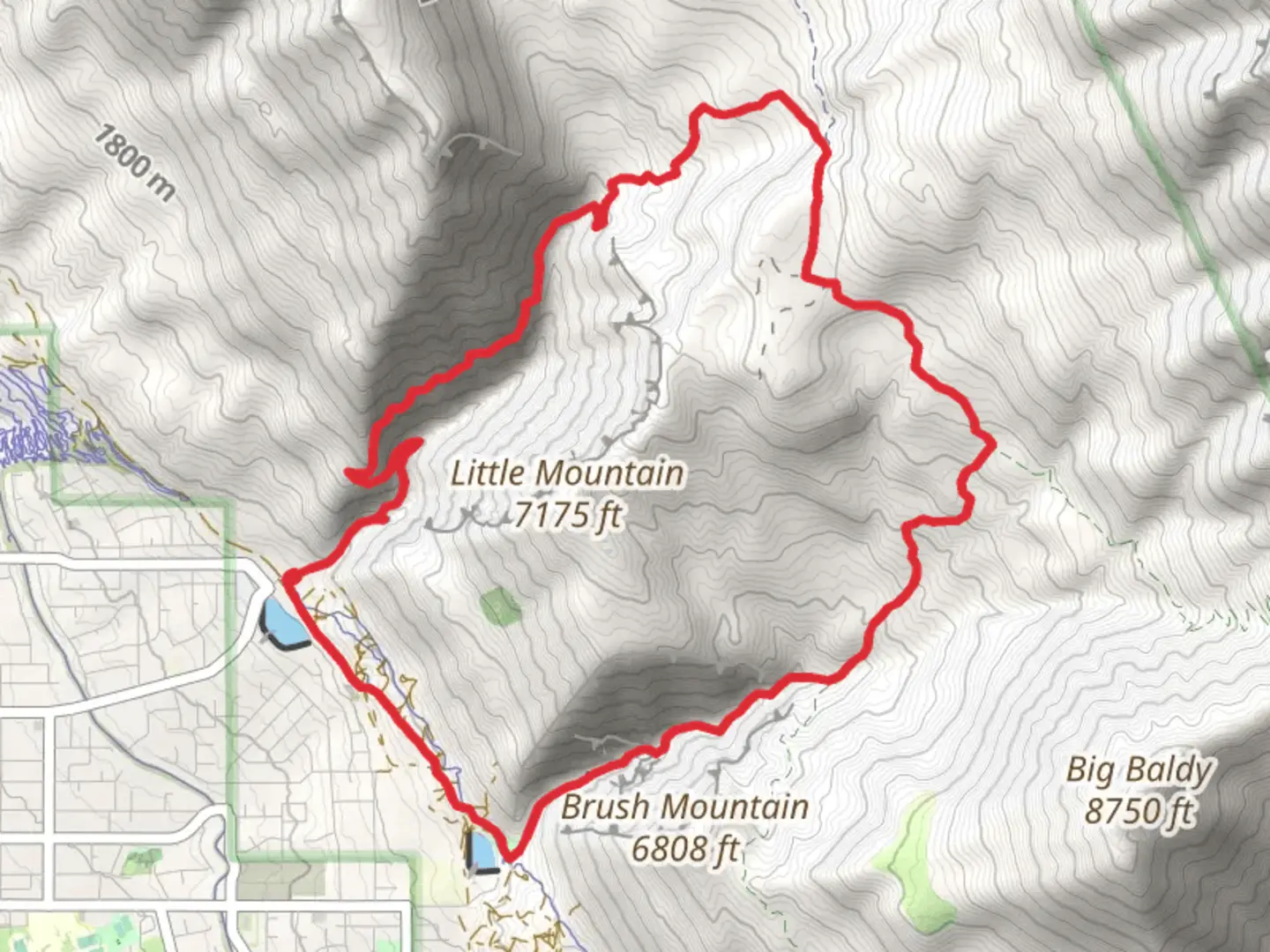
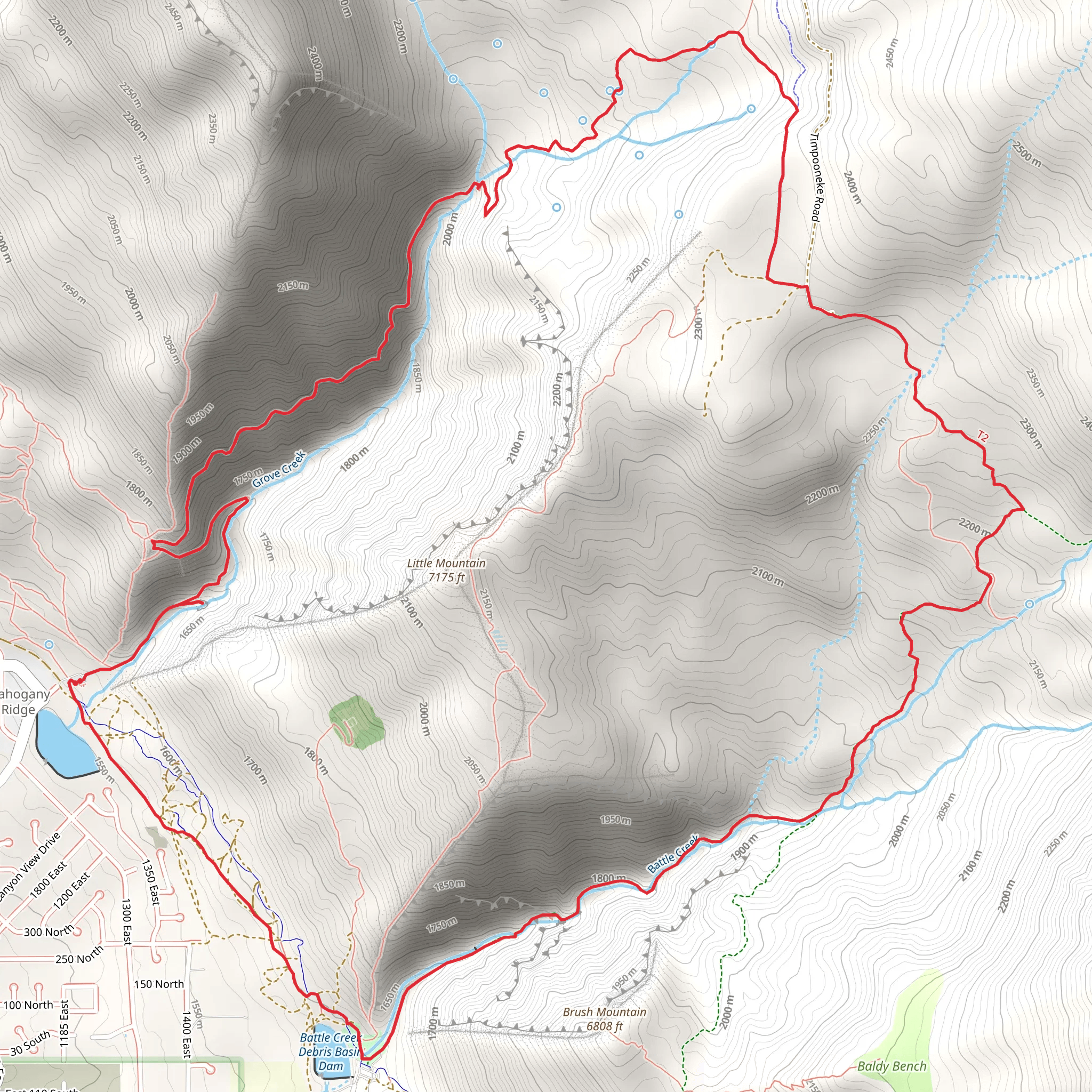
Starting your adventure near Utah County, Utah, the Grove Creek, Chris Fisher Flat, and Battle Creek Loop Trail offers a captivating journey through diverse landscapes. This 13 km (8 miles) loop trail features an elevation gain of approximately 1000 meters (3280 feet), making it a moderately challenging hike suitable for those with a reasonable level of fitness.### Getting There To reach the trailhead, you can drive or use public transport. If driving, head towards the city of Pleasant Grove, Utah. The nearest significant landmark is the Kiwanis Park, located at 200 S 1700 E, Pleasant Grove, UT 84062. From there, it's a short drive to the trailhead. For those using public transport, the Utah Transit Authority (UTA) offers bus services to Pleasant Grove, and from the bus stop, you can take a short taxi ride or use a rideshare service to reach the trailhead.### Trail Overview The trail begins with a steady ascent through Grove Creek Canyon. The initial 2 km (1.2 miles) will take you through a lush, forested area with Grove Creek flowing alongside. This section is particularly beautiful in spring and early summer when wildflowers are in full bloom. As you climb, you'll gain approximately 300 meters (984 feet) in elevation, so pace yourself and take breaks as needed.### Key Landmarks and Points of Interest At around the 3 km (1.9 miles) mark, you'll reach Chris Fisher Flat. This open, grassy area offers panoramic views of the surrounding mountains and valleys. It's an excellent spot for a short rest and some photography. From here, the trail continues to climb, and you'll encounter a series of switchbacks that will take you up another 400 meters (1312 feet) in elevation over the next 4 km (2.5 miles).### Wildlife and Nature As you hike, keep an eye out for local wildlife. Mule deer, elk, and various bird species are commonly seen in this area. The trail also passes through several different ecosystems, from dense forests to alpine meadows, providing a rich variety of flora and fauna.### Historical Significance The Battle Creek section of the trail is named after a skirmish that took place in the mid-19th century between Mormon settlers and the local Native American tribe. This area holds historical significance, and there are several plaques and markers along the trail that provide more information about this event.### Navigation and Safety Given the elevation gain and the varying terrain, it's essential to be well-prepared. Use the HiiKER app for accurate navigation and real-time updates on trail conditions. The app will help you stay on course and provide information on any potential hazards.### Final Stretch The final 4 km (2.5 miles) of the trail will take you through Battle Creek Canyon. This section is a descent, so it’s easier on the legs but requires careful footing, especially if the trail is wet or muddy. You'll pass by Battle Creek Falls, a stunning waterfall that is a highlight of the hike. The falls are particularly impressive after a rainstorm or during the spring melt.### Completing the Loop As you near the end of the loop, the trail will gradually level out, leading you back to the trailhead. This section is a great opportunity to reflect on the diverse landscapes and historical significance of the area.
What to expect?
Activity types
Comments and Reviews
User comments, reviews and discussions about the Grove Creek, Chris Fisher Flat and Battle Creek Loop Trail, Utah.
4.45
average rating out of 5
20 rating(s)
