Download
Preview
Add to list
More
12.8 km
~4 hrs 13 min
992 m
Loop
“The Dry Canyon and Little Baldy Trail loop offers scenic views, diverse wildlife, and historical significance.”
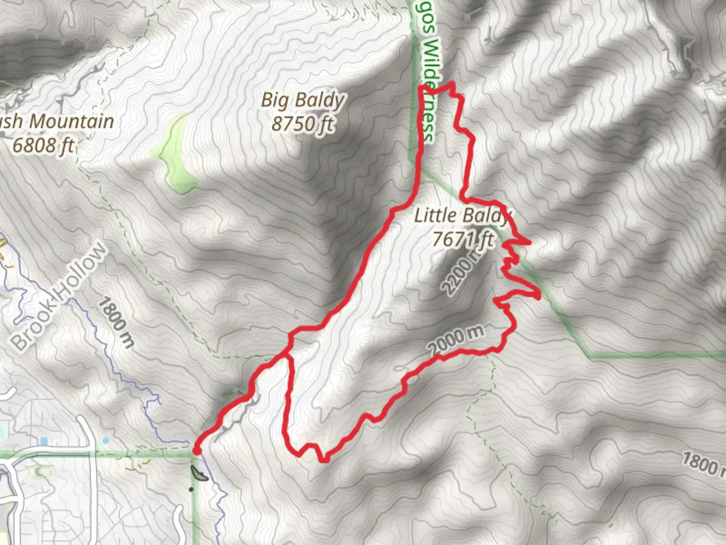
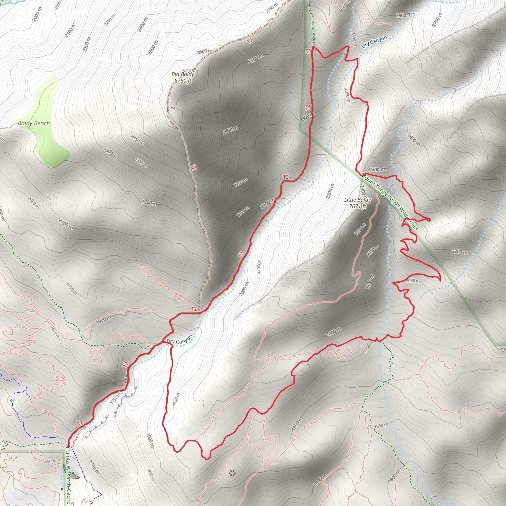
Starting near Utah County, Utah, the Dry Canyon Trail and Little Baldy Trail loop spans approximately 13 kilometers (8 miles) with an elevation gain of around 900 meters (2,950 feet). This medium-difficulty trail offers a mix of scenic views, diverse wildlife, and historical significance, making it a rewarding experience for hikers.
Getting There To reach the trailhead, you can drive or use public transport. If driving, head towards the Dry Canyon Trailhead near the city of Lindon, Utah. The nearest significant landmark is the Lindon City Park, located at 200 N State St, Lindon, UT 84042. From there, it's a short drive to the trailhead. For those using public transport, take a bus to the Lindon City Park and then arrange for a taxi or rideshare to the trailhead.
Trail Overview The loop begins with a gradual ascent through Dry Canyon, where you'll be greeted by a variety of flora, including juniper and scrub oak. The first 2 kilometers (1.2 miles) involve a steady climb, gaining about 200 meters (650 feet) in elevation. This section is relatively shaded, making it a pleasant start to your hike.
Significant Landmarks and Nature As you continue, you'll reach a fork in the trail around the 3-kilometer (1.9-mile) mark. Here, you can take a short detour to explore the Dry Canyon Waterfall, a seasonal waterfall that is particularly impressive in the spring. Returning to the main trail, you'll begin the ascent towards Little Baldy.
Little Baldy Summit The climb to Little Baldy is the most challenging part of the hike, with an elevation gain of approximately 500 meters (1,640 feet) over the next 4 kilometers (2.5 miles). The trail becomes steeper and rockier, so be prepared for a more strenuous effort. Upon reaching the summit, you'll be rewarded with panoramic views of Utah Valley and the surrounding mountains. This is an excellent spot for a break and some photography.
Wildlife and Flora Throughout the hike, keep an eye out for local wildlife such as mule deer, wild turkeys, and various bird species. The area is also home to a variety of wildflowers, especially in the spring and early summer. The diverse ecosystem provides ample opportunities for nature enthusiasts to enjoy the local flora and fauna.
Historical Significance The region around Dry Canyon and Little Baldy has historical significance dating back to the early settlers of Utah. The trails were originally used by Native American tribes and later by pioneers and settlers in the 19th century. As you hike, you'll be walking paths that have been traversed for centuries, adding a layer of historical depth to your adventure.
Navigation and Safety Given the elevation changes and varying trail conditions, it's advisable to use a reliable navigation tool like HiiKER to keep track of your progress and ensure you stay on the correct path. The trail is well-marked, but having a digital map can provide extra assurance.
Completing the Loop After enjoying the summit, the descent begins. The trail loops back towards the starting point, offering a more gradual decline over the final 4 kilometers (2.5 miles). This section provides a mix of open meadows and shaded forest areas, making for a pleasant end to your hike.
Prepare adequately with water, snacks, and appropriate gear, and you'll find the Dry Canyon Trail and Little Baldy Trail loop to be a fulfilling and memorable hiking experience.
What to expect?
Activity types
Comments and Reviews
User comments, reviews and discussions about the Dry Canyon Trail and Little Baldy Trail, Utah.
4.5
average rating out of 5
14 rating(s)
