Download
Preview
Add to list
More
17.9 km
~4 hrs 18 min
439 m
Out and Back
“Embark on a scenic and moderately challenging 18 km hike through Utah's Uinta Mountains to Tamarack and Fish Lakes.”
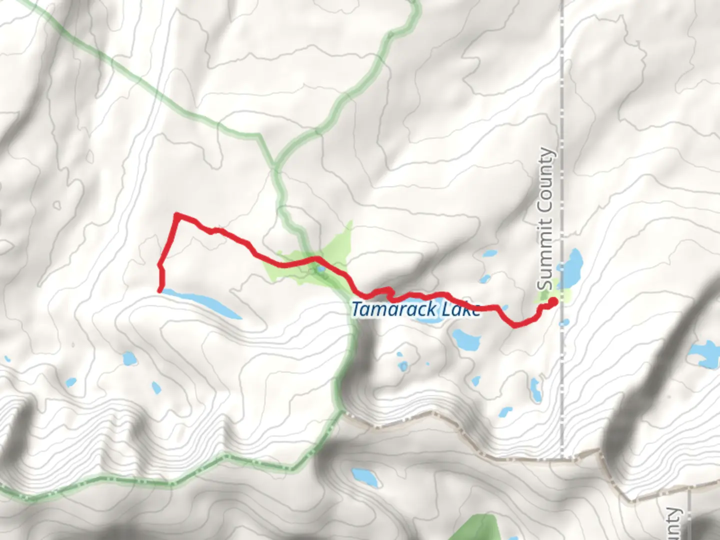
Starting your adventure near Summit County, Utah, the Tamarack Lake and Fish Lake via North Slope Highline B Trail offers a captivating journey through the Uinta Mountains. This out-and-back trail spans approximately 18 kilometers (11.2 miles) with an elevation gain of around 400 meters (1,312 feet), making it a moderately challenging hike suitable for those with some hiking experience.
Getting There To reach the trailhead, you can drive or use public transportation. If driving, head towards the Mirror Lake Highway (UT-150) and look for the North Slope Road turnoff. The nearest significant landmark is the Bear River Ranger Station, which is a good point of reference. For those using public transport, the closest major city is Salt Lake City, from where you can take a bus to Kamas and then arrange for a local shuttle or taxi to the trailhead.
Trail Overview The trail begins with a gentle ascent through dense pine forests, offering a cool and shaded start to your hike. As you progress, the trail opens up to meadows filled with wildflowers during the summer months. Keep an eye out for mule deer and elk, which are commonly seen in this area.
Significant Landmarks and Nature At approximately 5 kilometers (3.1 miles) into the hike, you'll reach a fork in the trail. Take the left path to continue towards Tamarack Lake. This section of the trail is relatively flat, allowing you to enjoy the serene beauty of the surrounding landscape. Tamarack Lake, located around 7 kilometers (4.3 miles) from the trailhead, is a pristine alpine lake perfect for a short rest and some photography.
Continuing on, the trail becomes steeper as you head towards Fish Lake. This part of the hike is more strenuous, with an elevation gain of about 200 meters (656 feet) over the next 4 kilometers (2.5 miles). Fish Lake is nestled in a picturesque basin, surrounded by towering peaks and lush greenery. It's an ideal spot for a longer break or even some fishing if you have the necessary permits.
Historical Significance The Uinta Mountains have a rich history, with evidence of Native American habitation dating back thousands of years. The area was also explored by early trappers and settlers in the 19th century. The North Slope Highline B Trail itself has been used for decades by hikers and outdoor enthusiasts seeking to experience the natural beauty of the region.
Navigation and Safety Given the moderate difficulty of the trail, it's advisable to use a reliable navigation tool like HiiKER to ensure you stay on track. The trail is well-marked, but weather conditions can change rapidly, so always be prepared with appropriate gear, including a map, compass, and plenty of water.
Wildlife and Flora The trail offers abundant opportunities to observe local wildlife. In addition to mule deer and elk, you might spot marmots, pikas, and various bird species. The flora is equally impressive, with fields of lupine, Indian paintbrush, and columbine adding splashes of color to the landscape.
Final Stretch As you make your way back, take the time to appreciate the changing perspectives and the tranquility of the Uinta Mountains. The return journey offers a chance to reflect on the natural beauty and historical significance of the area, making this hike a truly enriching experience.

What to expect?
Activity types
Comments and Reviews
User comments, reviews and discussions about the Tamarack Lake and Fish Lake via North Slope Highline B Trail, Utah.
4.56
average rating out of 5
16 rating(s)