Download
Preview
Add to list
More
11.9 km
~3 hrs 32 min
691 m
Out and Back
“The Oakley Trail is a 12-km hike offering scenic views, historical sites, and a moderate challenge.”
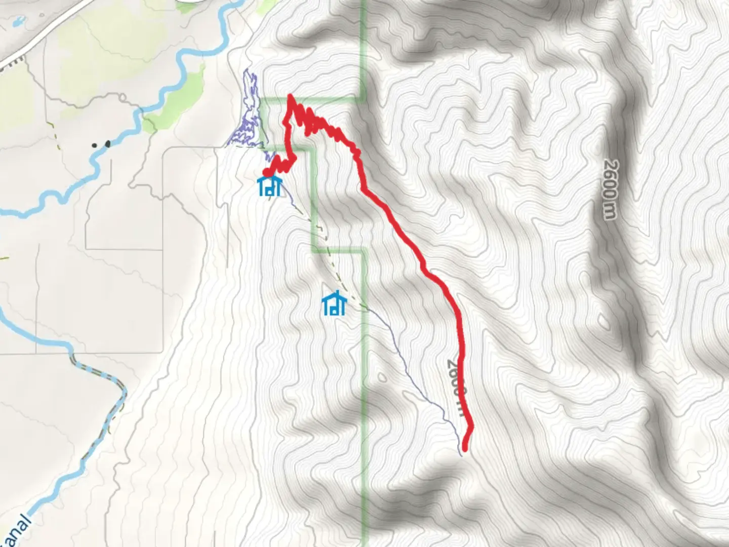
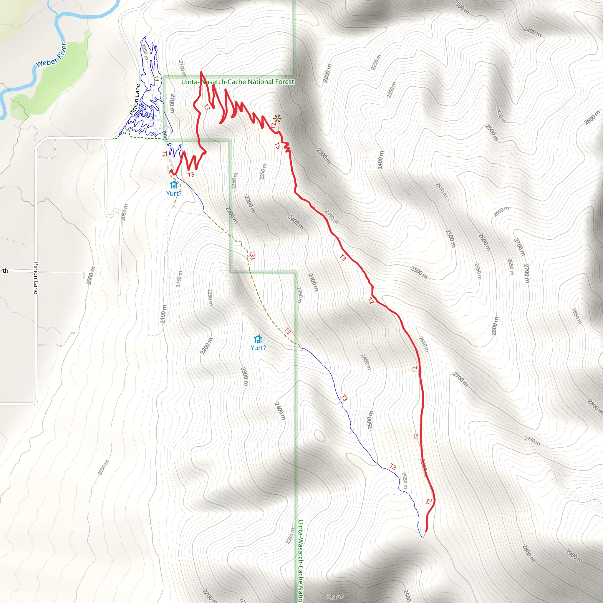
Starting near Summit County, Utah, the Oakley Trail is an out-and-back hike that spans approximately 12 kilometers (7.5 miles) with an elevation gain of around 600 meters (1,970 feet). This medium-difficulty trail offers a blend of natural beauty, historical significance, and a moderate challenge suitable for most hikers.### Getting There To reach the trailhead, you can drive or use public transportation. If driving, head towards Summit County, Utah, and look for parking near the Oakley Town Hall, which is the nearest significant landmark. For those using public transport, the nearest bus stop is at Oakley Town Hall, serviced by local routes. From there, it's a short walk to the trailhead.### Trail Overview The Oakley Trail begins with a gentle ascent through a mixed forest of aspen and pine. The initial 2 kilometers (1.2 miles) are relatively easy, with an elevation gain of about 100 meters (328 feet). This section is perfect for warming up and getting accustomed to the terrain.### Mid-Trail Highlights As you progress, the trail becomes steeper, gaining another 200 meters (656 feet) over the next 3 kilometers (1.9 miles). Here, you'll encounter several switchbacks that offer stunning views of the surrounding valleys and distant peaks. Keep an eye out for wildlife such as mule deer, elk, and various bird species. The flora is equally captivating, with wildflowers blooming in the spring and summer months.### Historical Significance Around the 5-kilometer (3.1-mile) mark, you'll come across remnants of old mining operations. This area was once bustling with activity during the late 19th and early 20th centuries. Informational plaques provide insights into the history of mining in the region, making this a great spot to take a break and soak in some local history.### Final Ascent and Views The final stretch of the trail involves a more strenuous climb, gaining the remaining 300 meters (984 feet) in elevation over the last 2 kilometers (1.2 miles). This section is rocky and may require careful footing, especially after rain. Upon reaching the summit, you'll be rewarded with panoramic views of the Uinta Mountains and the Weber River Valley. This is an excellent spot for photography and a well-deserved rest before heading back down.### Navigation and Safety Given the varying terrain and elevation changes, it's advisable to use a reliable navigation tool like HiiKER to stay on track. The trail is well-marked, but having a digital map can be invaluable, especially in foggy or low-visibility conditions.### Return Journey The return journey follows the same path, offering a different perspective on the landscape as you descend. The downhill trek is easier on the legs but still requires caution, particularly on the steeper sections.### Practical Tips - Water and Snacks: Ensure you carry enough water and high-energy snacks. There are no water sources along the trail. - Clothing: Dress in layers, as the weather can change rapidly. A windproof jacket is recommended for the summit. - Footwear: Sturdy hiking boots with good ankle support are essential due to the rocky sections. - Wildlife: Be mindful of wildlife and maintain a safe distance. Carry bear spray if hiking during early morning or late evening hours.The Oakley Trail offers a rewarding hike with a mix of natural beauty, historical intrigue, and moderate physical challenge. Whether you're a seasoned hiker or a nature enthusiast, this trail provides a memorable outdoor experience.
What to expect?
Activity types
Comments and Reviews
User comments, reviews and discussions about the Oakley Trail, Utah.
4.73
average rating out of 5
15 rating(s)
