Download
Preview
Add to list
More
21.6 km
~1 day 0 hrs
989 m
Out and Back
“Explore the stunning Uinta Mountains on the moderately challenging 22 km Island Lake via Smith Morehouse Trail.”
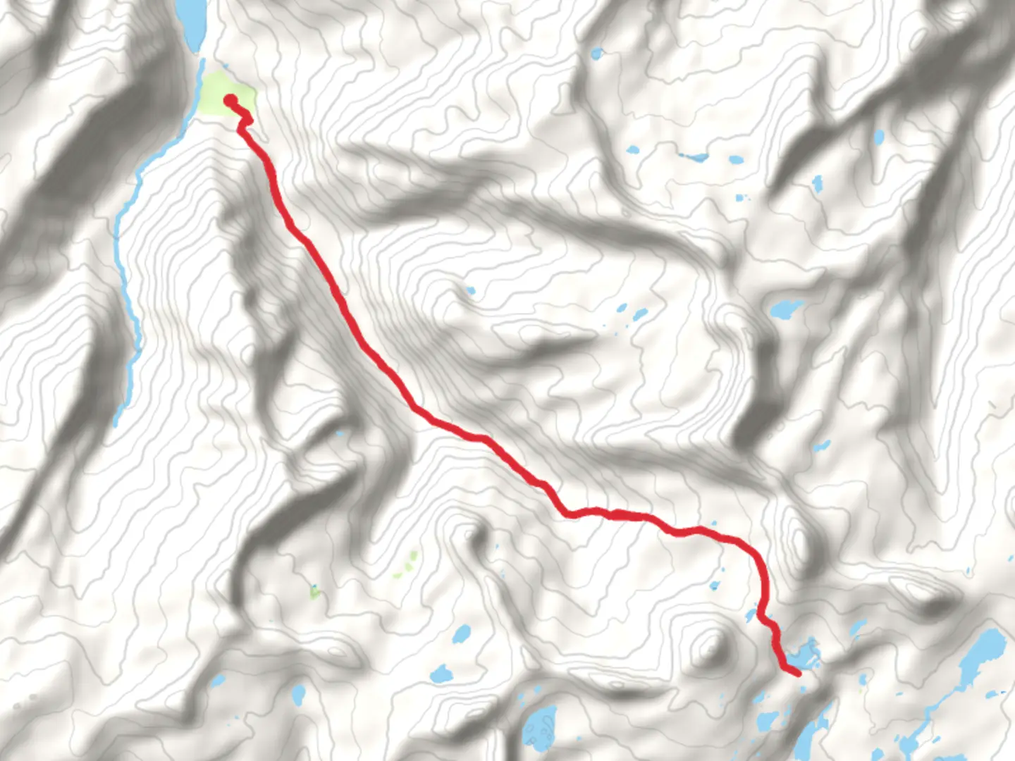
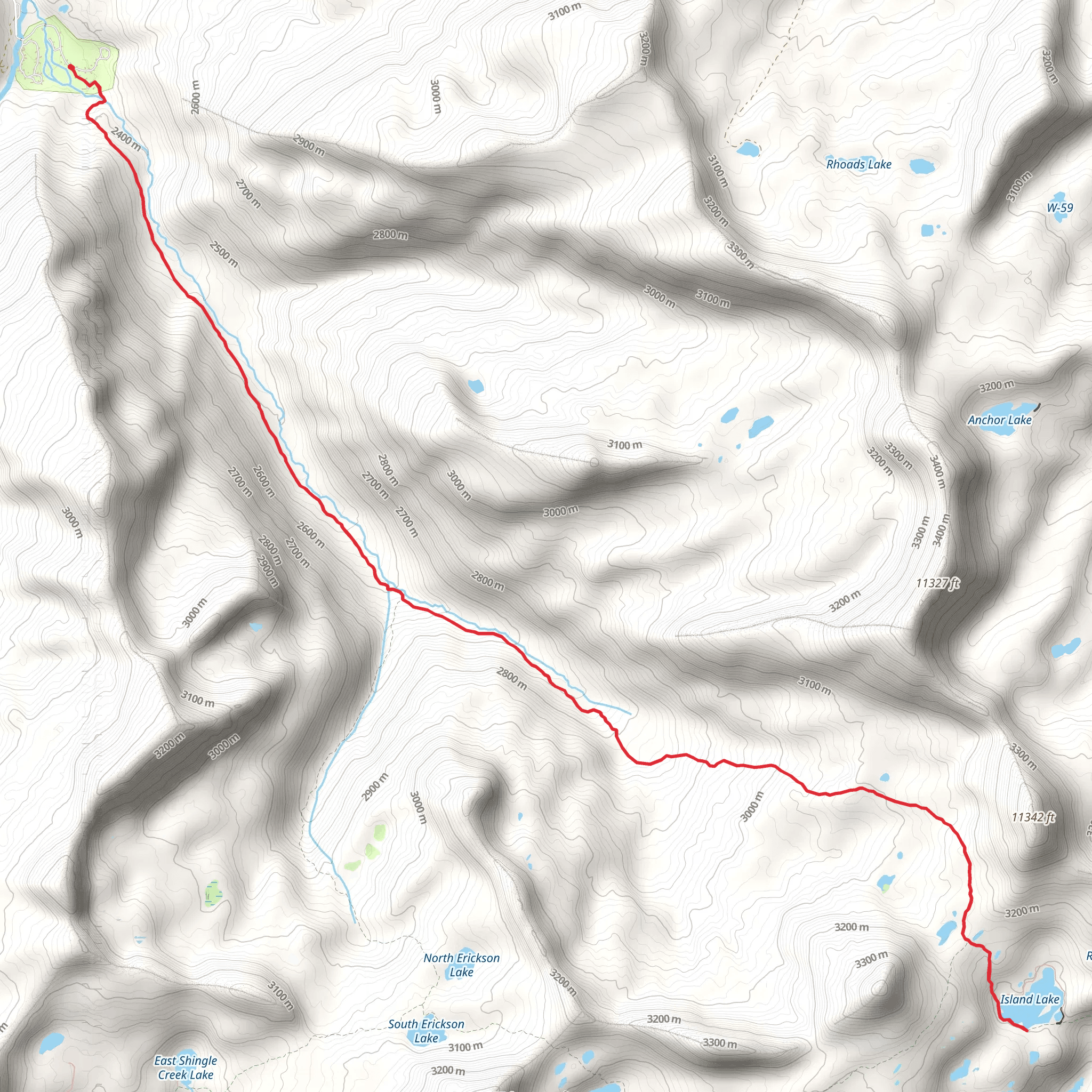
Starting your adventure near Summit County, Utah, the Island Lake via Smith Morehouse Trail and Lakes County Trail offers a captivating journey through the Uinta Mountains. This out-and-back trail spans approximately 22 kilometers (13.7 miles) with an elevation gain of around 900 meters (2,950 feet), making it a moderately challenging hike suitable for those with some experience.
Getting There To reach the trailhead, you can drive or use public transport. If driving, head towards the Smith and Morehouse Reservoir, located near Oakley, Utah. The nearest significant landmark is the Smith and Morehouse Campground, which provides ample parking. For those using public transport, the closest major city is Salt Lake City. From there, you can take a bus to Kamas and then a taxi or rideshare to the trailhead.
Trail Overview The trail begins at the Smith and Morehouse Campground, situated at an elevation of approximately 2,438 meters (8,000 feet). The initial section of the trail meanders through dense pine forests and follows the Smith and Morehouse Creek. This part of the hike is relatively gentle, with a gradual ascent that allows you to acclimate to the altitude.
Key Landmarks and Sections - **Smith and Morehouse Reservoir (0-3 km / 0-1.9 miles):** The first few kilometers take you along the edge of the Smith and Morehouse Reservoir. This serene body of water is a great spot for fishing and offers picturesque views, especially in the early morning light. - **Creek Crossings (3-6 km / 1.9-3.7 miles):** As you continue, you'll encounter several creek crossings. These can be tricky during the spring melt, so be prepared with waterproof boots or gaiters. The trail here is well-marked but can be muddy. - **Elevation Gain (6-11 km / 3.7-6.8 miles):** The trail begins to climb more steeply as you approach the halfway point. You'll gain significant elevation, moving through alpine meadows dotted with wildflowers in the summer months. Keep an eye out for wildlife such as deer, elk, and the occasional moose. - **Lakes County Trail Junction (11 km / 6.8 miles):** At this junction, you'll merge onto the Lakes County Trail. This section is less traveled and offers a more rugged experience. The trail narrows and becomes rockier, requiring careful footing.
Final Ascent to Island Lake The last stretch to Island Lake involves a steep climb, gaining the final 300 meters (984 feet) in elevation over about 2 kilometers (1.2 miles). The effort is well worth it as you reach Island Lake, nestled in a high alpine basin at around 3,353 meters (11,000 feet). The lake is surrounded by towering peaks and offers a tranquil setting for a well-deserved rest.
Historical Significance The Uinta Mountains are rich in history, with evidence of Native American use dating back thousands of years. The area was also explored by early trappers and settlers in the 19th century. The Smith and Morehouse area itself is named after two early pioneers who were instrumental in developing the region.
Navigation and Safety Given the trail's moderate difficulty and varying conditions, it's advisable to use a reliable navigation tool like HiiKER to stay on track. Weather in the Uinta Mountains can change rapidly, so pack layers and be prepared for sudden temperature drops. Always carry enough water, as natural sources may be scarce or require purification.
This trail offers a rewarding experience for those prepared to tackle its challenges, with stunning natural beauty and a touch of historical intrigue.
What to expect?
Activity types
Comments and Reviews
User comments, reviews and discussions about the Island Lake via Smith Morehouse Trail and Lakes County Trail, Utah.
4.53
average rating out of 5
15 rating(s)
