Download
Preview
Add to list
More
5.9 km
~2 hrs 18 min
675 m
Out and Back
“Experience the perfect blend of scenic beauty, moderate challenge, and rich history on Hayden Peak trail!”
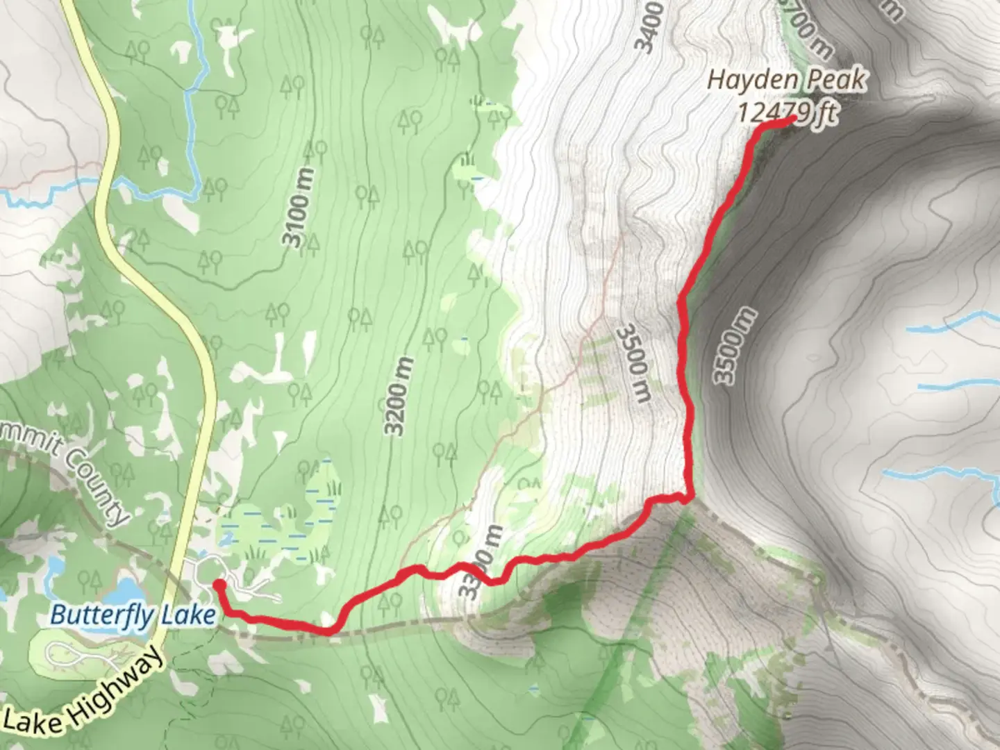
Starting your hike near Summit County, Utah, the trailhead for Hayden Peak from Hayden Pass is accessible by car. If you're using public transport, the nearest significant landmark is the town of Kamas, Utah. From Kamas, you can take a local shuttle or taxi service to reach the trailhead. The trailhead is located near the Mirror Lake Highway, a well-known route that offers stunning views of the Uinta Mountains.
Trail Overview
The Hayden Peak from Hayden Pass trail is an out-and-back route covering approximately 6 km (3.7 miles) with an elevation gain of around 600 meters (1,968 feet). This medium-difficulty trail is perfect for hikers looking for a moderately challenging adventure with rewarding views.
Initial Ascent
Starting from the trailhead, the first section of the trail is a gradual ascent through a dense forest of pine and aspen trees. This part of the hike is relatively shaded, making it a pleasant start even on warmer days. After about 1 km (0.6 miles), you'll begin to notice the incline becoming steeper as you approach the tree line.
Mid-Trail Landmarks
As you continue your ascent, around the 2 km (1.2 miles) mark, you'll reach a clearing that offers your first panoramic views of the surrounding Uinta Mountains. This is a great spot to take a short break and hydrate. From here, the trail becomes rockier and more exposed, so be prepared for a more strenuous climb.
Flora and Fauna
The Uinta Mountains are home to a diverse range of wildlife. Keep an eye out for mule deer, elk, and even the occasional moose. Birdwatchers will enjoy spotting species like the Clark's Nutcracker and the Mountain Bluebird. The flora changes as you gain elevation, transitioning from dense forests to alpine meadows filled with wildflowers during the summer months.
Final Ascent and Summit
The last 1 km (0.6 miles) to the summit is the most challenging part of the hike. The trail becomes steeper and rockier, requiring careful footing. As you approach the summit of Hayden Peak, the elevation gain becomes more noticeable, and the air thinner. However, the effort is well worth it. At the summit, you'll be rewarded with breathtaking 360-degree views of the Uinta Mountain range and the surrounding valleys.
Historical Significance
The Uinta Mountains are rich in history, having been a significant area for Native American tribes, including the Ute and Shoshone. The region was also explored by early trappers and settlers in the 19th century. The Mirror Lake Highway, near the trailhead, was constructed in the 1930s and has since become a popular scenic byway.
Navigation and Safety
Given the rocky and exposed nature of the trail, it's advisable to use a reliable navigation tool like HiiKER to stay on track. Weather can change rapidly in the mountains, so always check the forecast before you set out and be prepared for sudden changes. Carry plenty of water, snacks, and a first aid kit.
Return Journey
After soaking in the views and perhaps snapping a few photos, you'll retrace your steps back to the trailhead. The descent, while easier on the lungs, can be tough on the knees, so take your time and use trekking poles if you have them.
This trail offers a perfect blend of natural beauty, moderate challenge, and historical intrigue, making it a must-do for any hiking enthusiast visiting the Uinta Mountains.
What to expect?
Activity types
Comments and Reviews
User comments, reviews and discussions about the Hayden Peak from Hayden Pass, Utah.
4.64
average rating out of 5
14 rating(s)
