8.5 km
~2 hrs 25 min
434 m
“Discover breathtaking vistas and ancient history on the moderately challenging White Canyon and Mesa Loop Trail.”
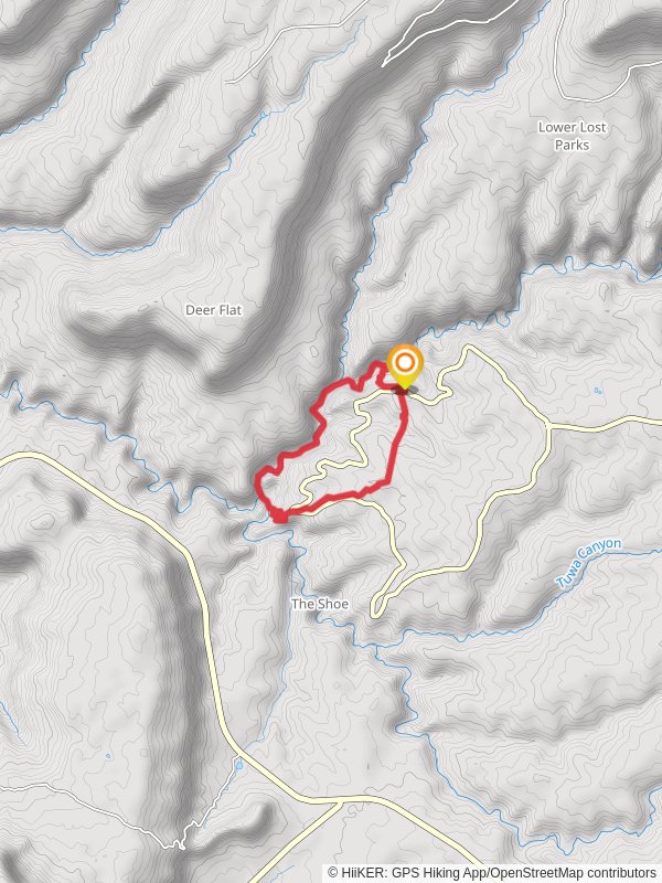
Starting your adventure near San Juan County, Utah, the White Canyon and Mesa Loop Trail offers a captivating 9 km (5.6 miles) journey with an elevation gain of approximately 400 meters (1,312 feet). This loop trail is rated as medium difficulty, making it suitable for moderately experienced hikers.### Getting There
To reach the trailhead, you can drive or use public transport. If driving, head towards the nearest significant landmark, Natural Bridges National Monument. From there, follow the signs to the trailhead. For those using public transport, the nearest major town is Blanding, Utah. From Blanding, you can take a local shuttle or taxi service to the trailhead.### Trail Overview
The trail begins with a gentle ascent, allowing you to acclimate to the terrain. As you progress, the path becomes steeper, leading you through a series of switchbacks. The initial 2 km (1.2 miles) will see you gaining about 150 meters (492 feet) in elevation, offering panoramic views of the surrounding canyons.### Significant Landmarks
At around the 3 km (1.9 miles) mark, you'll encounter the first significant landmark: the White Canyon Overlook. This vantage point provides breathtaking views of the canyon below, with its striking white sandstone formations. Take a moment to appreciate the geological history that shaped this landscape over millions of years.Continuing along the trail, you'll reach the Mesa section at approximately 5 km (3.1 miles). Here, the terrain levels out, and you'll traverse a high plateau with sparse vegetation. This area is rich in Native American history, with several ancient petroglyphs and ruins visible along the path. Keep an eye out for these historical markers, as they offer a glimpse into the lives of the region's early inhabitants.### Flora and Fauna
The trail is home to a diverse range of flora and fauna. In the lower canyon areas, you'll find juniper and pinyon pine trees, while the mesa is dotted with sagebrush and various desert wildflowers. Wildlife sightings are common, with mule deer, jackrabbits, and a variety of bird species frequently spotted. Be cautious of rattlesnakes, especially during the warmer months.### Navigation and Safety
Given the remote nature of the trail, it's crucial to have reliable navigation tools. The HiiKER app is highly recommended for its detailed maps and real-time GPS tracking. Ensure you have downloaded the trail map before setting out, as cell service can be unreliable in this area.### Final Stretch
The final 2 km (1.2 miles) of the trail involve a descent back into the canyon, where you'll encounter a series of small waterfalls and pools, particularly after recent rainfall. These natural features provide a refreshing end to your hike. The trail loops back to the starting point, completing your 9 km (5.6 miles) journey.### Historical Significance
The White Canyon and Mesa Loop Trail is not just a natural wonder but also a historical treasure. The area was once inhabited by the Ancestral Puebloans, and evidence of their presence is scattered throughout the trail. The petroglyphs and ruins you encounter are protected sites, so please respect these historical artifacts by not touching or disturbing them.This trail offers a perfect blend of natural beauty, historical intrigue, and moderate physical challenge, making it a must-visit for any hiking enthusiast.
Reviews
User comments, reviews and discussions about the White Canyon and Mesa Loop Trail, Utah.
5.0
average rating out of 5
19 rating(s)
Loading reviews...


