Download
Preview
Add to list
More
15.7 km
~4 hrs 15 min
668 m
Loop
“A 16-km loop with stunning desert views, historical landmarks, diverse wildlife, and moderate challenges near Moab, Utah.”
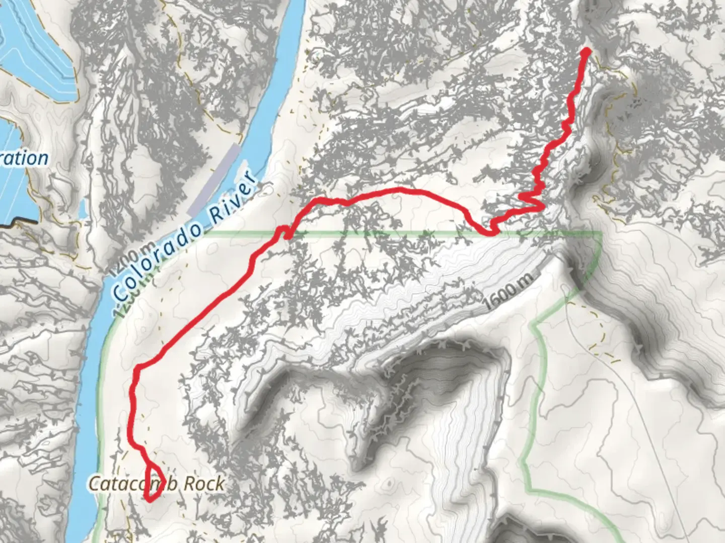
Starting near San Juan County, Utah, this loop trail spans approximately 16 kilometers (10 miles) with an elevation gain of around 600 meters (1,970 feet). The trailhead is accessible by car, and the nearest significant landmark is the town of Moab, Utah. From Moab, head south on US-191 for about 30 miles until you reach Lockhart Basin Road, where the trail begins.
Getting There For those relying on public transport, the closest major hub is Moab, which is serviced by regional bus lines. From Moab, you may need to arrange a taxi or rideshare to reach the trailhead, as public transport options are limited in this remote area.
Trail Overview The trail starts with a gradual ascent, offering panoramic views of the surrounding desert landscape. The initial 3 kilometers (1.9 miles) are relatively easy, with a gentle incline that allows hikers to acclimate to the terrain. As you progress, the trail becomes steeper, gaining approximately 300 meters (985 feet) in elevation over the next 4 kilometers (2.5 miles).
Significant Landmarks One of the first notable landmarks is the Catacomb Rock, a striking geological formation that appears around the 5-kilometer (3.1-mile) mark. This rock is a popular spot for photography and offers a great place to take a break and enjoy the views. Continuing along the trail, you'll encounter several smaller rock formations and natural arches, each with its own unique characteristics.
Flora and Fauna The trail is rich in desert flora, including sagebrush, juniper, and various types of cacti. Wildlife is abundant, with frequent sightings of mule deer, jackrabbits, and various bird species such as hawks and eagles. Keep an eye out for reptiles like lizards and the occasional rattlesnake, especially during warmer months.
Historical Significance The region has a rich history, with evidence of Native American habitation dating back thousands of years. Petroglyphs and ancient artifacts have been found in the area, adding a layer of historical intrigue to your hike. The trail also intersects with the American Discovery Trail (ADT), a coast-to-coast trail that spans the United States, highlighting the area's importance in long-distance hiking routes.
Navigation and Safety Given the remote nature of the trail, it's crucial to have reliable navigation tools. The HiiKER app is highly recommended for its detailed maps and real-time GPS tracking. Ensure you have enough water, as sources are scarce along the trail. Weather conditions can change rapidly, so be prepared for both hot sun and sudden rain showers.
Final Stretch The final 4 kilometers (2.5 miles) of the trail loop back towards the starting point, descending gradually and offering a different perspective of the landscape. This section is less strenuous, allowing you to enjoy the scenery and reflect on the journey.
This trail offers a balanced mix of natural beauty, historical significance, and moderate physical challenge, making it a rewarding experience for hikers of all levels.

What to expect?
Activity types
Comments and Reviews
User comments, reviews and discussions about the Catacomb Rock via ADT and Lockhart Basin Road, Utah.
4.71
average rating out of 5
17 rating(s)