Download
Preview
Add to list
More
18.0 km
~1 day 1 hrs
1545 m
Out and Back
“Embark on the Orson Smith and Cherry Canyon Trails for an 18-km adventure through panoramic views and historical intrigue.”
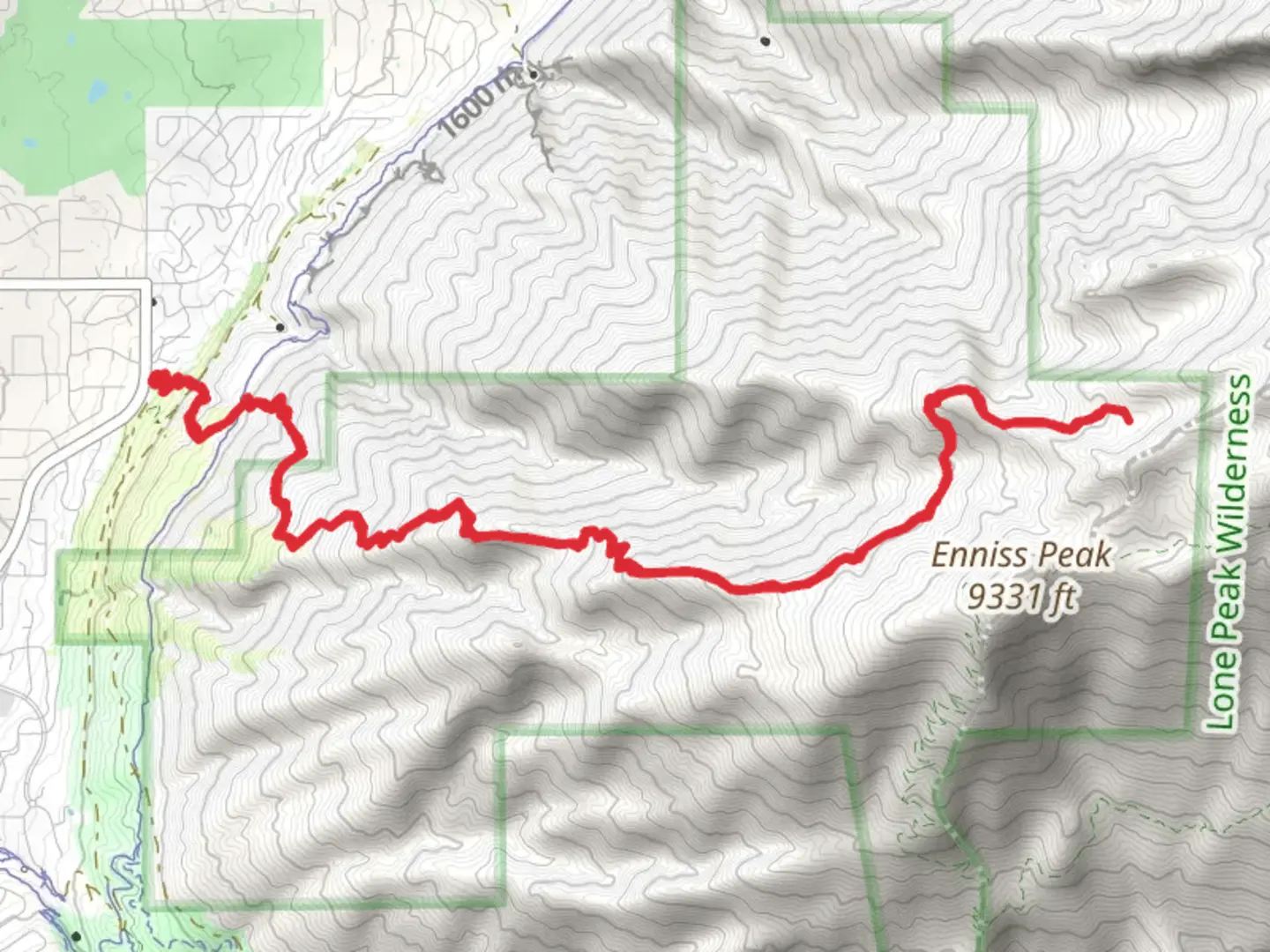
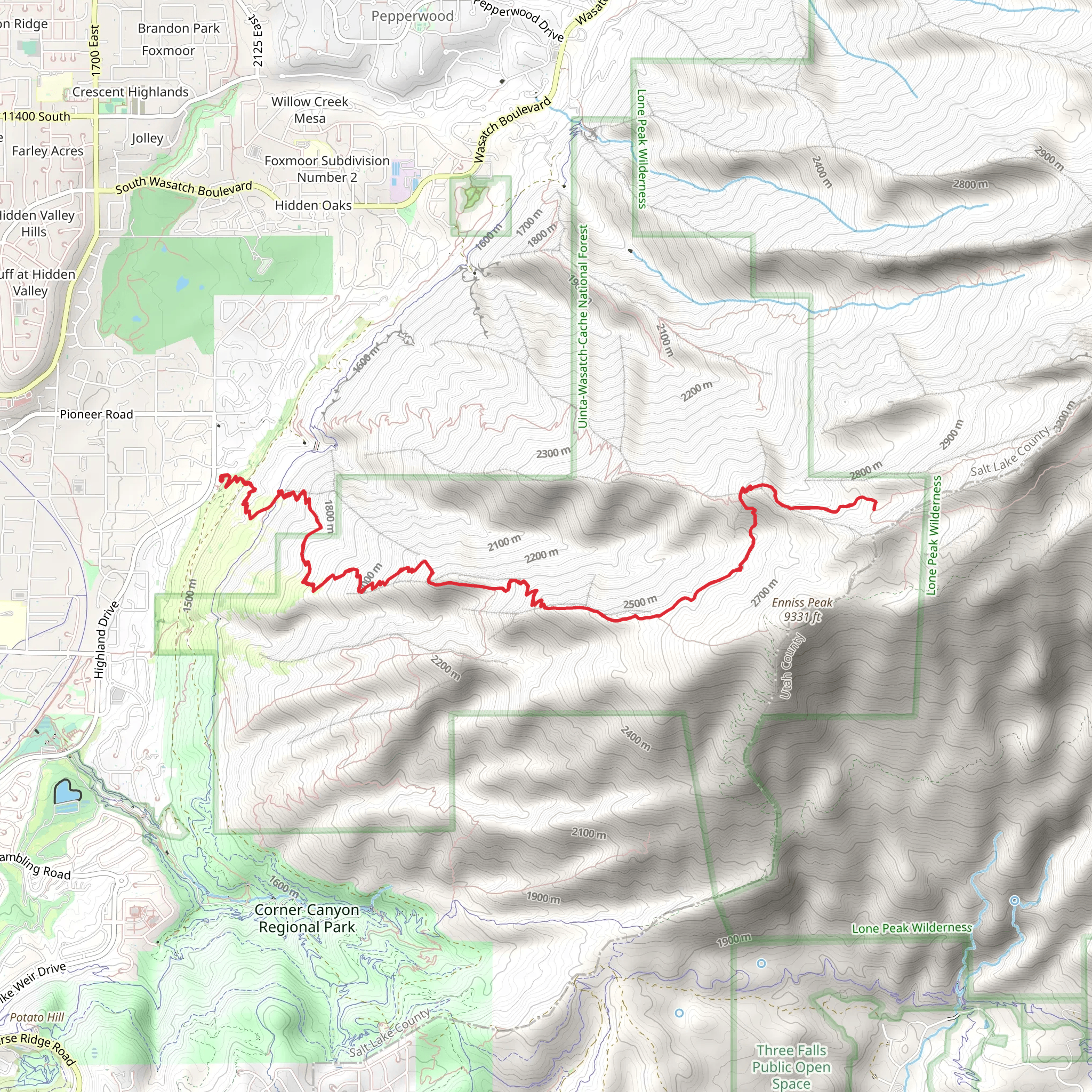
Starting near Salt Lake County, Utah, the Orson Smith Trail and Cherry Canyon Logging Trail offer a challenging yet rewarding hiking experience. This out-and-back trail spans approximately 18 kilometers (around 11 miles) with an elevation gain of about 1500 meters (4921 feet). The trailhead is conveniently located near the Orson Smith Park, which is easily accessible by car or public transport. If you're driving, you can park at the Orson Smith Trailhead Parking Lot. For those using public transport, the nearest bus stop is at the intersection of 2000 E and 11400 S, from where it's a short walk to the trailhead.
Trail Overview
The trail begins with a steady ascent through a series of switchbacks, offering panoramic views of the Salt Lake Valley. Early on, you'll encounter a mix of scrub oak and juniper trees, providing some shade and a sense of seclusion. As you climb higher, the vegetation transitions to a mix of pine and fir trees, and the trail becomes rockier.
Significant Landmarks and Points of Interest
Around the 3-kilometer (1.9-mile) mark, you'll reach the first significant viewpoint, offering a stunning vista of the valley below. This is a great spot for a quick rest and some photos. Continuing on, at approximately 5 kilometers (3.1 miles) in, you'll come across an old logging road, a remnant from the area's historical logging activities in the early 20th century. This section of the trail is relatively flat and provides a brief respite from the continuous climb.
Wildlife and Nature
The trail is home to a variety of wildlife, including mule deer, foxes, and a plethora of bird species. Keep an eye out for golden eagles soaring above and listen for the distinctive calls of the mountain chickadee. In spring and early summer, the trail is adorned with wildflowers such as Indian paintbrush and lupine, adding vibrant splashes of color to the landscape.
Elevation and Terrain
As you approach the 9-kilometer (5.6-mile) mark, the trail becomes steeper and more rugged. The final push to the highest point involves navigating through loose rocks and some narrow sections. The elevation gain is significant, so be prepared for a strenuous climb. The summit offers breathtaking 360-degree views, making the effort well worth it.
Historical Significance
The Cherry Canyon Logging Trail has historical significance dating back to the early 1900s when the area was actively logged. Remnants of old logging equipment and pathways can still be seen, offering a glimpse into the region's past. This historical context adds an extra layer of interest to your hike, making it not just a physical challenge but also an educational experience.
Navigation and Safety
Given the trail's length and elevation gain, it's crucial to be well-prepared. Use HiiKER to download the trail map and ensure you have a reliable navigation tool. The trail is well-marked, but it's always good to have a backup. Bring plenty of water, snacks, and wear appropriate hiking boots. Weather can change rapidly, so pack layers and be prepared for sudden shifts in temperature.
Getting There
To reach the trailhead, drive to Orson Smith Park, located at 12600 S Highland Dr, Draper, UT 84020. If using public transport, take the bus to the stop at 2000 E and 11400 S, and walk the remaining distance to the park. The trailhead is clearly marked, and there are restroom facilities and picnic areas available at the park.
This trail offers a mix of natural beauty, challenging terrain, and historical intrigue, making it a must-visit for any avid hiker.
What to expect?
Activity types
Comments and Reviews
User comments, reviews and discussions about the Orson Smith Trail and Cherry Canyon Logging Trail, Utah.
4.65
average rating out of 5
17 rating(s)
