Download
Preview
Add to list
More
11.3 km
~3 hrs 17 min
620 m
Out and Back
“Experience the scenic and moderately challenging Murdock Peak hike, featuring historical trails and stunning Wasatch views.”
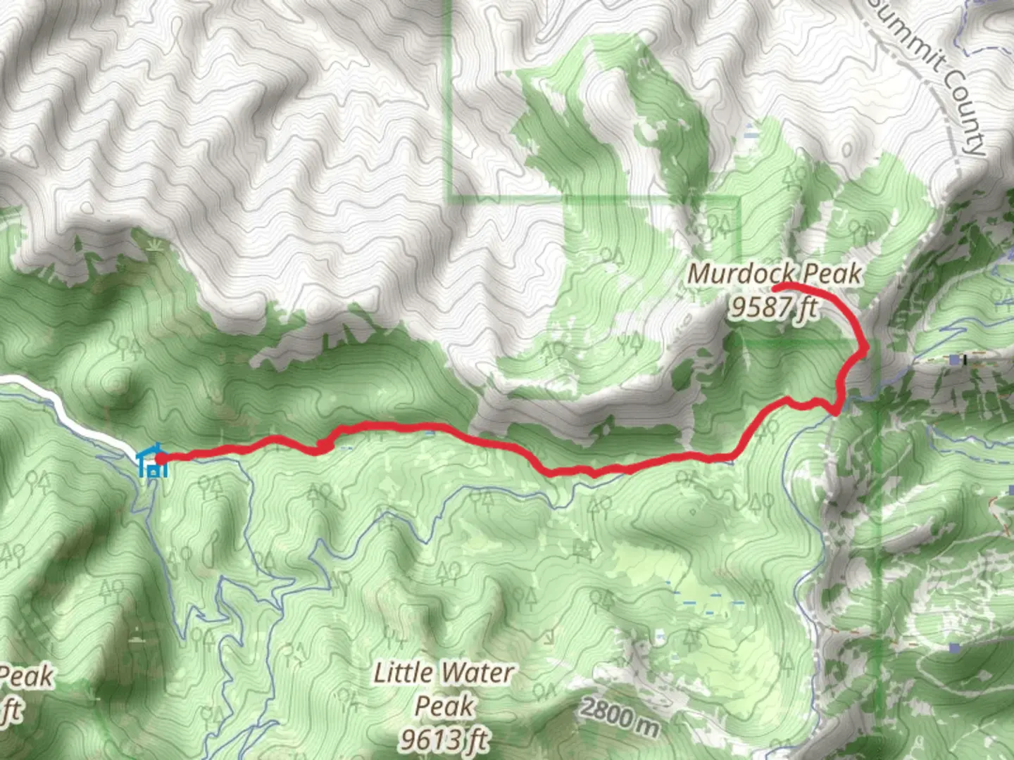
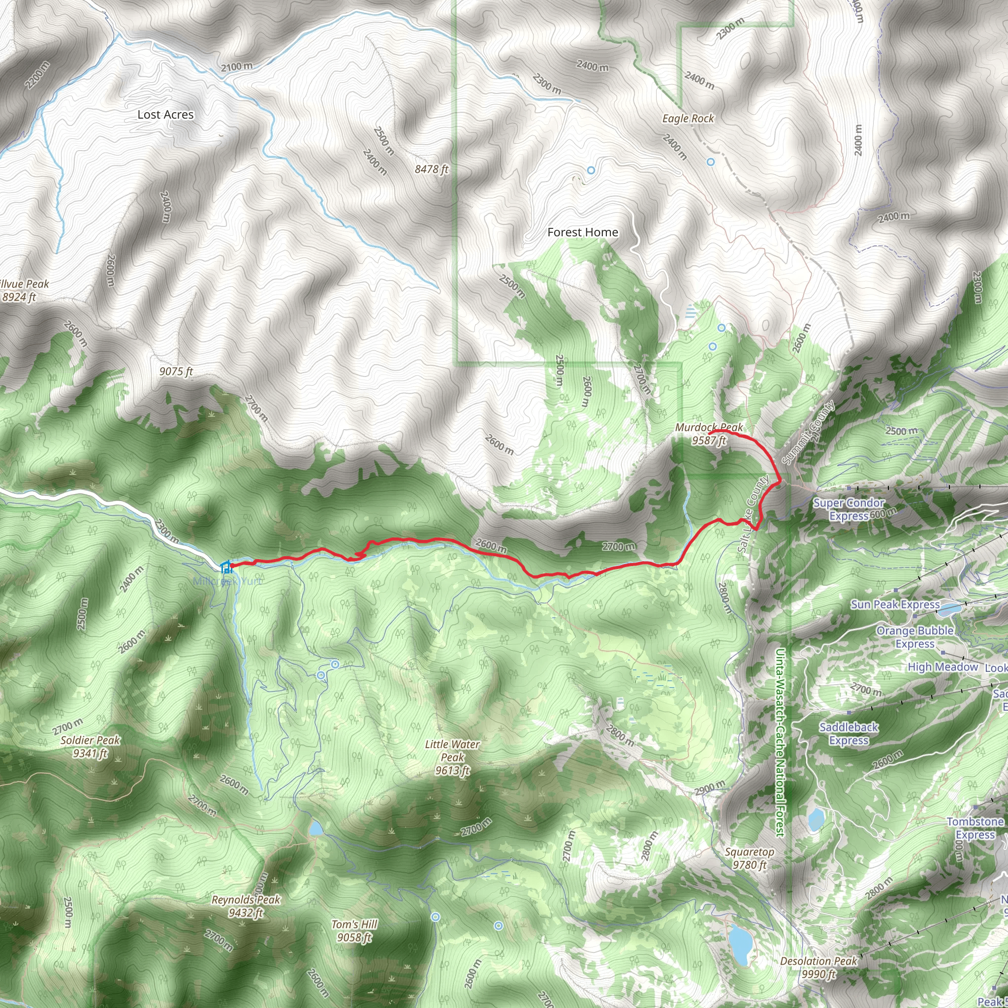
Starting near Salt Lake County, Utah, the Murdock Peak via Old Red Pine Road Trail offers a rewarding out-and-back hike spanning approximately 11 kilometers (around 6.8 miles) with an elevation gain of about 600 meters (approximately 1,970 feet). This trail is rated as medium difficulty, making it suitable for moderately experienced hikers.
Getting There
To reach the trailhead, you can drive or use public transportation. If driving, head towards the Big Cottonwood Canyon area. The nearest significant landmark is the Spruces Campground, which is a convenient starting point. For those using public transport, the Utah Transit Authority (UTA) offers bus services that can get you close to the trailhead. Check the latest schedules and routes on the UTA website to plan your trip.
Trail Overview
The trail begins with a gentle ascent through a dense forest of pine and aspen trees. The first 2 kilometers (1.2 miles) are relatively easy, with a gradual elevation gain of about 100 meters (328 feet). This section is well-shaded, making it a pleasant walk even during warmer months.
Significant Landmarks and Nature
As you continue, you'll reach a clearing at around the 3-kilometer (1.9-mile) mark. Here, the elevation gain becomes more noticeable, and the trail starts to wind through a series of switchbacks. This section offers stunning views of the surrounding Wasatch Mountains. Keep an eye out for local wildlife, including mule deer and various bird species.
At approximately 5 kilometers (3.1 miles) in, you'll encounter a small, serene meadow. This is a great spot to take a break and enjoy the natural beauty. The meadow is often dotted with wildflowers in the spring and summer months, adding a splash of color to the landscape.
Historical Significance
The Old Red Pine Road has historical significance as it was once a route used by early settlers and miners in the region. The trail's name is derived from the red pine trees that were abundant in the area and used for timber during the mining boom in the late 19th and early 20th centuries.
Final Ascent to Murdock Peak
The final push to Murdock Peak is the most challenging part of the hike. Over the last 1.5 kilometers (0.9 miles), you'll gain approximately 200 meters (656 feet) in elevation. The trail becomes steeper and rockier, requiring careful footing. However, the effort is well worth it. Upon reaching the summit, you'll be rewarded with panoramic views of the Wasatch Range and the Salt Lake Valley.
Navigation and Safety
For navigation, it's highly recommended to use the HiiKER app, which provides detailed maps and real-time GPS tracking. This will help ensure you stay on the correct path, especially in areas where the trail may not be well-marked.
Return Journey
The return journey follows the same path back to the trailhead. While descending, take your time to enjoy the views and perhaps spot some wildlife you may have missed on the way up. The descent is generally easier but still requires attention to footing, especially on the steeper sections.
This trail offers a mix of natural beauty, historical context, and a moderate physical challenge, making it a fulfilling hike for those looking to explore the Wasatch Mountains.
What to expect?
Activity types
Comments and Reviews
User comments, reviews and discussions about the Murdock Peak via Old Red Pine Road Trail, Utah.
4.63
average rating out of 5
19 rating(s)
