Mount Raymond via Alexander Basin Trail and Alexander Bowman Trail
Download
Preview
Add to list
More
12.9 km
~4 hrs 55 min
1415 m
Loop
“Embark on a challenging 13-km loop hike offering breathtaking views and rich history near Salt Lake City.”
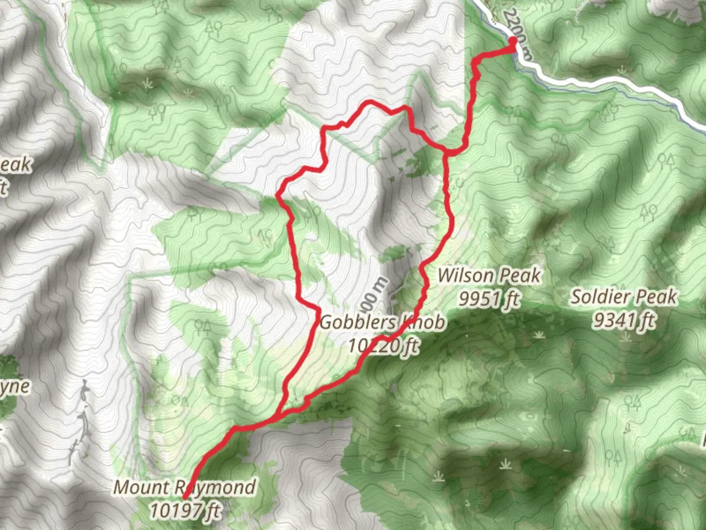
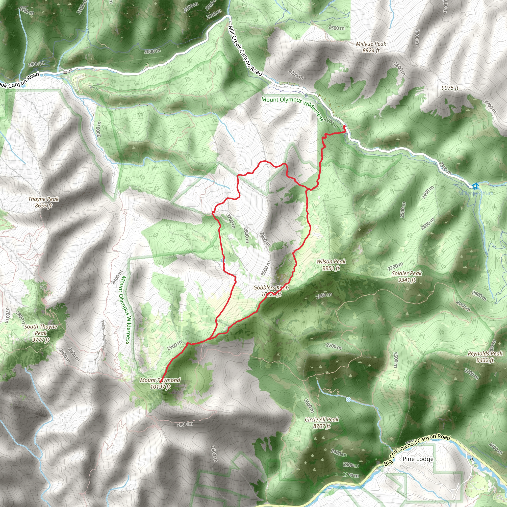
Starting your adventure near Salt Lake County, Utah, the Mount Raymond via Alexander Basin Trail and Alexander Bowman Trail offers a challenging yet rewarding loop hike. The trailhead is conveniently located near the Mill Creek Canyon area, accessible by car from Salt Lake City. If you're using public transport, the nearest bus stop is at the base of Mill Creek Canyon, from where you can arrange a taxi or rideshare to the trailhead.
Trail Overview
The loop spans approximately 13 kilometers (8 miles) with an elevation gain of around 1400 meters (4600 feet). This medium-difficulty trail is perfect for hikers looking for a bit of a challenge without venturing into expert territory. The trail is well-marked, but it's advisable to use the HiiKER app for navigation to ensure you stay on track.
Initial Ascent
Starting from the trailhead, the first section of the hike takes you through the Alexander Basin. This part of the trail is steep and gains elevation quickly, climbing about 600 meters (2000 feet) in the first 3 kilometers (1.9 miles). The dense forest canopy provides ample shade, making it a pleasant climb even on warmer days. Keep an eye out for mule deer and various bird species that inhabit this area.
Midway Point and Scenic Views
As you continue, the trail opens up to a more alpine environment. Around the 5-kilometer (3.1-mile) mark, you'll reach a plateau offering panoramic views of the surrounding peaks and valleys. This is a great spot to take a break and soak in the scenery. The elevation here is approximately 2600 meters (8530 feet), and you might notice the air getting thinner.
Summit Push
The final push to Mount Raymond's summit involves a series of switchbacks and rocky terrain. This section is about 2 kilometers (1.2 miles) long and gains another 400 meters (1300 feet) in elevation. The summit stands at 3230 meters (10600 feet) and offers breathtaking 360-degree views. On clear days, you can see as far as the Great Salt Lake and the Wasatch Range.
Descent via Alexander Bowman Trail
The descent begins by following the Alexander Bowman Trail. This part of the loop is less steep but still requires careful footing, especially if the ground is wet. The trail meanders through meadows and mixed forests, gradually losing elevation over the next 5 kilometers (3.1 miles). You'll pass several small streams and might spot wildflowers in bloom during the spring and summer months.
Historical Significance
The region around Mount Raymond has a rich history, with Native American tribes such as the Ute and Shoshone having traversed these lands for centuries. In the 19th century, the area was also frequented by pioneers and miners. Remnants of old mining operations can still be found off the main trail, adding a historical dimension to your hike.
Wildlife and Flora
The diverse ecosystems you'll encounter range from dense pine forests to alpine meadows. Wildlife is abundant, with chances to see elk, black bears, and a variety of bird species. Always carry bear spray and make noise to avoid surprising any wildlife.
Getting There
If driving, take I-215 to exit 4 for 3900 S. Follow Mill Creek Canyon Road (UT-65) for about 6 miles (9.7 kilometers) until you reach the trailhead parking area. For those using public transport, the UTA bus service can drop you off at the base of Mill Creek Canyon, from where you can arrange a taxi or rideshare to the trailhead.
Prepare well, stay safe, and enjoy the natural beauty and historical richness of the Mount Raymond via Alexander Basin Trail and Alexander Bowman Trail.
What to expect?
Activity types
Comments and Reviews
User comments, reviews and discussions about the Mount Raymond via Alexander Basin Trail and Alexander Bowman Trail, Utah.
4.38
average rating out of 5
13 rating(s)
