Mormon Flat Campground via Donner Reed Party and Mormon Pioneer Trail
Download
Preview
Add to list
More
32.8 km
~1 day 3 hrs
1233 m
Out and Back
“Experience history and nature on the 33 km Mormon Flat Campground Trail, perfect for moderately experienced hikers.”
Starting near Salt Lake County, Utah, the trailhead for the Mormon Flat Campground via Donner Reed Party and Mormon Pioneer Trail is accessible by car or public transport. If driving, head towards the nearest known landmark, the This Is The Place Heritage Park. From there, follow the signs to the trailhead. For those using public transport, the UTA bus system has routes that can get you close to the starting point, with a short walk required to reach the trailhead.
Trail Overview
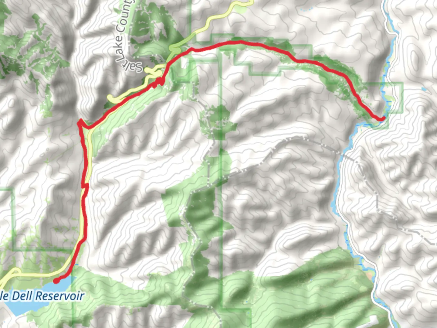
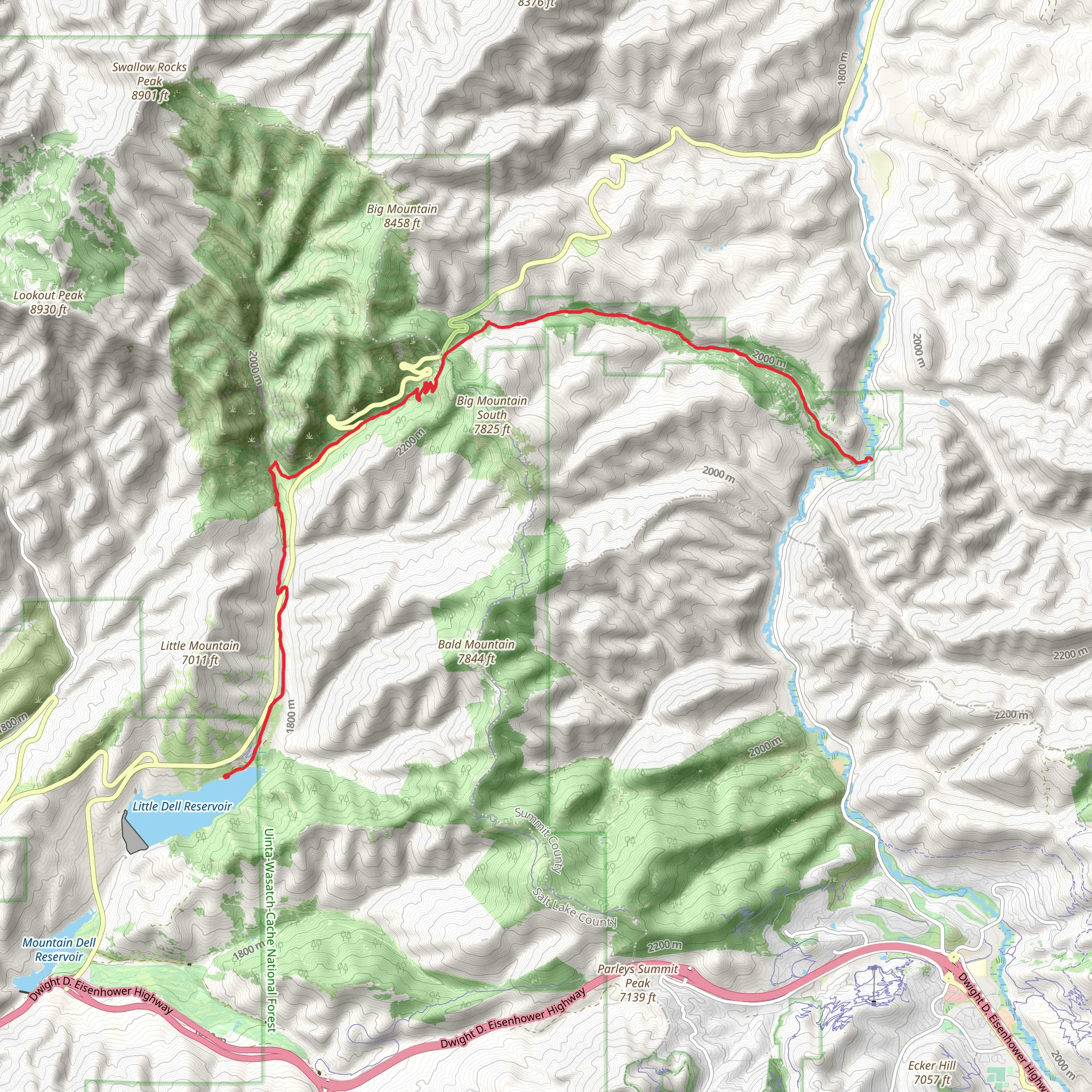
This out-and-back trail spans approximately 33 kilometers (20.5 miles) with an elevation gain of around 1200 meters (3937 feet). Rated as medium difficulty, it offers a mix of historical intrigue and natural beauty, making it a rewarding experience for moderately experienced hikers.
Historical Significance
The trail is steeped in history, tracing the paths of the Donner Reed Party and the Mormon Pioneers. As you hike, you'll be walking in the footsteps of these early settlers who braved harsh conditions in search of a better life. Key historical markers along the trail provide insights into their journey, struggles, and perseverance.
Key Landmarks and Sections
- First 5 Kilometers (3.1 Miles): The initial stretch of the trail is relatively gentle, with a gradual ascent. You'll pass through a mix of open meadows and forested areas. Keep an eye out for interpretive signs that detail the history of the Mormon Pioneers and the Donner Reed Party.
- 5 to 10 Kilometers (3.1 to 6.2 Miles): The trail begins to climb more steeply, offering panoramic views of the surrounding valleys and mountains. This section is particularly scenic during the fall when the foliage turns vibrant shades of red and gold.
- 10 to 15 Kilometers (6.2 to 9.3 Miles): As you continue, the trail becomes rockier and more challenging. You'll encounter several switchbacks that help manage the elevation gain. This section also features some of the most significant historical markers, including remnants of old wagon tracks and campsites used by the pioneers.
- 15 to 16.5 Kilometers (9.3 to 10.3 Miles): The final stretch to the turnaround point at Mormon Flat Campground is a bit easier, with a more gradual incline. The campground itself is a serene spot, perfect for a rest before heading back. It's also a great place to spot local wildlife, including deer and various bird species.
Nature and Wildlife
The trail traverses diverse ecosystems, from lush meadows to dense forests. Depending on the season, you might see wildflowers in bloom, vibrant fall foliage, or snow-dusted trees. Wildlife is abundant, with deer, elk, and various bird species commonly spotted. Be sure to carry a map and navigation tools like HiiKER to stay on track, especially in the more remote sections.
Preparation and Safety
Given the trail's medium difficulty rating, it's essential to be well-prepared. Wear sturdy hiking boots and bring plenty of water, snacks, and layers of clothing to adjust to changing weather conditions. The trail can be rocky and uneven in places, so trekking poles might be helpful. Always check the weather forecast before heading out and let someone know your plans.
Getting There
To reach the trailhead, drive or take public transport to This Is The Place Heritage Park. From there, follow the signs to the trailhead. If using public transport, the UTA bus system can get you close, with a short walk required to reach the starting point. Parking is available near the trailhead, but it can fill up quickly on weekends and holidays, so plan to arrive early.
What to expect?
Activity types
Comments and Reviews
User comments, reviews and discussions about the Mormon Flat Campground via Donner Reed Party and Mormon Pioneer Trail, Utah.
4.52
average rating out of 5
21 rating(s)
