Download
Preview
Add to list
More
3.9 km
~1 hrs 9 min
231 m
Out and Back
“Explore natural beauty and history on the captivating Lower Albino Meadows and Snake Pit Trail.”
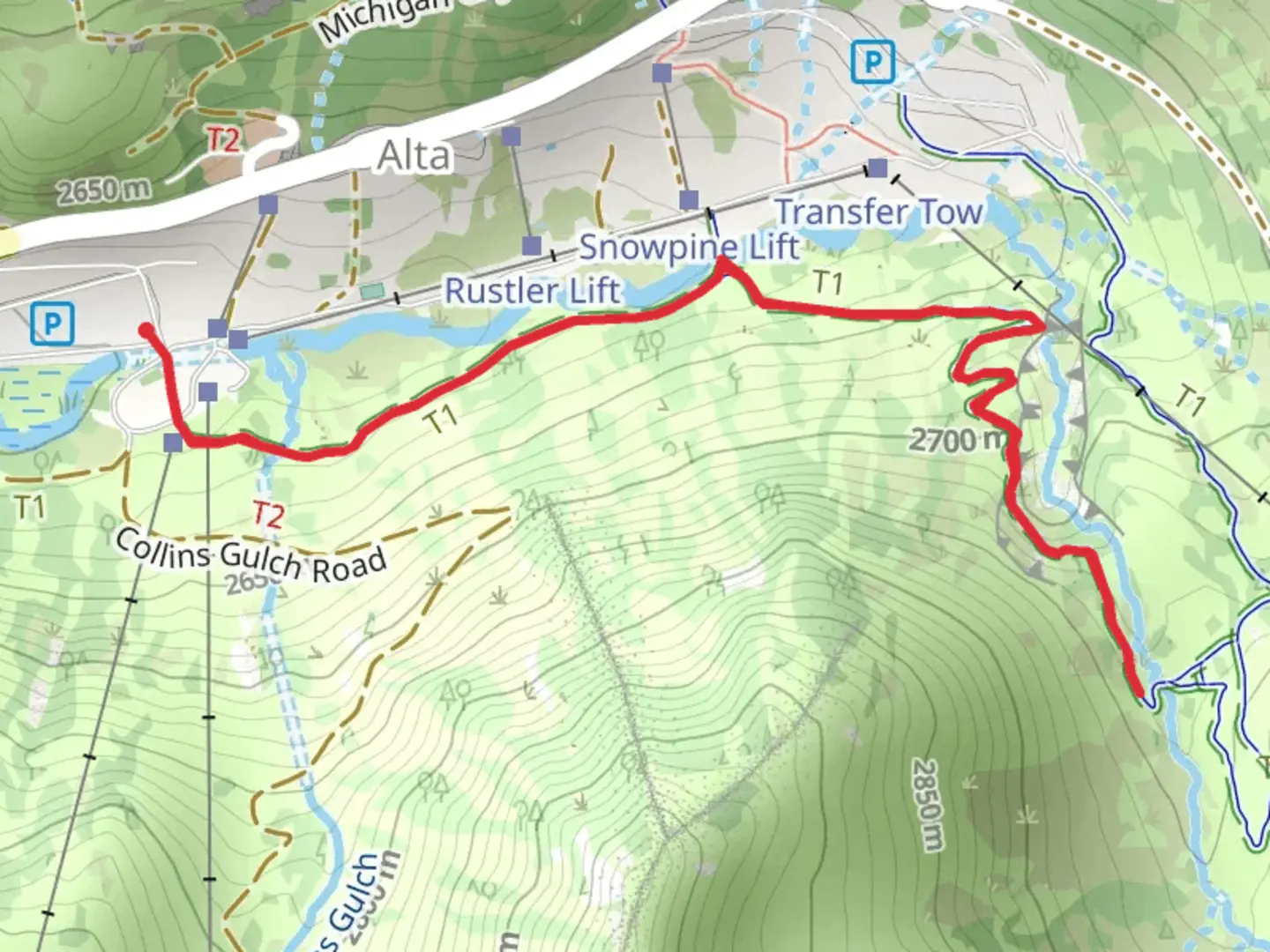
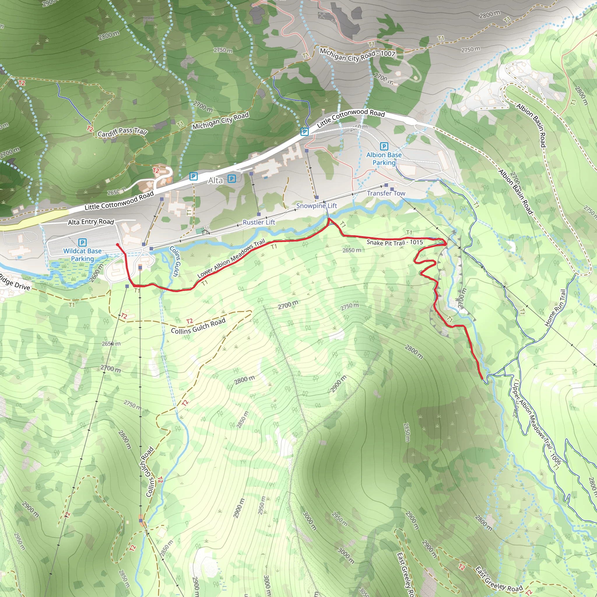
Starting near Salt Lake County, Utah, the Lower Albino Meadows Trail and Snake Pit Trail offer a captivating 4 km (2.5 miles) out-and-back adventure with an elevation gain of approximately 200 meters (656 feet). This medium-difficulty trail is perfect for those looking to immerse themselves in the natural beauty and historical richness of the area.
Getting There To reach the trailhead, you can drive or use public transport. If driving, head towards the nearest significant landmark, the Big Cottonwood Canyon Park & Ride, located at 6450 S Wasatch Blvd, Holladay, UT 84121. From there, it's a short drive to the trailhead. For those using public transport, take the UTA bus route 972, which stops at the Big Cottonwood Canyon Park & Ride. From the park and ride, you can either carpool or take a short taxi ride to the trailhead.
Trail Overview The trail begins with a gentle ascent through a mixed forest of pine and aspen trees. Early in the hike, you'll encounter a small, serene meadow known as the Lower Albino Meadows. This area is particularly beautiful in the spring and early summer when wildflowers are in full bloom. Keep an eye out for mule deer and various bird species that frequent this meadow.
Significant Landmarks and Nature As you continue, the trail becomes steeper, leading you through a series of switchbacks. Approximately 1.5 km (0.9 miles) into the hike, you'll reach a rocky outcrop that offers stunning views of the surrounding canyon and distant peaks. This is a great spot to take a break and enjoy the scenery.
Further along, at around the 2 km (1.2 miles) mark, you'll come across the Snake Pit, a unique geological formation that resembles a pit or depression in the ground. This area is named for the occasional sightings of harmless garter snakes basking in the sun. The Snake Pit is a fascinating spot for geology enthusiasts, as it provides a glimpse into the region's volcanic past.
Historical Significance The trail also holds historical significance. The area was once traversed by Native American tribes, and you may come across ancient petroglyphs etched into the rocks. These petroglyphs offer a window into the lives and cultures of the indigenous people who once inhabited this land.
Navigation and Safety Given the moderate difficulty of the trail, it's advisable to use a reliable navigation tool like HiiKER to ensure you stay on the correct path. The trail is well-marked, but having a digital map can provide extra assurance, especially in areas where the path may be less distinct.
Wildlife and Flora Throughout the hike, you'll be surrounded by diverse flora and fauna. In addition to mule deer and garter snakes, you might spot red foxes, squirrels, and a variety of bird species, including hawks and woodpeckers. The flora ranges from towering pines to delicate wildflowers, making the trail a botanical delight.
Final Stretch The return journey follows the same path, allowing you to revisit the scenic spots and perhaps notice details you missed on the way up. The descent offers a different perspective of the landscape, with the changing light creating new photo opportunities.
This trail is a perfect blend of natural beauty, wildlife, and historical intrigue, making it a rewarding experience for any hiker.
What to expect?
Activity types
Comments and Reviews
User comments, reviews and discussions about the Lower Albino Meadows Trail and Snake Pit Trail, Utah.
4.46
average rating out of 5
13 rating(s)
