Download
Preview
Add to list
More
10.7 km
~3 hrs 24 min
755 m
Loop
“Experience rewarding challenges, stunning views, and rich history on the Hell Canyon Trail near Salt Lake County.”
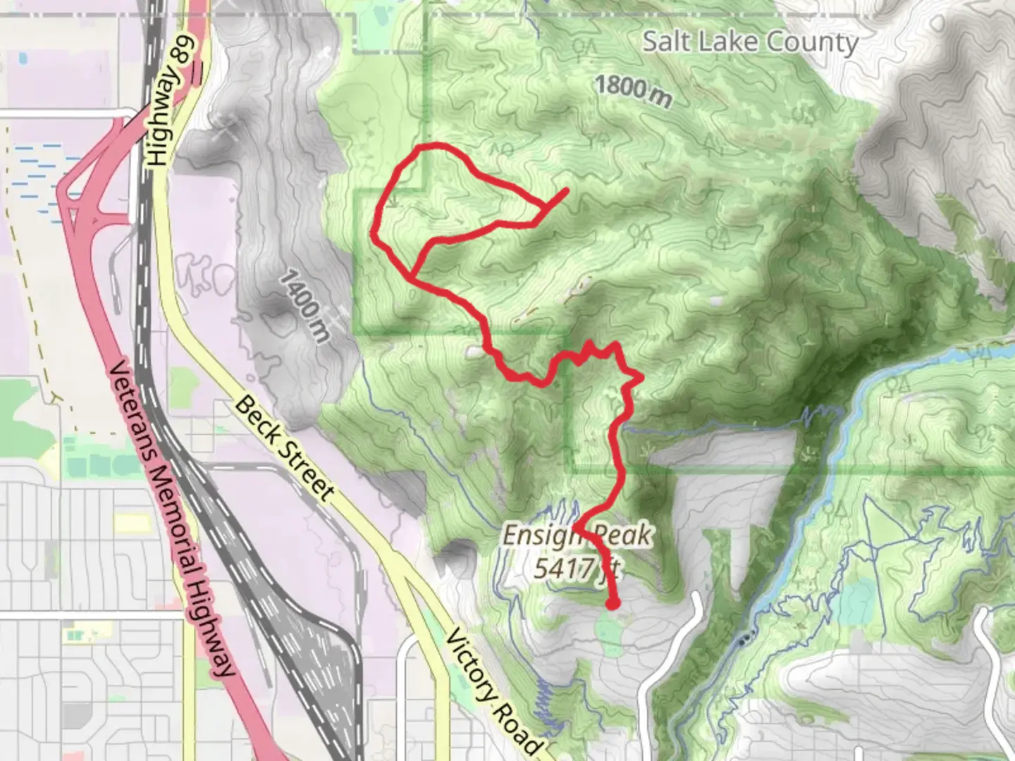
Starting near Salt Lake County, Utah, the Hell Canyon Trail and Tower Connector offers a challenging yet rewarding loop hike of approximately 11 km (around 6.8 miles) with an elevation gain of about 700 meters (2,300 feet). This trail is rated as medium difficulty, making it suitable for hikers with some experience and a good level of fitness.
Getting There To reach the trailhead, you can drive or use public transportation. If driving, head towards the nearest significant landmark, which is the Big Cottonwood Canyon Park and Ride. From there, it's a short drive to the trailhead. For those using public transport, take a bus to the Big Cottonwood Canyon Park and Ride, and then arrange for a short taxi or rideshare to the trailhead.
Trail Overview The trail begins with a steady ascent through a dense forest of pine and aspen trees. Early on, you'll encounter a series of switchbacks that help to manage the elevation gain. After about 2 km (1.2 miles), the trail levels out briefly, offering a chance to catch your breath and enjoy the surrounding nature.
Significant Landmarks At approximately 3 km (1.9 miles) into the hike, you'll come across a scenic overlook that provides stunning views of the Salt Lake Valley. This is a great spot for a quick rest and some photos. Continuing on, the trail winds through Hell Canyon, a rugged and rocky section that requires careful footing. This part of the trail is known for its unique geological formations and offers a glimpse into the area's volcanic past.
Flora and Fauna The trail is rich in biodiversity. Keep an eye out for mule deer, which are commonly seen in the area. Birdwatchers will also enjoy spotting various species such as the Mountain Bluebird and the Red-tailed Hawk. The flora changes with elevation; lower sections are dominated by sagebrush and juniper, while higher elevations feature lush meadows filled with wildflowers during the spring and summer months.
Historical Significance The region has a rich history, with evidence of Native American habitation dating back thousands of years. The trail itself was used by early settlers and miners in the 19th century, and remnants of old mining equipment can still be seen along the route.
Navigation Given the complexity of the trail, it's advisable to use a reliable navigation tool like HiiKER to ensure you stay on track. The app provides detailed maps and real-time updates, which can be particularly useful in the more remote sections of the trail.
Final Stretch As you approach the final 2 km (1.2 miles) of the loop, the trail descends gradually, offering a more relaxed end to your hike. You'll pass through a beautiful meadow before re-entering the forest and making your way back to the trailhead.
This hike offers a mix of challenging terrain, stunning views, and rich history, making it a must-do for any avid hiker visiting the Salt Lake County area.
What to expect?
Activity types
Comments and Reviews
User comments, reviews and discussions about the Hell Canyon Trail and Tower Connector, Utah.
4.43
average rating out of 5
14 rating(s)
