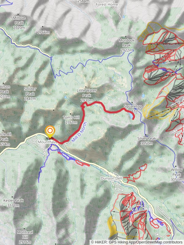
13.0 km
~3 hrs 42 min
670 m
“Discover the natural beauty and historical intrigue of Utah's Desolation Lake via a rewarding 13-kilometer hike.”
Starting your adventure near Salt Lake County, Utah, the Desolation Lake via Desolation Trail offers a rewarding out-and-back hike that spans approximately 13 kilometers (8 miles) with an elevation gain of around 600 meters (1,970 feet). This trail is rated as medium difficulty, making it suitable for moderately experienced hikers.
### Getting There
To reach the trailhead, you can drive or use public transportation. If driving, head towards Mill D North Fork Trailhead, located off Big Cottonwood Canyon Road (UT-190). For those using public transport, the Utah Transit Authority (UTA) offers bus services that can get you close to the trailhead. Check the latest schedules and routes on the UTA website to plan your trip.
### Trail Overview
The trail begins at the Mill D North Fork Trailhead, where you'll find ample parking and basic facilities. The initial section of the trail is relatively gentle, winding through a lush forest of aspen and pine trees. As you progress, the trail becomes steeper, offering a moderate challenge as you ascend.
### Key Landmarks and Points of Interest
#### 1. Mill D North Fork Approximately 2 kilometers (1.2 miles) into the hike, you'll reach the junction with the Mill D North Fork Trail. This is a good spot to take a short break and enjoy the serene surroundings. The trail here is well-marked, but it's always a good idea to have a reliable navigation tool like HiiKER to ensure you're on the right path.
#### 2. Scenic Overlook Around the 4-kilometer (2.5-mile) mark, you'll come across a scenic overlook that offers breathtaking views of the surrounding mountains and valleys. This is an excellent spot for photography and to catch your breath before continuing your ascent.
#### 3. Desolation Lake The highlight of the trail is Desolation Lake, located approximately 6.5 kilometers (4 miles) from the trailhead. Nestled in a high alpine basin, the lake is surrounded by towering peaks and lush meadows. The area around the lake is perfect for a picnic or simply to relax and take in the natural beauty.
### Flora and Fauna
The trail is rich in biodiversity. In the lower sections, you'll encounter dense forests of aspen and pine, while higher elevations feature alpine meadows filled with wildflowers during the summer months. Wildlife is abundant, with chances to spot deer, moose, and various bird species. Always maintain a safe distance from wildlife and follow Leave No Trace principles to preserve the natural environment.
### Historical Significance
Big Cottonwood Canyon, where the trail is located, has a rich history dating back to the 19th century. It was a significant area during the Utah Gold Rush and later became a popular spot for logging. Remnants of old mining operations can still be found in the area, adding a historical dimension to your hike.
### Final Ascent and Return
The final ascent to Desolation Lake is steep but manageable, with switchbacks that ease the climb. Once you've enjoyed the lake, retrace your steps back to the trailhead. The descent offers a different perspective of the landscape, making the return journey equally enjoyable.
### Preparation Tips
- Water and Snacks: Ensure you carry enough water and high-energy snacks. There are no water sources along the trail until you reach the lake. - Clothing: Dress in layers, as temperatures can vary significantly with elevation gain. - Navigation: Use HiiKER for real-time navigation and trail updates. - Safety: Inform someone about your hiking plans and expected return time.
This trail offers a perfect blend of natural beauty, moderate challenge, and historical intrigue, making it a must-visit for any hiking enthusiast.
Reviews
User comments, reviews and discussions about the Desolation Lake via Desolation Trail, Utah.
0.0
average rating out of 5
0 rating(s)


