Download
Preview
Add to list
More
20.0 km
~1 day 1 hrs
1761 m
Out and Back
“The Cherry Canyon Logging Trail offers a scenic, historical hike with breathtaking views and diverse wildlife.”
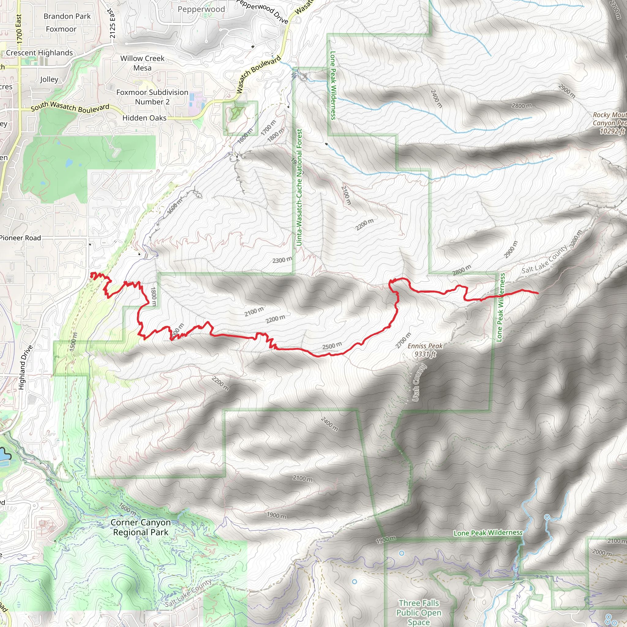
Starting near Salt Lake County, Utah, the Cherry Canyon Logging Trail offers a rewarding out-and-back hike that spans approximately 20 kilometers (12.4 miles) with an elevation gain of around 1700 meters (5577 feet). This medium-difficulty trail is perfect for those looking to experience the natural beauty and historical significance of the region.
Getting There To reach the trailhead, you can drive or use public transportation. If driving, head towards the nearest known address, which is the Orson Smith Trailhead Park, located at 12601 S 2000 E, Draper, UT 84020. From there, follow the signs to the Cherry Canyon Logging Trail. For those using public transport, take the UTA bus to the Draper Town Center Station, and then use a rideshare service or taxi to reach the trailhead.
Trail Overview The Cherry Canyon Logging Trail begins with a steady ascent through a dense forest of pine and aspen trees. The initial 3 kilometers (1.9 miles) will see you gaining about 300 meters (984 feet) in elevation, providing a good warm-up for the more challenging sections ahead. As you hike, keep an eye out for deer and various bird species that inhabit the area.
Significant Landmarks and Nature Around the 5-kilometer (3.1-mile) mark, you'll encounter the remnants of old logging operations, including rusted machinery and abandoned cabins. These relics offer a glimpse into the area's history, dating back to the early 20th century when logging was a significant industry in the region.
Continuing on, the trail becomes steeper and more rugged. By the time you reach the 10-kilometer (6.2-mile) point, you'll have gained approximately 1000 meters (3281 feet) in elevation. Here, the forest opens up to reveal stunning vistas of the Salt Lake Valley and the surrounding Wasatch Mountains. This is an excellent spot to take a break and enjoy the panoramic views.
Wildlife and Flora As you ascend further, the landscape transitions to alpine meadows filled with wildflowers during the summer months. Keep an eye out for marmots and mountain goats, which are commonly seen in this area. The trail also passes through several small streams, providing opportunities to refill your water supply if you have a filtration system.
Final Ascent and Return The final stretch of the trail is the most challenging, with a steep climb that gains the remaining 700 meters (2297 feet) in elevation over the last 5 kilometers (3.1 miles). This section requires careful footing, especially if the trail is wet or icy. Upon reaching the highest point, you'll be rewarded with breathtaking views of the surrounding peaks and valleys.
After taking in the scenery, retrace your steps back to the trailhead. The descent offers a different perspective of the landscape and allows you to appreciate the trail's diverse ecosystems once more.
Navigation and Safety For navigation, it's highly recommended to use the HiiKER app, which provides detailed maps and real-time updates. Ensure you have adequate water, snacks, and appropriate clothing for changing weather conditions. Always inform someone of your hiking plans and estimated return time.
This trail offers a blend of natural beauty, historical intrigue, and physical challenge, making it a must-visit for any avid hiker.
What to expect?
Activity types
Comments and Reviews
User comments, reviews and discussions about the Cherry Canyon Logging Trail, Utah.
4.6
average rating out of 5
15 rating(s)
