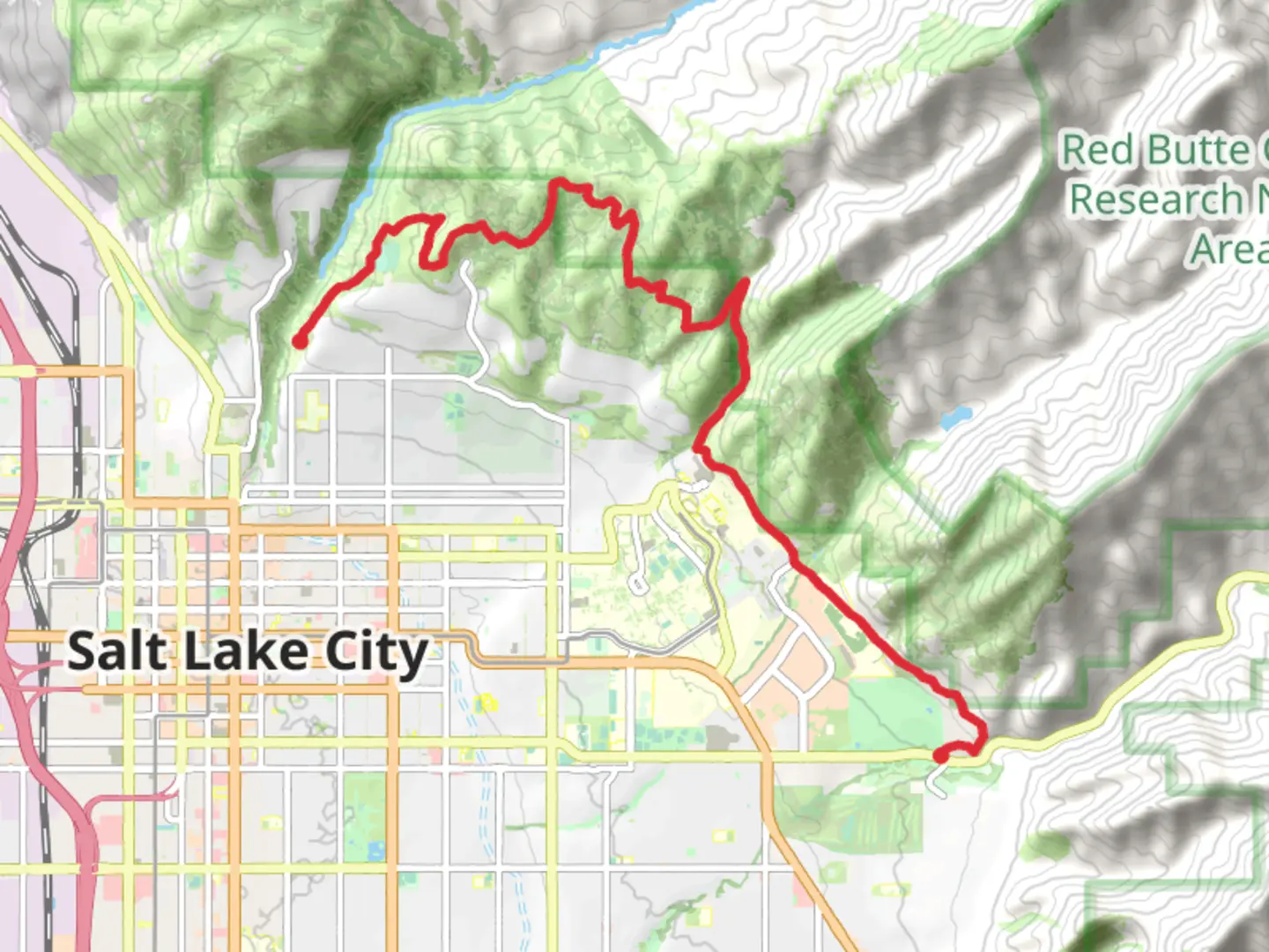
Bonneville Shoreline Trail - Mount Wire Section to East City Creek Section
Download
Preview
Add to list
More
16.0 km
~4 hrs 35 min
843 m
Point-to-Point
“The Bonneville Shoreline Trail offers a captivating hike through diverse landscapes and historical landmarks with moderate challenges.”
Starting near Salt Lake County, Utah, the Bonneville Shoreline Trail - Mount Wire Section to East City Creek Section offers a captivating journey through diverse landscapes and historical landmarks. This point-to-point trail spans approximately 16 kilometers (10 miles) with an elevation gain of around 800 meters (2,625 feet), making it a moderately challenging hike suitable for those with some hiking experience.
Getting There To reach the trailhead, you can either drive or use public transportation. If driving, head towards the University of Utah area, where parking is available near the Natural History Museum of Utah. For those using public transport, several bus routes service the University of Utah, making it a convenient starting point.
Trail Overview The trail begins near the Natural History Museum of Utah, a significant landmark that offers a glimpse into the region's rich geological and paleontological history. As you start your hike, you'll ascend gradually, passing through a mix of scrub oak and sagebrush, typical of the Wasatch Front.
Key Landmarks and Sections - **Mount Wire**: At approximately 3 kilometers (1.9 miles) into the hike, you'll reach Mount Wire. This section offers panoramic views of the Salt Lake Valley and the Great Salt Lake. The elevation gain here is about 300 meters (984 feet), making it a good spot for a short break. - **Red Butte Canyon**: Continuing along the trail, you'll pass Red Butte Canyon around the 5-kilometer (3.1 miles) mark. This area is known for its diverse plant life and is a designated research natural area, so stay on the trail to protect the environment.
- Dry Creek: At roughly 8 kilometers (5 miles), you'll encounter Dry Creek. This section involves a descent into the creek bed, followed by a steep climb out, adding another 200 meters (656 feet) of elevation gain. The creek is often dry, but it's a good spot to observe local wildlife, including mule deer and various bird species.
Historical Significance The Bonneville Shoreline Trail follows the ancient shoreline of Lake Bonneville, a prehistoric lake that once covered much of Utah. The trail offers a unique opportunity to walk along what was once the lake's edge, providing a tangible connection to the region's geological past.
Final Stretch As you approach the East City Creek Section, the trail levels out, offering a more relaxed hike through grassy meadows and patches of wildflowers in the spring and summer. The final 3 kilometers (1.9 miles) are relatively flat, making for a pleasant end to your journey.
Navigation and Safety Given the trail's moderate difficulty and varying terrain, it's advisable to use a reliable navigation tool like HiiKER to stay on track. The trail is well-marked, but having a digital map can be invaluable, especially in less trafficked sections.
Wildlife and Flora Throughout the hike, keep an eye out for local wildlife such as mule deer, red foxes, and a variety of bird species. The flora changes with elevation, from scrub oak and sagebrush at lower levels to wildflowers and grasses in higher meadows.
Preparation Ensure you bring plenty of water, especially during the hotter months, as the trail offers limited shade. Sturdy hiking boots are recommended due to the rocky and uneven terrain. Weather can change rapidly, so pack layers and be prepared for sudden shifts.
This trail offers a blend of natural beauty, historical significance, and moderate physical challenge, making it a rewarding experience for those prepared to tackle its diverse landscapes.

What to expect?
Activity types
Comments and Reviews
User comments, reviews and discussions about the Bonneville Shoreline Trail - Mount Wire Section to East City Creek Section, Utah.
4.6
average rating out of 5
20 rating(s)