Download
Preview
Add to list
More
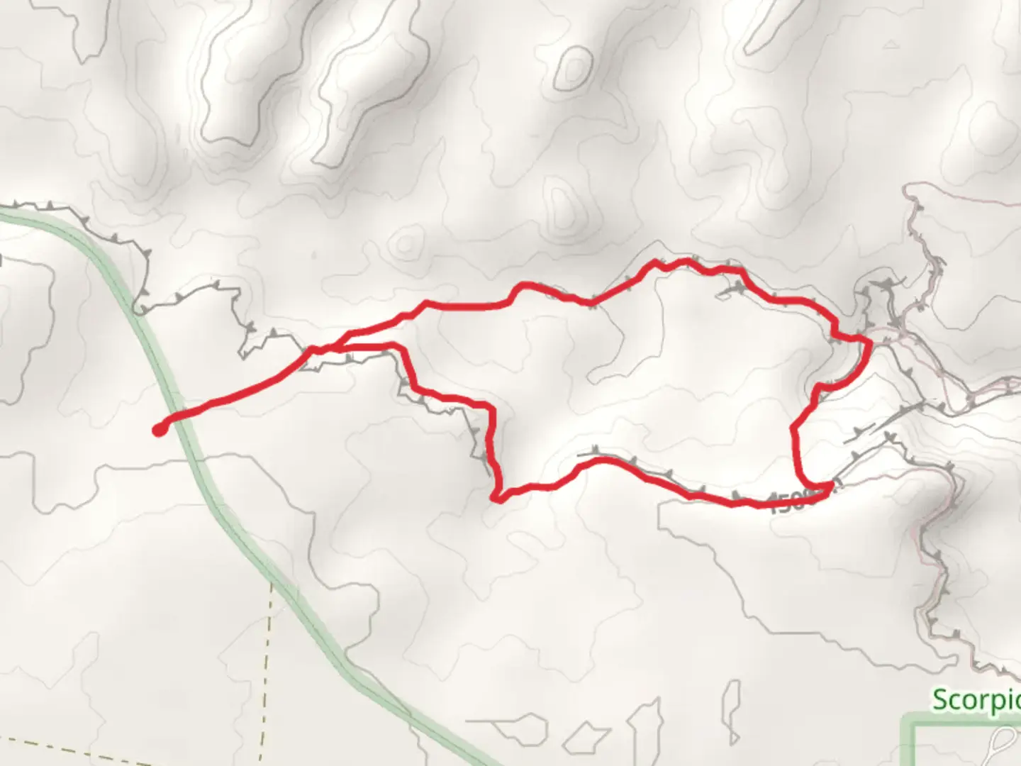
5.8 km
~1 hrs 29 min
204 m
Loop
“Embark on Utah's Upper and Lower Dry Fork Trails for a captivating 3.7-mile journey through history-etched canyons and breathtaking desert landscapes.”
The Upper Dry Fork Trail and Lower Dry Fork Trail loop is a moderately challenging hike located near Kane County, Utah, offering a blend of scenic views, geological wonders, and a touch of historical significance. Spanning approximately 6 kilometers (about 3.7 miles) with an elevation gain of around 200 meters (656 feet), this trail provides a diverse experience for hikers looking to explore the rugged beauty of the American Southwest.Getting to the TrailheadTo reach the trailhead, hikers can drive to the nearest significant landmark, the town of Kanab, Utah. From Kanab, take US-89 north for about 40 kilometers (25 miles) until you reach the signed turnoff for the Dry Fork area. A well-maintained dirt road leads to the trailhead parking area, suitable for most vehicles under normal conditions. Public transport options are limited in this remote area, so a personal vehicle is recommended.Navigating the TrailOnce at the trailhead, hikers can use the HiiKER app to navigate the loop. The trail begins with a descent into the Dry Fork of Coyote Gulch, where the landscape is characterized by Navajo Sandstone cliffs and a dry riverbed that occasionally flows after heavy rains. The initial descent is the most challenging part of the hike, requiring careful footing on the sandy and rocky terrain.Landmarks and Natural FeaturesAs you progress along the trail, you'll encounter a series of slot canyons, including Peek-a-boo, Spooky, and Brimstone Gulch. Peek-a-boo Gulch, about 1.6 kilometers (1 mile) from the trailhead, is known for its undulating walls and several arches. Spooky Gulch, roughly 3.2 kilometers (2 miles) into the hike, is aptly named for its narrow passageways that can be as tight as 30 centimeters (12 inches) wide.Brimstone Gulch, which can be accessed by continuing down the main Dry Fork wash, is often less crowded and offers a more secluded experience. The slot canyons provide a cool respite from the sun and a chance to marvel at the geological forces that have sculpted these formations over millennia.Flora and FaunaThe area is home to a variety of desert plants, including sagebrush, juniper, and cacti, as well as wildlife such as lizards, snakes, and the occasional desert fox. Birdwatchers may spot species like the peregrine falcon and the canyon wren.Historical SignificanceThe region around the Upper and Lower Dry Fork Trails is steeped in history, with the canyons having been used by ancestral Puebloans. Hikers may notice petroglyphs and other remnants of these ancient cultures, reminding us of the area's long-standing human presence.Preparation and SafetyDue to the remote nature of the trail and the potential for extreme weather conditions, it's essential to be well-prepared. Bring plenty of water, sun protection, and wear appropriate hiking shoes. Check the weather forecast before heading out, as flash flooding can be a danger in slot canyons. Always let someone know your hiking plans and expected return time.By following these guidelines and being prepared, hikers can enjoy a safe and memorable experience on the Upper Dry Fork Trail and Lower Dry Fork Trail loop, taking in the natural beauty and historical context of this unique area.

What to expect?
Activity types
Comments and Reviews
User comments, reviews and discussions about the Upper Dry Fork Trail and Lower Dry Fork Trail, Utah.
4.6
average rating out of 5
20 rating(s)