Download
Preview
Add to list
More
10.4 km
~2 hrs 45 min
398 m
Point-to-Point
“Embark on the Moab Rim Trail for stunning views, historical petroglyphs, and diverse landscapes over 10 km.”
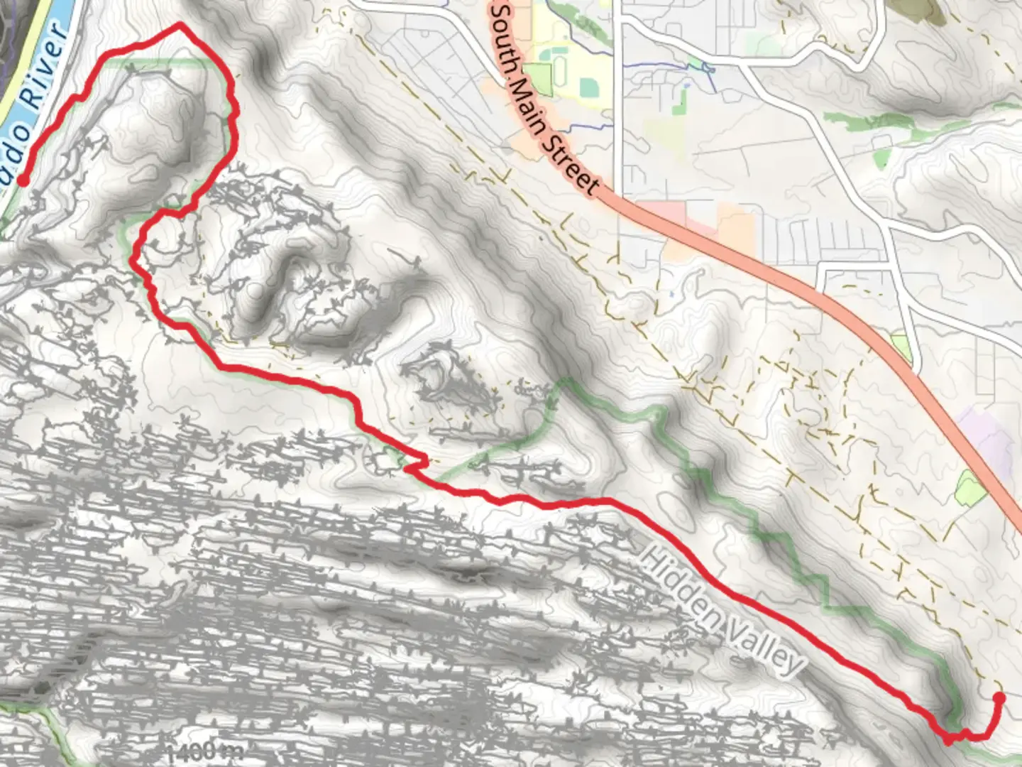
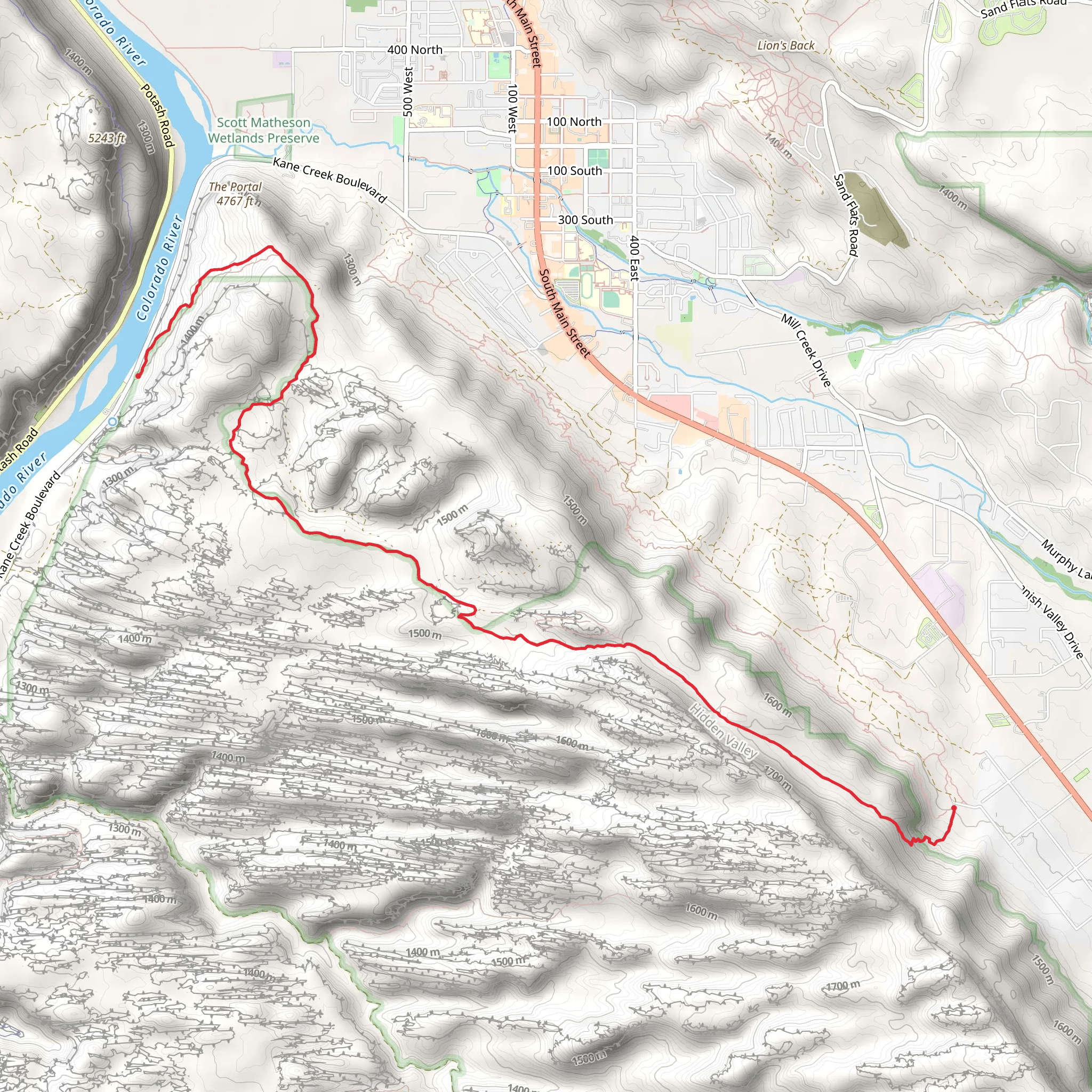
Starting near Grand County, Utah, the Moab Rim Trail Point to Point stretches approximately 10 km (6.2 miles) with an elevation gain of around 300 meters (984 feet). This trail is rated as medium difficulty and offers a variety of landscapes and experiences for hikers.
Getting There To reach the trailhead, you can drive or use public transport. If driving, head towards the Moab area and look for signs directing you to the Moab Rim Trailhead. The nearest significant landmark is the Moab Information Center, located at 25 E Center St, Moab, UT 84532. From there, it's a short drive to the trailhead. Public transport options include local shuttle services that can drop you off near the starting point.
Trail Overview The trail begins with a steep ascent, gaining elevation quickly as you make your way up the rim. The initial climb can be challenging, but the panoramic views of the Moab Valley and the Colorado River make it worthwhile. As you ascend, you'll encounter rocky terrain and slickrock sections, so sturdy hiking boots are recommended.
Key Landmarks and Sections - **First Kilometer (0.6 miles):** The trail starts with a steep climb, gaining about 150 meters (492 feet) in elevation. This section offers stunning views of the Moab Valley and the La Sal Mountains in the distance. - **Second Kilometer (0.6-1.2 miles):** The trail levels out slightly, providing a mix of slickrock and sandy paths. Keep an eye out for petroglyphs etched into the rocks, a testament to the area's rich Native American history. - **Third Kilometer (1.2-1.8 miles):** As you continue, you'll pass through a series of switchbacks. This section is less steep but still requires careful footing. The views of the Colorado River become more prominent here. - **Fourth Kilometer (1.8-2.4 miles):** The trail flattens out, offering a respite from the climb. This is a good spot to take a break and enjoy the scenery. Look for desert flora like yucca and prickly pear cactus. - **Fifth Kilometer (2.4-3 miles):** The trail descends slightly, leading you to a viewpoint overlooking the Moab Rim. This is one of the most photographed spots on the trail, offering a sweeping view of the surrounding landscape.
Wildlife and Nature The Moab Rim Trail is home to a variety of wildlife, including mule deer, lizards, and various bird species. Keep an eye out for golden eagles soaring above and listen for the calls of canyon wrens. The flora is typical of the high desert, with juniper trees, sagebrush, and various cacti dotting the landscape.
Historical Significance The area around the Moab Rim Trail has a rich history, with evidence of Native American habitation dating back thousands of years. The petroglyphs you'll see along the trail are remnants of the Ancestral Puebloans who once lived in the region. Additionally, the trail offers views of the Colorado River, a vital waterway that has shaped the history and development of the American Southwest.
Navigation For navigation, it's highly recommended to use the HiiKER app, which provides detailed maps and real-time updates. The trail is well-marked, but having a reliable navigation tool can enhance your hiking experience and ensure you stay on track.
Final Stretch As you approach the end of the trail, the descent can be steep and rocky, so take your time and watch your footing. The trail concludes near the Colorado River, offering a serene spot to rest and reflect on your hike.
This trail offers a mix of challenging climbs, breathtaking views, and historical landmarks, making it a rewarding experience for any hiker.
What to expect?
Activity types
Comments and Reviews
User comments, reviews and discussions about the Moab Rim Trail Point to Point, Utah.
4.6
average rating out of 5
10 rating(s)
