Download
Preview
Add to list
More
21.4 km
~1 day 0 hrs
802 m
Loop
“Experience the Moab Rim Trail's stunning vistas, ancient petroglyphs, and diverse terrain on a moderately challenging hike.”
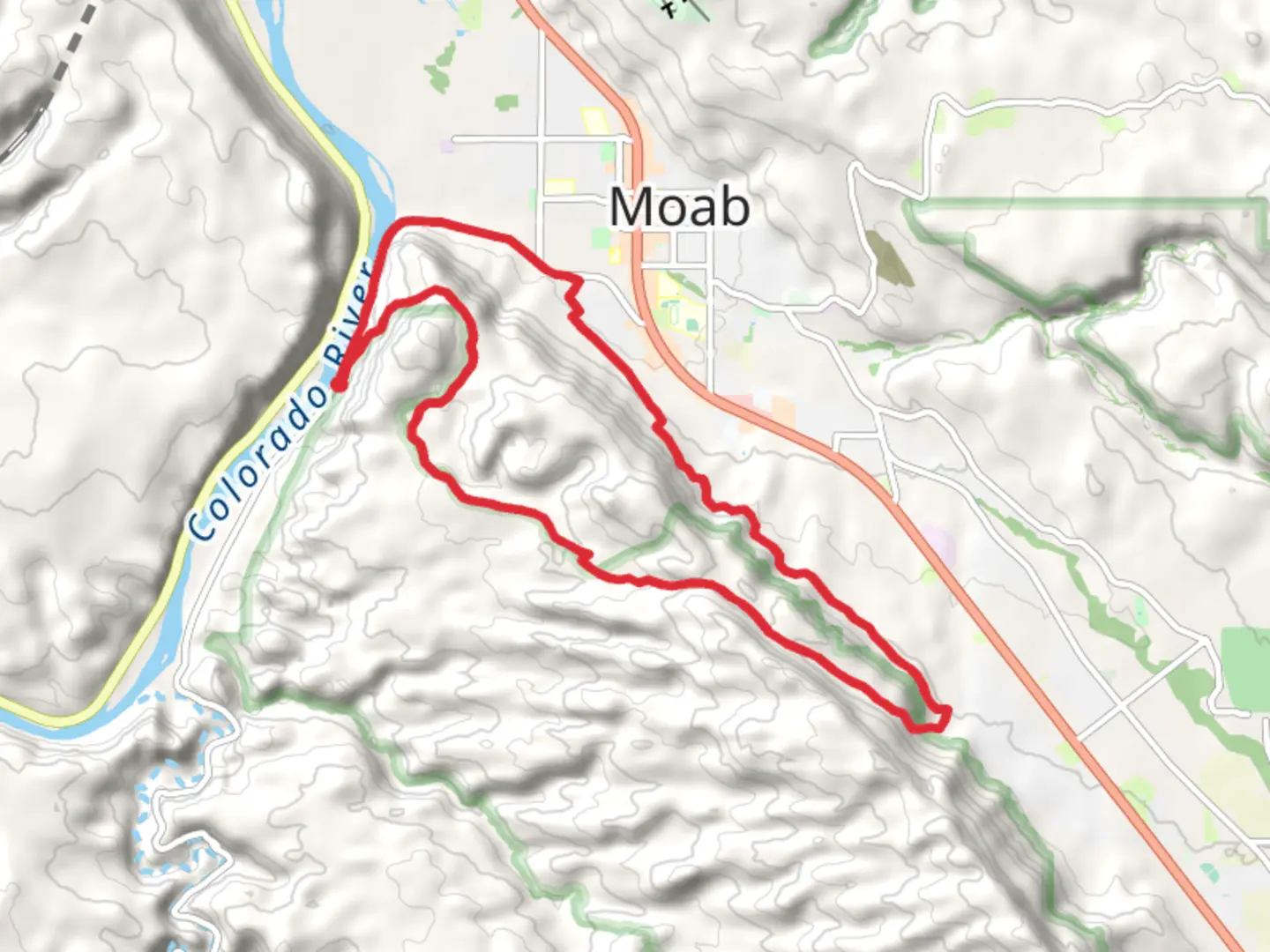
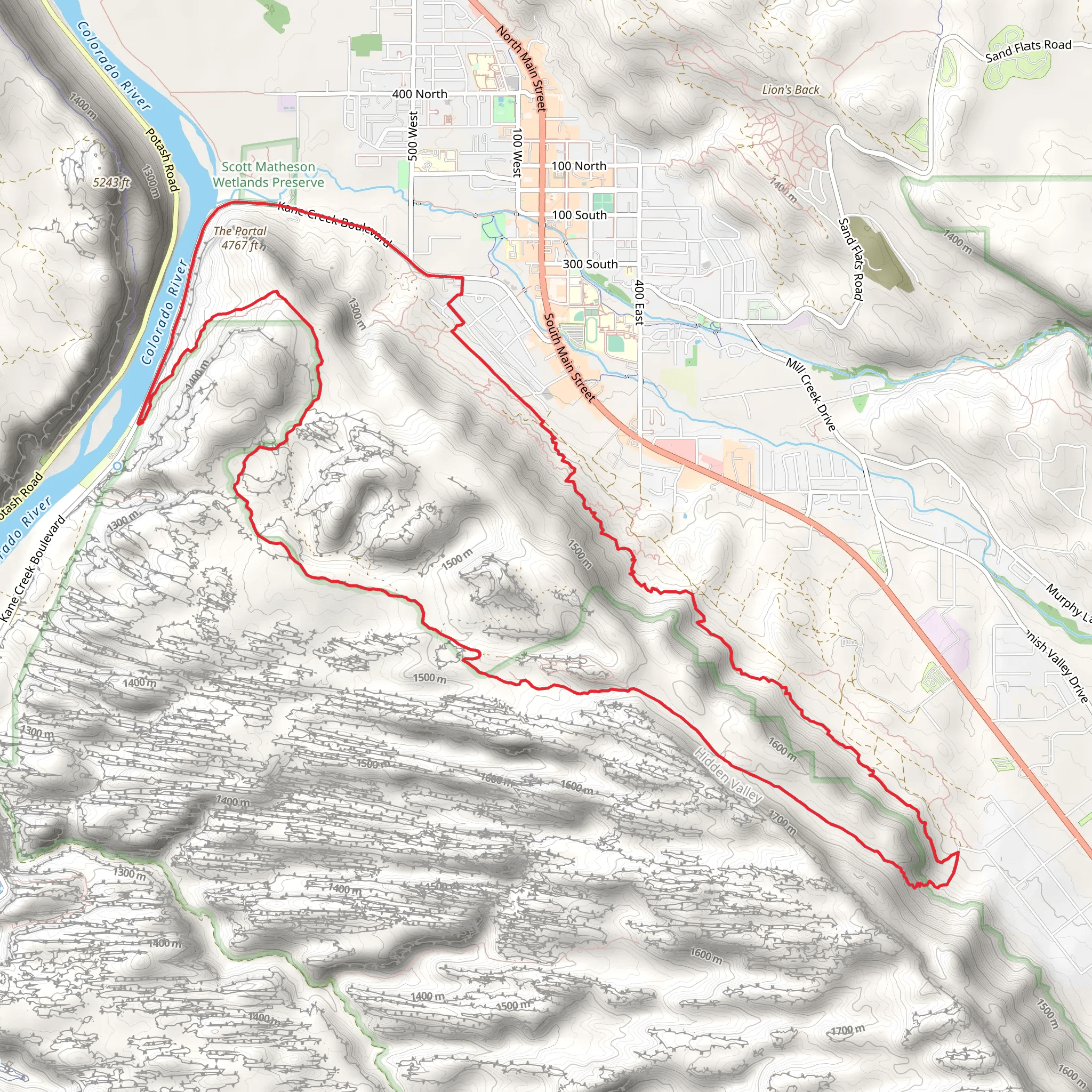
Starting near Grand County, Utah, the Moab Rim Trail, Hidden Valley Trail, and Pipe Dream Loop offer a diverse and engaging hiking experience. This loop trail spans approximately 21 kilometers (13 miles) with an elevation gain of around 800 meters (2,625 feet), making it a moderately challenging adventure for most hikers.
Getting There To reach the trailhead, you can drive or use public transportation. If driving, head towards the Moab Rim Trailhead, located near the intersection of Kane Creek Boulevard and U.S. Highway 191. For those using public transport, the nearest significant landmark is the Moab Information Center, from where you can catch a local shuttle or taxi to the trailhead.
Trail Overview The trail begins with a steep ascent up the Moab Rim, offering panoramic views of the Colorado River and the surrounding red rock formations. This initial climb is one of the most strenuous parts of the hike, gaining approximately 300 meters (984 feet) in the first 2 kilometers (1.2 miles). As you ascend, keep an eye out for petroglyphs etched into the rock faces, remnants of the ancient Native American cultures that once inhabited this region.
Hidden Valley Trail After conquering the Moab Rim, the trail levels out as you enter Hidden Valley. This section is a serene contrast to the rugged climb, featuring a relatively flat path surrounded by towering sandstone cliffs. The valley is home to a variety of desert flora, including juniper trees, sagebrush, and prickly pear cacti. Wildlife sightings are common, with lizards, jackrabbits, and occasionally, desert bighorn sheep making appearances. This part of the trail covers about 5 kilometers (3.1 miles) with minimal elevation change.
Pipe Dream Loop Transitioning from Hidden Valley to the Pipe Dream Loop, the trail begins to undulate, offering a mix of gentle climbs and descents. This section is approximately 14 kilometers (8.7 miles) long and features a cumulative elevation gain of around 500 meters (1,640 feet). The Pipe Dream Loop is known for its stunning vistas of the La Sal Mountains and the expansive Moab Valley. Along the way, you'll encounter several viewpoints perfect for taking a break and soaking in the scenery.
Navigation and Safety Given the trail's complexity and varying terrain, it's advisable to use a reliable navigation tool like HiiKER to stay on course. The trail is well-marked, but having a digital map can provide extra assurance, especially in less trafficked areas.
Historical Significance The region is steeped in history, with evidence of human habitation dating back thousands of years. The petroglyphs along the Moab Rim are a testament to the area's rich cultural heritage. Additionally, the trail passes near several old mining sites, remnants of the uranium boom that brought prospectors to the area in the mid-20th century.
Final Stretch As you complete the loop, the trail descends back towards the trailhead, offering a final opportunity to enjoy the breathtaking landscapes that define this part of Utah. The descent is gradual, allowing for a more relaxed end to your hike.
Preparation Tips Ensure you carry plenty of water, as the desert environment can be extremely dry and hot, especially in the summer months. Wear sturdy hiking boots to navigate the rocky terrain, and consider bringing trekking poles for added stability during the steeper sections. Sunscreen, a hat, and sunglasses are also essential to protect against the intense sun.
This trail offers a rewarding mix of natural beauty, historical intrigue, and physical challenge, making it a must-do for any avid hiker visiting the Moab area.
What to expect?
Activity types
Comments and Reviews
User comments, reviews and discussions about the Moab Rim Trail, Hidden Valley Trail and Pipe Dream Loop, Utah.
4.5
average rating out of 5
12 rating(s)
