Download
Preview
Add to list
More
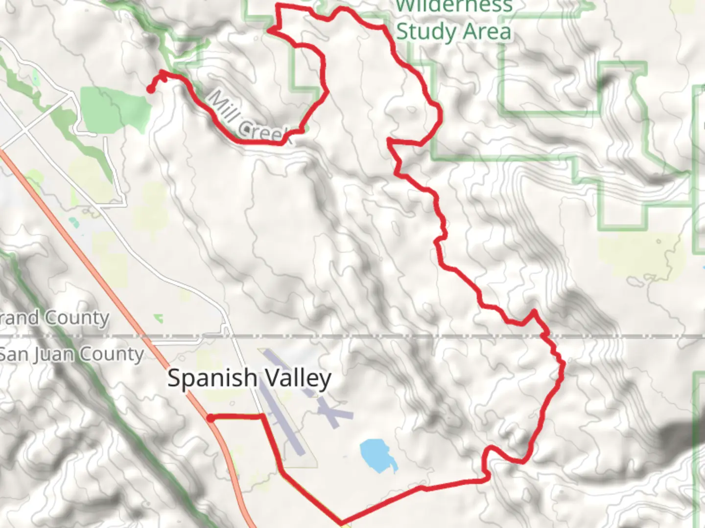
28.7 km
~1 day 2 hrs
928 m
Point-to-Point
“The Mill Creek Walk offers a diverse, scenic journey through Utah's lush creeks, rugged canyons, and historic landmarks.”
Starting near Grand County, Utah, the Mill Creek Walk is a point-to-point trail that spans approximately 29 kilometers (18 miles) with an elevation gain of around 900 meters (2,950 feet). This medium-difficulty trail offers a diverse range of landscapes, from lush creekside paths to rugged canyon terrain, making it a rewarding experience for hikers of varying skill levels.### Getting There To reach the trailhead, you can drive or use public transportation. If you're driving, head towards Grand County, Utah, and look for parking near the Mill Creek Canyon Wilderness Study Area. For those using public transport, the nearest significant landmark is the town of Moab, Utah. From Moab, you can take a local shuttle service or a taxi to the trailhead, which is approximately a 15-minute drive away.### Trail Overview The trail begins with a gentle ascent along Mill Creek, where you'll be greeted by the soothing sounds of flowing water and the sight of lush vegetation. This initial section is relatively easy, making it a great warm-up for the more challenging parts ahead. As you progress, the trail becomes steeper and rockier, requiring careful footing and a good level of fitness.### Key Landmarks and Points of Interest - Mill Creek Waterfall (Approx. 5 km / 3.1 miles in): One of the first major landmarks you'll encounter is the Mill Creek Waterfall. This picturesque spot is perfect for a short break and some photography. The waterfall is surrounded by native flora, including cottonwood trees and various wildflowers, depending on the season.
- Petroglyphs (Approx. 10 km / 6.2 miles in): As you continue, keep an eye out for ancient petroglyphs etched into the canyon walls. These rock carvings are a testament to the region's rich Native American history and offer a fascinating glimpse into the past.- Hidden Valley (Approx. 15 km / 9.3 miles in): Midway through the hike, you'll reach Hidden Valley, a serene and secluded area that provides a stark contrast to the rugged canyon terrain. This is an excellent spot for a longer rest or even a picnic.### Wildlife and Nature The Mill Creek Walk is home to a variety of wildlife, including mule deer, foxes, and numerous bird species such as hawks and eagles. The diverse ecosystem also supports a range of plant life, from desert shrubs to riparian vegetation along the creek. Be sure to carry a camera and binoculars if you're interested in birdwatching or wildlife photography.### Navigation and Safety Given the trail's varying terrain, it's advisable to use a reliable navigation tool like HiiKER to stay on track. The trail is well-marked, but certain sections can be confusing, especially where the path intersects with other trails or natural features. Always carry a map and a compass as a backup.### Historical Significance The Mill Creek area has a rich history, with evidence of human habitation dating back thousands of years. The petroglyphs along the trail are a significant highlight, offering insights into the lives of the Native American tribes who once inhabited the region. Additionally, the trail passes through areas that were historically used for cattle grazing and mining, adding another layer of historical context to your hike.### Final Stretch As you approach the end of the trail, the terrain gradually levels out, offering a more relaxed finish to your hike. The final section takes you through a scenic canyon before emerging near the endpoint, where you can arrange for a pickup or shuttle back to your starting point.Whether you're a seasoned hiker or a nature enthusiast, the Mill Creek Walk offers a captivating journey through some of Utah's most stunning landscapes.

What to expect?
Comments and Reviews
User comments, reviews and discussions about the Mill Creek Walk, Utah.
4.48
average rating out of 5
23 rating(s)