Download
Preview
Add to list
More
1.1 km
~24 min
111 m
Loop
“Discover geological wonders and rich natural beauty on the captivating Losee Canyon Arches Loop Trail.”
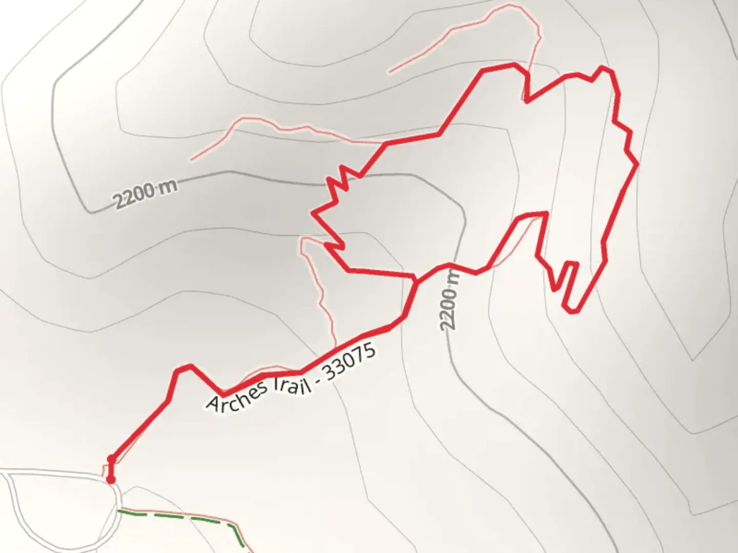
Starting near Garfield County, Utah, the Losee Canyon Arches Loop Trail offers a captivating 1 km (0.62 miles) journey through a landscape rich in geological wonders and natural beauty. With an elevation gain of approximately 100 meters (328 feet), this loop trail is rated as medium in difficulty, making it accessible for most hikers with a moderate level of fitness.### Getting There To reach the trailhead, you can drive to the Losee Canyon Trailhead, located off of Bryce Woodlands Drive. If you're using public transport, the nearest major hub is Bryce Canyon City. From there, you can arrange for a taxi or shuttle service to take you to the trailhead. Ensure you have a reliable navigation tool like HiiKER to guide you to the starting point.### Trail Highlights As you embark on the trail, you'll immediately notice the striking red rock formations that define the region. The trail meanders through Losee Canyon, offering a variety of natural arches and rock formations that are a photographer's dream. The first significant landmark is the Losee Canyon Arch, located approximately 0.3 km (0.2 miles) from the trailhead. This natural arch is a stunning example of the erosive forces that have shaped the landscape over millennia.### Flora and Fauna The trail is home to a diverse range of plant and animal life. Keep an eye out for pinyon pines and juniper trees, which are common in this area. Wildlife enthusiasts might spot mule deer, jackrabbits, and a variety of bird species, including the majestic golden eagle. The best times for wildlife viewing are early morning and late afternoon.### Geological Features The trail's elevation gain of 100 meters (328 feet) provides ample opportunities to appreciate the geological history of the region. The rock layers visible along the trail date back millions of years, offering a window into the Earth's past. The natural arches and hoodoos are particularly fascinating, formed by the relentless forces of wind and water erosion.### Navigation and Safety Given the trail's moderate difficulty, it's essential to come prepared. Wear sturdy hiking boots and bring plenty of water, especially during the hotter months. The trail is well-marked, but having a navigation tool like HiiKER can be invaluable for ensuring you stay on course. Be mindful of the weather, as conditions can change rapidly in this region.### Historical Significance The area around Losee Canyon has a rich history, with evidence of Native American habitation dating back thousands of years. The Paiute people, who once roamed these lands, left behind petroglyphs and other artifacts that offer a glimpse into their way of life. While hiking, take a moment to reflect on the historical significance of the land and its original inhabitants.### Final Stretch As you complete the loop, you'll return to the trailhead, having experienced a microcosm of the natural beauty and historical richness that Garfield County has to offer. The Losee Canyon Arches Loop Trail may be short, but it packs a punch with its diverse landscapes and fascinating geological features.

What to expect?
Activity types
Comments and Reviews
User comments, reviews and discussions about the Losee Canyon Arches Loop Trail, Utah.
4.26
average rating out of 5
19 rating(s)