Download
Preview
Add to list
More
5.1 km
~1 hrs 11 min
108 m
Loop
“Explore the Buffalo Head and Landslide Loop: a 5 km, medium-difficulty trail rich in natural beauty and history.”
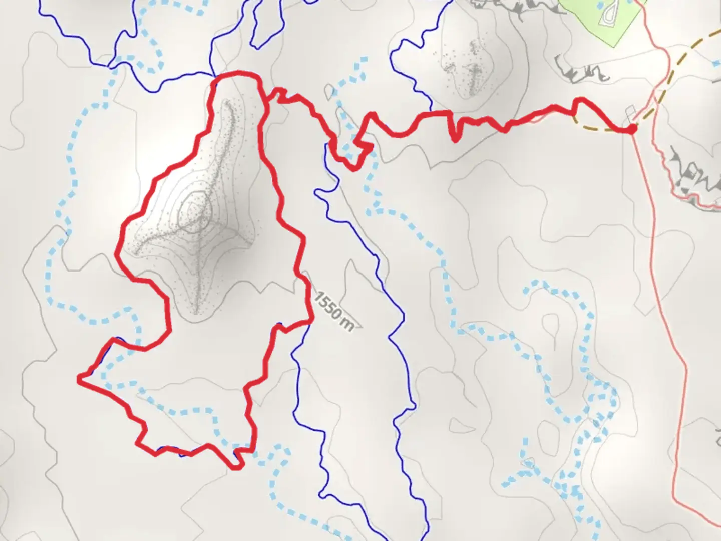
Starting your adventure near Emery County, Utah, the Buffalo Head and Landslide Loop is a captivating 5 km (3.1 miles) trail with an elevation gain of approximately 100 meters (328 feet). This loop trail is rated as medium difficulty, making it suitable for moderately experienced hikers.### Getting There To reach the trailhead, you can drive or use public transportation. If you're driving, head towards the nearest significant landmark, which is the town of Castle Dale. From Castle Dale, take UT-10 S and follow the signs to the trailhead. For those using public transport, the nearest bus stop is in Castle Dale, from where you can arrange a taxi or rideshare to the trailhead.### Trail Overview The trail begins with a gentle ascent, allowing you to ease into the hike. As you progress, you'll encounter a mix of terrains, including rocky paths and dirt trails. The initial 1 km (0.6 miles) offers a gradual climb of about 30 meters (98 feet), providing a good warm-up for the more challenging sections ahead.### Significant Landmarks and Nature One of the first landmarks you'll come across is the Buffalo Head Rock Formation, located approximately 1.5 km (0.9 miles) into the hike. This unique geological feature resembles the head of a buffalo and offers a great spot for photos. Continuing along the trail, you'll reach the Landslide Area around the 3 km (1.9 miles) mark. This section is particularly fascinating due to the visible remnants of a historical landslide, offering a glimpse into the geological history of the region.### Flora and Fauna The trail is rich in diverse plant life, including sagebrush, juniper, and various wildflowers, especially vibrant in the spring and early summer. Wildlife enthusiasts might spot mule deer, jackrabbits, and a variety of bird species such as hawks and eagles soaring above.### Historical Significance The area around Emery County has a rich history, with evidence of Native American habitation dating back thousands of years. Petroglyphs and ancient artifacts have been discovered in nearby regions, adding a layer of historical intrigue to your hike. The landslide area itself is a testament to the dynamic geological processes that have shaped the landscape over millennia.### Navigation and Safety Given the varied terrain, it's advisable to use a reliable navigation tool like HiiKER to stay on track. The trail is well-marked, but having a digital map can provide additional peace of mind. Make sure to carry sufficient water, especially during the hotter months, and wear sturdy hiking boots to navigate the rocky sections safely.### Final Stretch The last 1 km (0.6 miles) of the loop descends gradually, bringing you back to the trailhead. This section offers panoramic views of the surrounding landscape, making it a perfect way to end your hike. Whether you're a seasoned hiker or someone looking to explore the natural beauty and historical richness of Emery County, the Buffalo Head and Landslide Loop offers a rewarding experience.
What to expect?
Activity types
Comments and Reviews
User comments, reviews and discussions about the Buffalo Head and Landslide Loop, Utah.
4.33
average rating out of 5
9 rating(s)
