Download
Preview
Add to list
More
14.3 km
~1 day 0 hrs
1621 m
Out and Back
“Embark on the Thurston Peak Trail for stunning views, diverse wildlife, and rich historical insights.”
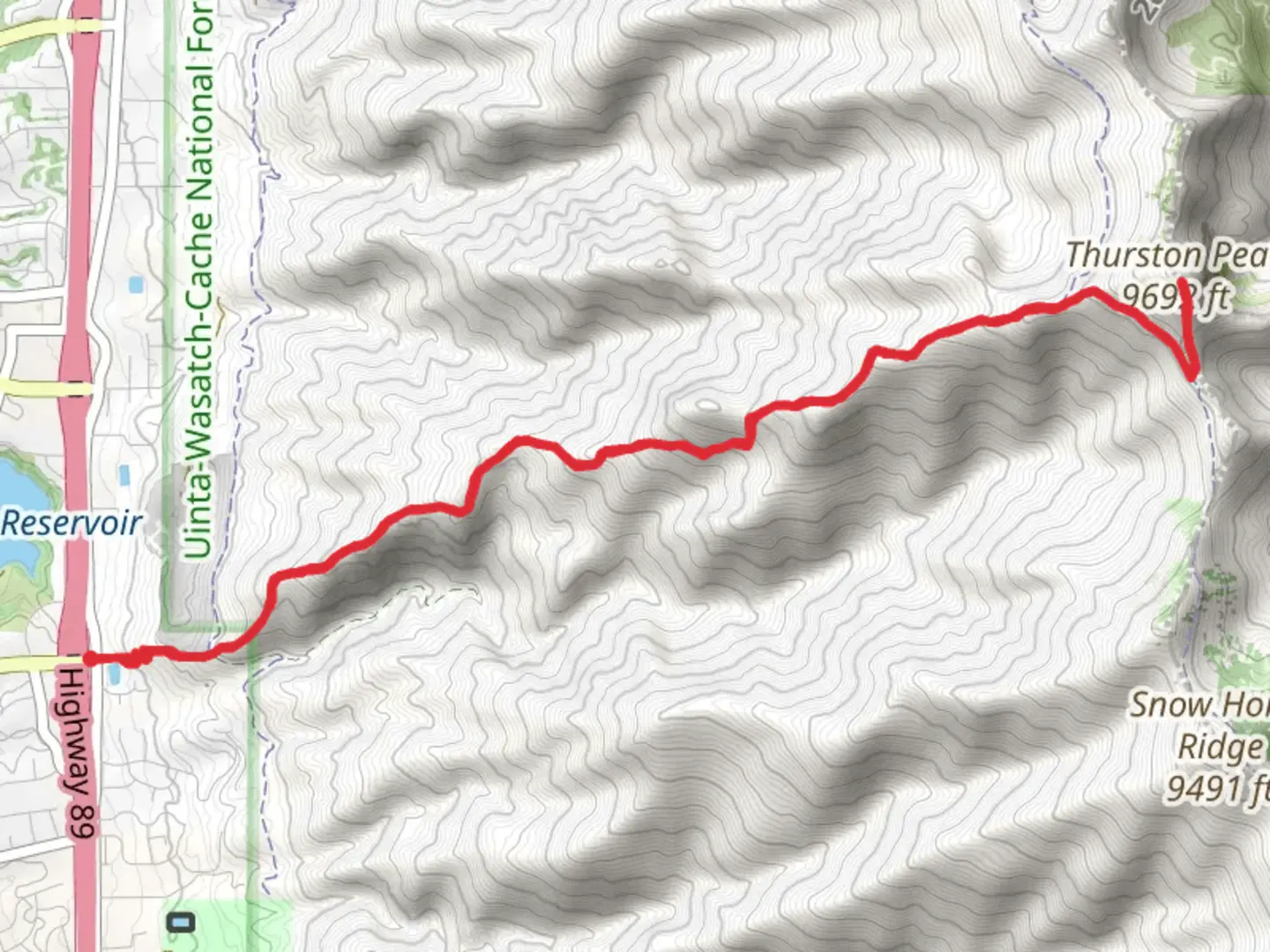
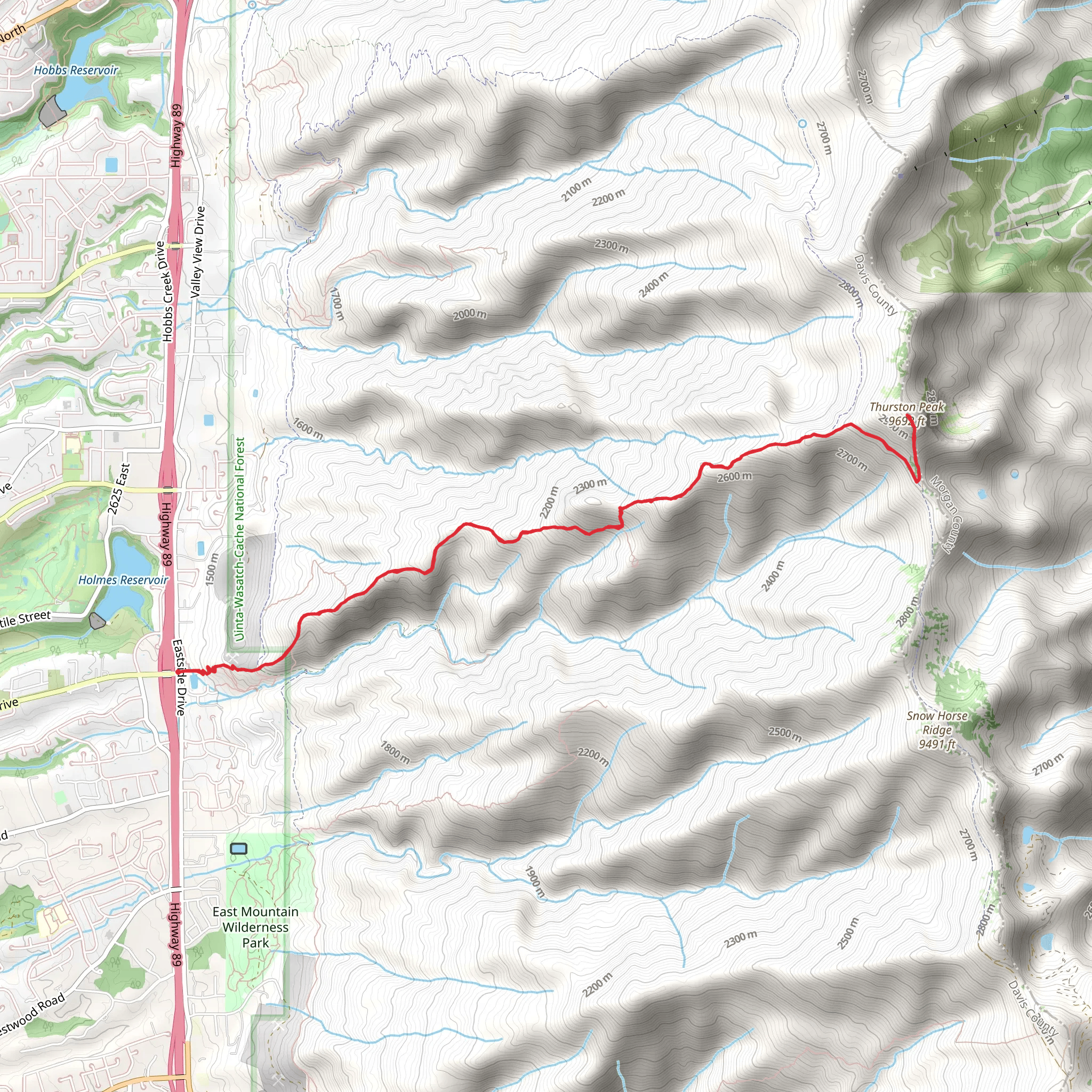
Starting near Davis County, Utah, the Thurston Peak Trail and Adams Canyon North Ridge is an invigorating out-and-back hike that spans approximately 14 kilometers (8.7 miles) with an elevation gain of around 1600 meters (5,249 feet). This trail offers a medium difficulty rating, making it suitable for hikers with some experience and a good level of fitness.
Getting There To reach the trailhead, you can drive or use public transportation. If driving, head towards the nearest significant landmark, the Layton Hills Mall, located at 1201 N Hill Field Rd, Layton, UT 84041. From there, it's a short drive to the trailhead. For those using public transport, take a bus or train to Layton Station, then use a local taxi or rideshare service to reach the trailhead.
Trail Overview The trail begins with a steady ascent through a mix of scrub oak and pine trees, providing a shaded start to your hike. As you climb, you'll encounter several switchbacks that help manage the steep elevation gain. Around the 2-kilometer (1.2-mile) mark, you'll reach a clearing that offers your first panoramic views of the Great Salt Lake and the surrounding valleys.
Significant Landmarks At approximately 4 kilometers (2.5 miles) into the hike, you'll come across a notable landmark, the Adams Canyon Waterfall. This is a great spot to take a break and enjoy the cascading water, especially during the spring and early summer when the flow is strongest.
Continuing on, the trail becomes more rugged and exposed, so be prepared for a more challenging ascent. Around the 7-kilometer (4.3-mile) mark, you'll reach the North Ridge of Adams Canyon. This section offers stunning views of the Wasatch Range and is a prime spot for photography.
Flora and Fauna The trail is rich in diverse plant life, including wildflowers like Indian paintbrush and lupine during the spring and summer months. Wildlife is also abundant; keep an eye out for mule deer, red foxes, and a variety of bird species, including hawks and eagles.
Historical Significance The region has a rich history, with Native American tribes such as the Shoshone and Ute having inhabited the area for centuries. The trail itself was used by early settlers and pioneers as a route through the Wasatch Range. Historical markers along the trail provide insights into the area's past, making this hike not just a physical journey but a historical one as well.
Navigation and Safety Given the trail's elevation gain and exposed sections, it's crucial to be well-prepared. Use the HiiKER app for accurate navigation and real-time updates on trail conditions. Ensure you have adequate water, snacks, and layers of clothing to adapt to changing weather conditions. Trekking poles can also be beneficial for the steeper sections.
Final Ascent The final push to Thurston Peak is the most challenging part of the hike. The trail narrows and becomes rockier, requiring careful footing. Upon reaching the summit, you'll be rewarded with 360-degree views that stretch from the Great Salt Lake to the peaks of the Wasatch Range. This is a perfect spot to rest, take photos, and enjoy the sense of accomplishment before beginning your descent.
Descent The return journey follows the same path, allowing you to revisit the scenic spots and landmarks you encountered on the way up. Be mindful of your footing, especially on the steeper sections, and take your time to ensure a safe descent.
This trail offers a blend of natural beauty, historical significance, and physical challenge, making it a rewarding experience for those who undertake it.
What to expect?
Activity types
Comments and Reviews
User comments, reviews and discussions about the Thurston Peak Trail and Adams Canyon North Ridge, Utah.
4.56
average rating out of 5
16 rating(s)
