15.5 km
~1 day 0 hrs
1183 m
“The Parrish Creek Trail offers a 16-kilometer hike with stunning vistas, historical intrigue, and physical challenges.”
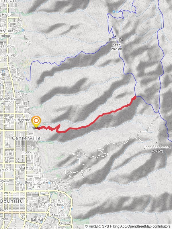
Starting near Davis County, Utah, the Parrish Creek Trail is an invigorating out-and-back hike that spans approximately 16 kilometers (10 miles) with an elevation gain of around 1100 meters (3600 feet). This trail is rated as medium difficulty, making it suitable for hikers with some experience and a good level of fitness.### Getting There
To reach the trailhead, you can drive or use public transportation. If driving, head towards the nearest known address, which is the Parrish Creek Trailhead Parking Lot, located near the intersection of Parrish Lane and 100 East in Centerville, Utah. For those using public transport, take a bus to the Centerville area and then a short taxi or rideshare to the trailhead.### Trail Overview
The trail begins with a moderate ascent through a shaded forest, offering a cool and refreshing start. As you progress, the path becomes steeper and rockier, so sturdy hiking boots are recommended. The first significant landmark you'll encounter is a small waterfall about 2 kilometers (1.2 miles) in, which is a great spot for a quick rest and some photos.### Mid-Trail Highlights
Around the 4-kilometer (2.5-mile) mark, the trail opens up to a series of switchbacks that provide stunning views of the surrounding valleys and the Great Salt Lake in the distance. This section is particularly challenging due to the steep incline, but the panoramic vistas are well worth the effort.### Flora and Fauna
The trail is rich in diverse plant life, including wildflowers in the spring and summer months. Keep an eye out for local wildlife such as deer, squirrels, and various bird species. It's also not uncommon to spot a hawk or eagle soaring above the ridges.### Historical Significance
The Parrish Creek area has historical significance dating back to the early settlers of Utah. The trail itself follows routes that were once used by Native American tribes and later by pioneers. Along the way, you might notice remnants of old mining operations, adding a touch of history to your hike.### Final Ascent
The final stretch of the trail is the most demanding, with a series of steep climbs leading to the summit. This section covers the last 3 kilometers (1.8 miles) and gains the majority of the elevation. Upon reaching the top, you'll be rewarded with breathtaking views of the Wasatch Range and the valley below.### Navigation
For navigation, it's highly recommended to use HiiKER, which provides detailed maps and real-time updates to ensure you stay on the right path. The trail is well-marked, but having a reliable navigation tool can enhance your hiking experience.### Return Journey
The return journey follows the same path back to the trailhead, offering a chance to revisit some of the beautiful spots you passed earlier. Make sure to pace yourself on the descent, as the steep sections can be tough on the knees.This trail offers a mix of natural beauty, historical intrigue, and physical challenge, making it a rewarding experience for those who take it on.
Reviews
User comments, reviews and discussions about the Parrish Creek Trail, Utah.
5.0
average rating out of 5
14 rating(s)
Loading reviews...


