Download
Preview
Add to list
More
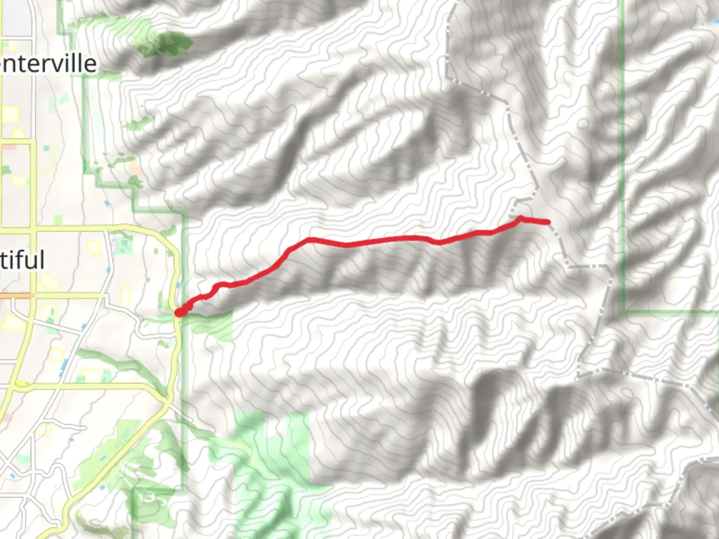
13.4 km
~4 hrs 31 min
1100 m
Out and Back
“Experience Utah's North Holbrook Route: a scenic, moderately challenging trail with stunning views and rich history.”
Starting near Davis County, Utah, the North Holbrook Route is an invigorating out-and-back trail that spans approximately 13 kilometers (8 miles) with an elevation gain of around 1100 meters (3609 feet). This trail is rated as medium difficulty, making it suitable for hikers with some experience and a good level of fitness.
Getting There
To reach the trailhead, you can drive or use public transportation. If driving, head towards Davis County, Utah, and look for parking near the Holbrook Canyon Trailhead, which is the nearest significant landmark. For those using public transport, the closest bus stop is in Bountiful, Utah. From there, you may need to arrange a taxi or rideshare to the trailhead, as public transport options directly to the trailhead are limited.
Trail Overview
The trail begins with a gradual ascent through a lush forested area, providing ample shade and a cool environment, especially during the summer months. The initial 2 kilometers (1.2 miles) are relatively gentle, with an elevation gain of about 200 meters (656 feet), making it a good warm-up for the more challenging sections ahead.
Key Landmarks and Points of Interest
#### Holbrook Canyon
As you progress, you'll enter Holbrook Canyon, a picturesque area known for its diverse flora and fauna. Keep an eye out for mule deer and various bird species that inhabit this region. The canyon walls are adorned with vibrant wildflowers in the spring and early summer, adding a splash of color to your hike.
#### Waterfalls
Around the 4-kilometer (2.5-mile) mark, you'll encounter a series of small waterfalls. These are particularly impressive after a period of rain or during the spring melt. The sound of cascading water provides a serene backdrop as you continue your ascent.
#### Scenic Overlook
At approximately 6 kilometers (3.7 miles) into the hike, you'll reach a scenic overlook that offers panoramic views of the surrounding valleys and distant mountain ranges. This is a great spot to take a break, hydrate, and snap some photos.
Elevation Gain and Terrain
The trail becomes steeper after the scenic overlook, with the next 3 kilometers (1.9 miles) involving a more strenuous climb. The terrain here is rocky and uneven, so sturdy hiking boots are recommended. The elevation gain in this section is about 500 meters (1640 feet), making it the most challenging part of the hike.
Historical Significance
The North Holbrook Route traverses areas that were historically significant to the indigenous peoples of the region. Artifacts and ancient petroglyphs have been found in nearby areas, indicating that this trail may have been used for centuries. Additionally, the trail passes through sections that were once part of early settler routes in the 19th century.
Final Ascent and Return
The final stretch to the turnaround point involves a series of switchbacks that lead to a high ridge. Upon reaching the top, you'll be rewarded with breathtaking views of the Wasatch Range. After taking in the scenery, retrace your steps back to the trailhead, enjoying the downhill sections that offer a different perspective of the landscape.
Navigation
For navigation, it's highly recommended to use the HiiKER app, which provides detailed maps and real-time updates. This will help ensure you stay on the correct path and can track your progress throughout the hike.
Prepare adequately with plenty of water, snacks, and appropriate clothing for changing weather conditions. The North Holbrook Route offers a rewarding experience with its natural beauty, historical significance, and challenging terrain.

What to expect?
Activity types
Comments and Reviews
User comments, reviews and discussions about the North Holbrook Route, Utah.
4.46
average rating out of 5
13 rating(s)