Bountiful Peak Trail
13.6 km
~1 day 0 hrs
1399 m
“Embark on the Bountiful Peak Trail for a challenging, scenic hike rich with wildlife and history.”
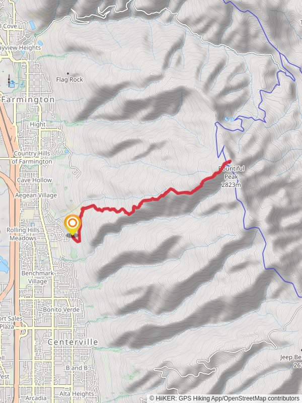
Starting your adventure near Davis County, Utah, the Bountiful Peak Trail offers a rewarding out-and-back hike that spans approximately 14 kilometers (around 8.7 miles) with an elevation gain of about 1300 meters (4265 feet). This trail is rated as medium difficulty, making it suitable for moderately experienced hikers looking for a challenge.
### Getting There To reach the trailhead, you can drive or use public transportation. If driving, head towards the nearest significant landmark, Mueller Park Picnic Area, located at 900 Mueller Park Rd, Bountiful, UT 84010. From there, follow the signs to the trailhead. For those using public transport, take a bus to Bountiful and then a taxi or rideshare service to the picnic area.
### Trail Overview The trail begins with a steady ascent through a dense forest of pine and aspen trees. The initial 2 kilometers (1.2 miles) are relatively gentle, allowing you to acclimate to the elevation gain. As you progress, the trail becomes steeper, with switchbacks that offer occasional breaks in the tree cover, providing stunning views of the valley below.
### Significant Landmarks and Points of Interest At around the 4-kilometer (2.5-mile) mark, you'll encounter a small, serene meadow. This is an excellent spot for a short break and to enjoy the surrounding wildflowers, especially vibrant in late spring and early summer. Continuing on, the trail becomes rockier and more challenging, requiring careful footing.
### Wildlife and Nature The Bountiful Peak Trail is home to a variety of wildlife. Keep an eye out for mule deer, which are commonly seen in the area. Birdwatchers will also appreciate the diverse avian population, including hawks and woodpeckers. The flora changes as you ascend, with lower elevations dominated by oak and maple trees, transitioning to conifers as you climb higher.
### Historical Significance This region has a rich history, with the trail itself being used by early settlers and Native American tribes. The area around Bountiful Peak was historically significant for its natural resources, including timber and water, which were vital for the early communities in Davis County.
### Final Ascent and Peak The final push to Bountiful Peak is the most strenuous part of the hike, with a steep incline over the last 2 kilometers (1.2 miles). However, the effort is well worth it. Upon reaching the summit, you'll be rewarded with panoramic views of the Great Salt Lake, the Wasatch Range, and the surrounding valleys. This is a perfect spot for a well-deserved rest and some memorable photos.
### Navigation and Safety Given the trail's elevation gain and varying terrain, it's advisable to use a reliable navigation tool like HiiKER to stay on track. The trail is well-marked, but weather conditions can change rapidly, especially at higher elevations. Always check the weather forecast before heading out and bring appropriate gear, including layers, plenty of water, and snacks.
### Return Journey The descent follows the same path back to the trailhead. While descending is generally easier, the rocky sections can be tricky, so take your time to ensure a safe return.
This hike offers a mix of natural beauty, wildlife, and historical context, making it a fulfilling experience for those prepared for its challenges.
Reviews
User comments, reviews and discussions about the Bountiful Peak Trail, Utah.
5.0
average rating out of 5
9 rating(s)


