Download
Preview
Add to list
More
10.7 km
~4 hrs 14 min
1259 m
Out and Back
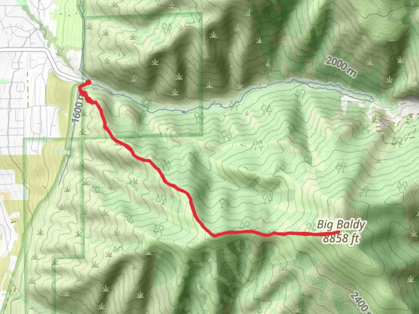
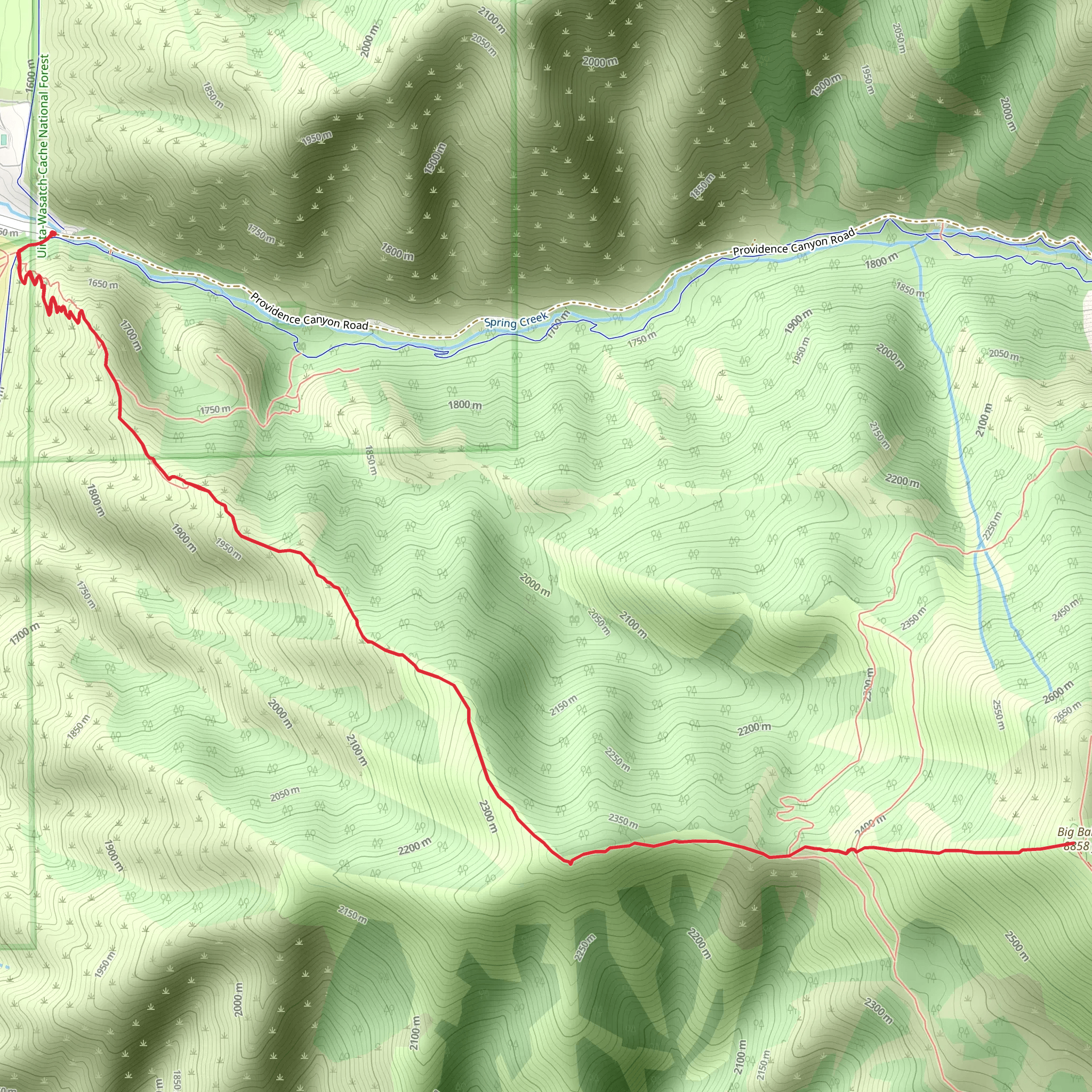
“Experience breathtaking views and rich history on this challenging 11-kilometer trail near Cache County, Utah.”
Starting near Cache County, Utah, this out-and-back trail spans approximately 11 kilometers (around 6.8 miles) with an elevation gain of about 1200 meters (3937 feet). The trailhead is accessible by car, and the nearest significant landmark is the Tony Grove Lake, which is a popular spot for both locals and visitors. If you're using public transport, the closest major town is Logan, Utah, from where you can take a taxi or rideshare service to reach the trailhead.
Trail Overview
The trail begins with a moderate ascent through a dense forest of aspen and pine trees. Early on, you'll encounter a series of switchbacks that help to manage the steep elevation gain. The first 2 kilometers (1.2 miles) will see you climbing steadily, gaining about 300 meters (984 feet) in elevation. This section is shaded and offers a cool respite, especially during the summer months.
Mid-Trail Highlights
Around the 3-kilometer (1.9-mile) mark, the forest begins to thin out, and you'll start to get glimpses of the surrounding mountains. This is a great spot to take a short break and hydrate. As you continue, the trail opens up into a meadow filled with wildflowers during the spring and summer. Keep an eye out for mule deer and the occasional moose, which are known to frequent this area.
At approximately 5 kilometers (3.1 miles), you'll reach a plateau that offers panoramic views of the Cache Valley and the Bear River Range. This is one of the most scenic points on the trail and a popular spot for photography. The elevation gain to this point is around 800 meters (2625 feet).
Final Ascent
The last stretch of the trail involves a steeper climb as you approach Big Baldy. The terrain becomes rockier, and the vegetation more sparse. This section can be challenging, especially if you're not accustomed to high elevations. The final kilometer (0.6 miles) will see you gaining the remaining 400 meters (1312 feet) in elevation.
Summit and Return
Upon reaching the summit of Big Baldy, you'll be rewarded with breathtaking 360-degree views. On a clear day, you can see as far as the Great Salt Lake to the west and the Uinta Mountains to the east. Take some time to enjoy the scenery and refuel before beginning your descent.
The return journey follows the same path, offering a chance to revisit the beautiful landscapes you passed on the way up. Be cautious on the descent, as the steep sections can be tricky to navigate.
Historical Significance
The region around Cache County has a rich history, with evidence of Native American habitation dating back thousands of years. The area was also a significant route for early trappers and settlers in the 19th century. The name "Cache" itself refers to the practice of hiding supplies in the area by fur trappers.
Navigation and Safety
For navigation, it's highly recommended to use the HiiKER app, which provides detailed maps and real-time updates. Always check the weather forecast before heading out, as conditions can change rapidly in the mountains. Carry plenty of water, snacks, and a first-aid kit, and let someone know your plans before you start your hike.
What to expect?
Activity types
Comments and Reviews
User comments, reviews and discussions about the Big Baldy Providence Canyon Road, Utah.
4.45
average rating out of 5
22 rating(s)
