Download
Preview
Add to list
More
Trail length
4.9 km
Time
~1 hrs 30 min
Elevation Gain
316 m
Hike Type
Out and Back
“Discover the natural beauty and historical richness of the 5-kilometer Flat Bottom Canyon Walk in Utah.”
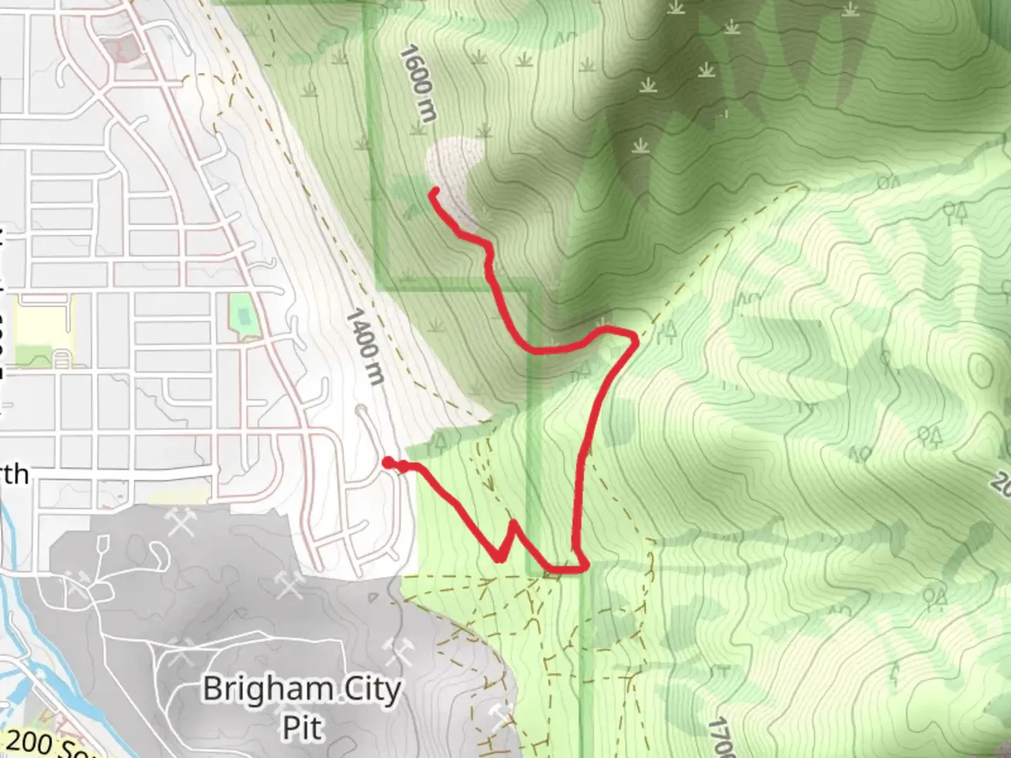
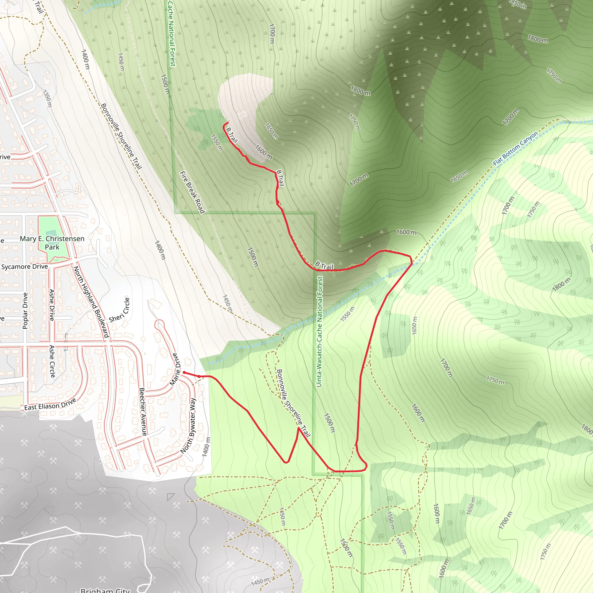
Starting near Box Elder County, Utah, the Flat Bottom Canyon Walk is a captivating out-and-back trail that stretches approximately 5 kilometers (3.1 miles) with an elevation gain of around 300 meters (984 feet). This medium-difficulty trail offers a blend of natural beauty, historical significance, and a moderate challenge suitable for most hikers.
Getting There To reach the trailhead, you can drive or use public transport. If driving, head towards Box Elder County and look for signs directing you to the trailhead near the nearest known address, which is close to the town of Brigham City. For those using public transport, the nearest bus stop is in Brigham City, from where you can take a local taxi or rideshare service to the trailhead.
Trail Overview The trail begins with a gentle ascent through a mixed forest of pine and aspen trees. The initial 1 kilometer (0.6 miles) is relatively easy, allowing you to warm up and enjoy the serene surroundings. As you progress, the trail becomes steeper, gaining elevation more rapidly. Around the 2-kilometer (1.2 miles) mark, you'll encounter a series of switchbacks that offer stunning views of the canyon below.
Landmarks and Points of Interest At approximately 2.5 kilometers (1.55 miles) into the hike, you'll come across a natural spring. This is a great spot to take a break, refill your water bottles, and enjoy the tranquil sound of flowing water. Continuing on, the trail leads you to a rocky outcrop that provides panoramic views of the surrounding landscape. This vantage point is particularly beautiful during sunrise or sunset, casting a golden hue over the canyon.
Flora and Fauna The Flat Bottom Canyon Walk is home to a diverse range of flora and fauna. Keep an eye out for mule deer, which are commonly seen grazing in the area. Birdwatchers will also be delighted by the variety of species, including hawks and songbirds. The trail is lined with wildflowers during the spring and summer months, adding a splash of color to your hike.
Historical Significance The region around Flat Bottom Canyon has a rich history. Native American tribes, including the Shoshone, once inhabited this area. Artifacts and petroglyphs have been found nearby, offering a glimpse into the lives of the early inhabitants. Additionally, the canyon was a significant route during the westward expansion of the United States, with pioneers and settlers traversing these paths.
Navigation and Safety For navigation, it's recommended to use the HiiKER app, which provides detailed maps and real-time updates. The trail is well-marked, but having a reliable navigation tool ensures you stay on track. Be prepared for changing weather conditions, as the elevation gain can lead to cooler temperatures and sudden weather shifts. Carry sufficient water, snacks, and a first-aid kit.
Final Stretch The final stretch of the trail involves a descent back to the trailhead, retracing your steps through the switchbacks and forested areas. This downhill section allows you to enjoy the views from a different perspective and reflect on the natural beauty and historical significance of the Flat Bottom Canyon Walk.
What to expect?
dog-friendly
family-friendly
scenic-views
wildflowers
wildlife
Activity types
birding
hiking
snowshoeing
trail-running
Comments and Reviews
User comments, reviews and discussions about the Flat Bottom Canyon Walk, Utah.
4.63
average rating out of 5
19 rating(s)
